
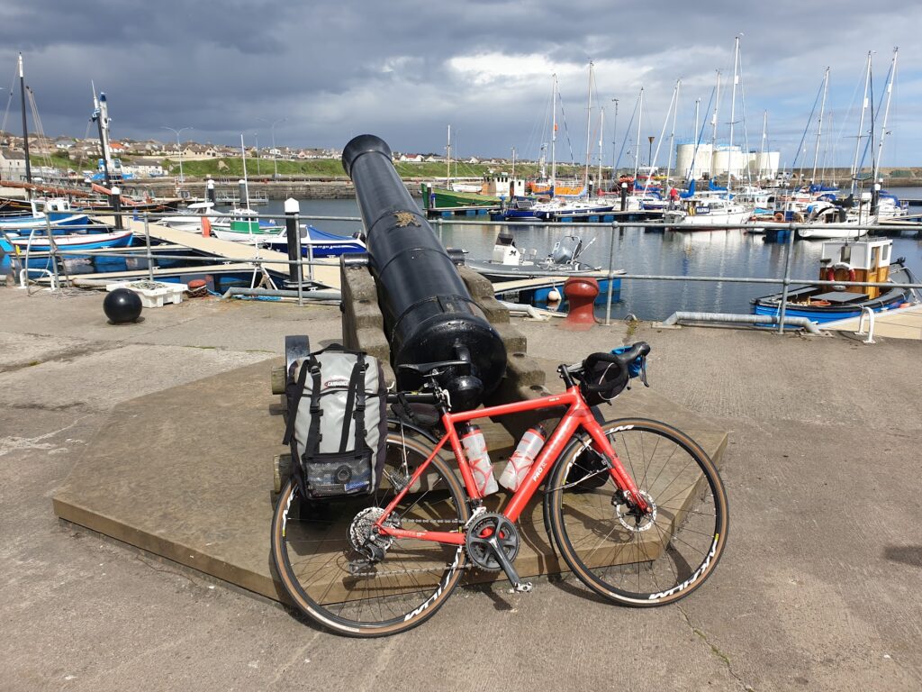
I started the day still feeling very full from last night’s delicious venison casserole. Despite this, there was the not-so-small matter of a 3 course breakfast to contend with, which I had ordered the night before. So I had absolutely no reason to worry about running out of energy as I set off for the east coast across the remainder of map 10, followed by maps 11 and 12. It’s not as long a ride as it sounds, because for reasons known only to Ordnance Survey, maps 11 and 12 are not far off being the same as each other. It is not unusual for OS maps to overlap. The country, after all, is a fiendishly complicated shape to map. But this is overlapping in the extreme, and you do have to wonder whether they could have somehow kept the total down to 203. My first view, as I pulled away from the Strathy Arms for the second and final time, was of the golden sands of Strathy Bay in the foreground and distant Orkney on the horizon, across the pale blue waters of the Pentland Firth. It brought a smile. The morning was fine, the breeze was helping me and I was about to complete my first coast-to-coast of the trip.
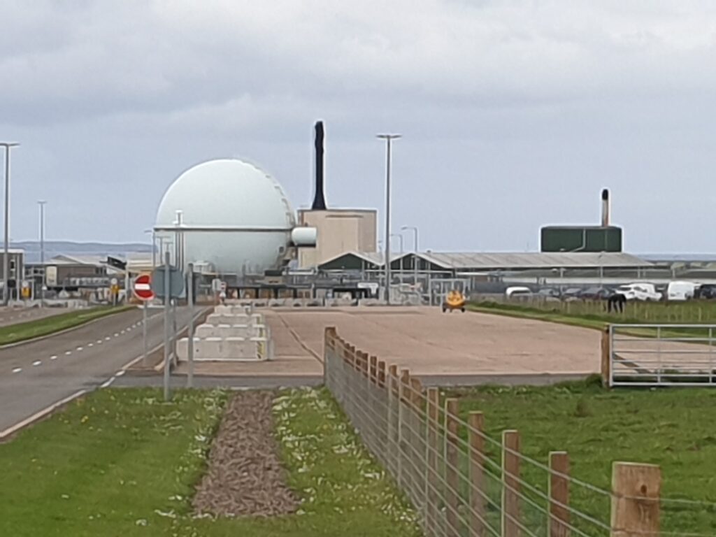
After a couple of big early hills, things calmed down into a much gentler landscape. The mountains were behind me now, replaced by fields with those distinctive Caithness stone field boundaries. All around, gorse bushes bloomed in their bright yellow splendour, adding colour to an overcast day. There is an awful lot of gorse in the north of Scotland. You can sometimes pick up the faint smell of coconut as you cycle past. My progress was swift and before long I was confronted with another local landmark: Dounreay Nuclear Power Station. I believe it is now in the long de-commissioning stage. There was certainly a clue in the snappy slogan on the shiny signs at the plant entrance: “Dealing with the Past”. Indeed.
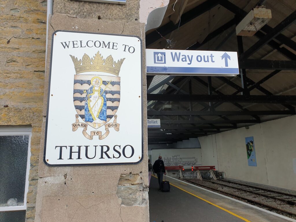
Not much further ahead I crested the brow of a hill and saw that most unusual of sights around here: a town! Thurso is the most northerly town on the British mainland, with the most northerly of railway stations, and I daresay a whole collection of other superlatives. I went to the station to try and collect my tickets and bike reservation for later today (from Wick to Inverness); but failed. The station was operating; but the facilities were all locked due to “operational issues”. Scotrail, who run the trains in Scotland, are in trouble. They were recently re-nationalised and in the past week have had to slash a hefty percentage off their timetable in the face of staff shortages and pay disputes. There have been some uncomplimentary headlines in the press this week. I went around to the platform and took a picture of 2 signs side-by-side on the wall: “Welcome to Thurso” and next to it “Way Out”!
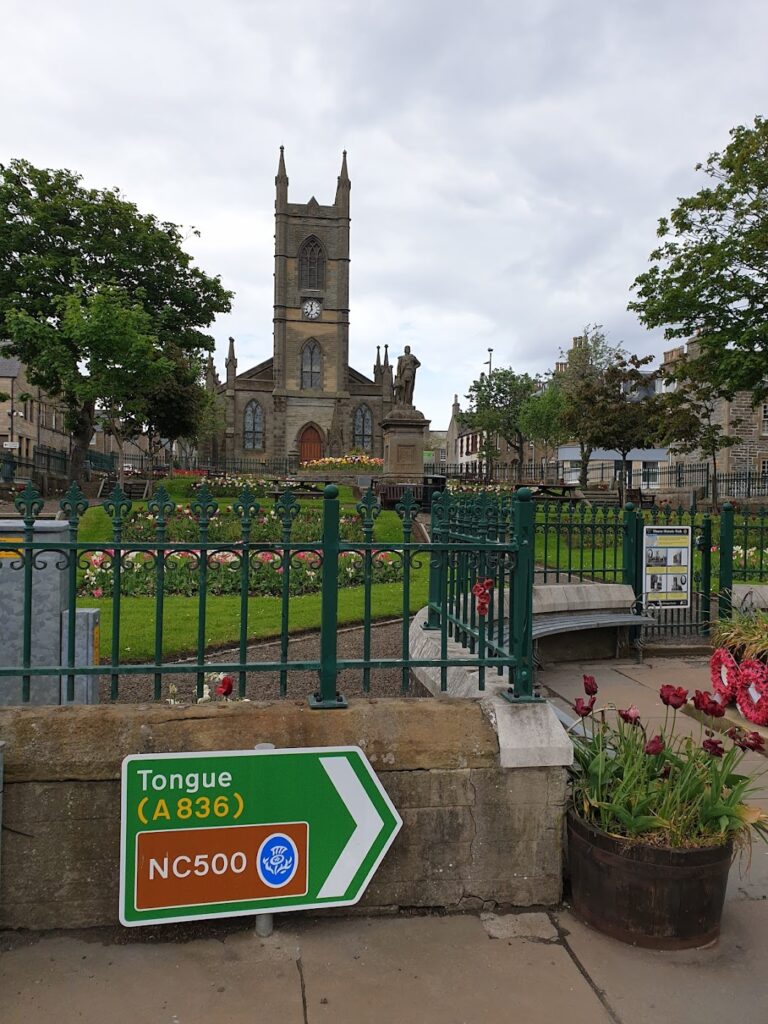
In fairness, I thought Thurso was alright. The town centre has a planned feel with some impressive civic buildings, statues, memorials, a bridge, gardens and a pedestrianised shopping area. It’s not Edinburgh, but it’s not Wick either (its downbeat northern twin down the road, of which more later). I’d come back. Actually I had; I passed through Thurso twice in a day back in 2008 when we made the obligatory trip from Farr Bay to John O’Groats and back to Scrabster, the ferry port for Stromness (Orkney), just along the bay from Thurso. On that occasion, we had the good fortune to meet my sister-in-law Elspeth’s sister’s ex-roommate, or something, who worked in the town and looked after our panniers until we got back, and then took us to a nice cafe. You don’t forget kind gestures like that. Anyway, according to the Thurso Historic Walk information board, a lot of this impressive townscape was thanks to the generosity and vision of the superbly named Sir Tollemache Sinclair and his later relative Archibald Sinclair, in memory of further Sinclairs John and George. Must have been quite a family. On the way out of Thurso you pass a petrol station with a sign saying “Last petrol for 50 miles on A9 south”. There’s another place about 4 miles down the road I took in Castletown; but it’s a reminder of where you are and how little is out there.
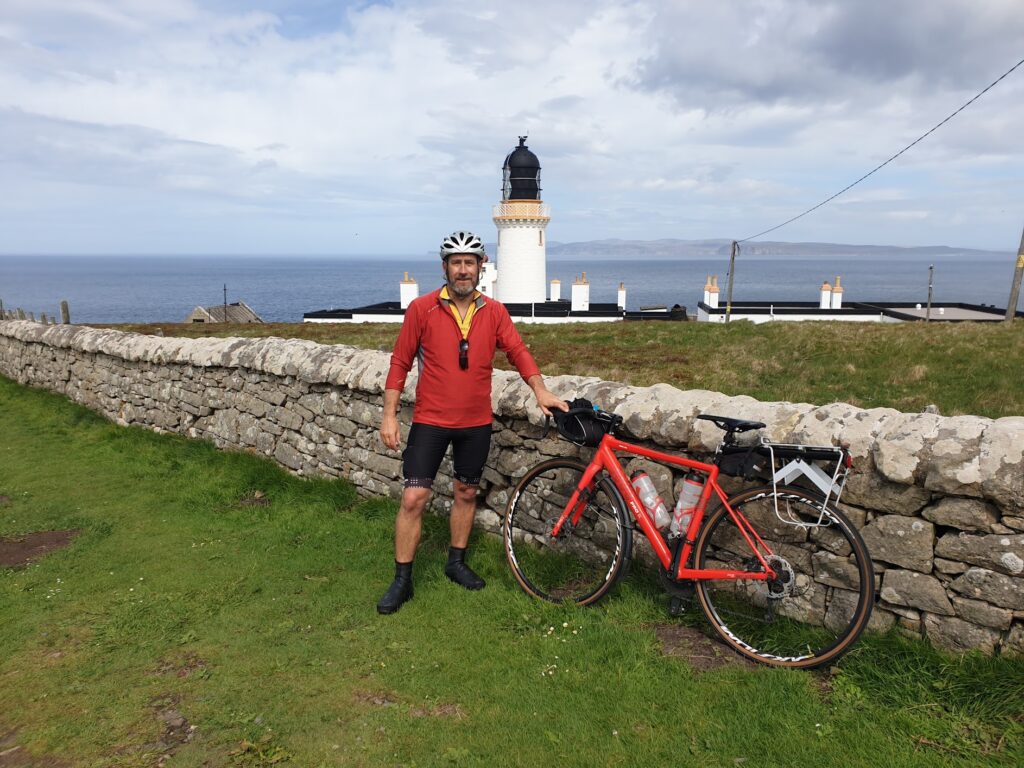
From Thurso, the next highlight is Dunnet Head, a few miles along the coast. It forms the northern portion of the lovely Dunnet Bay, which faces north-west and is backed by an impressive range of sand dunes. Dunnet Head is as high as anything around here and it also bears the distinction of being the most northerly point on the British mainland. I had to go. Before you climb up the last 3 miles to the lighthouse, there is Mainland Britain’s most northerly cafe, in the hamlet of Brough. They kindly minded my pannier to allow me to sprint up to the lighthouse (the most northerly in mainland Britain, obvs) and back. It was well worth the effort. The view past the pretty cream and yellow lighthouse across the water to the cliffs of Hoy, in Orkney, 8 miles away, was charming. It was a popular spot, much frequented by camper vans with Dutch and German licence plates, as well as plenty of native vehicles and 4 cyclists, who I chatted to. They were just finishing the NC500 and showed interest in my adventure. They asked where in Cornwall it would finish. In Fowey, I said. Oh, we live there, they said. So we agreed to meet when I get there in October!
Back at the Windhaven cafe, I sat outside in the sun, which had decided to make an appearance. A softly spoken lady joined me and was introduced by her friend, the cafe owner, as the Ferry Lady. She explained that she runs the John O’Groats to Burwick passenger ferry, running trips out to the bottom of Orkney twice a day. She had trained as a nurse in Aberdeen and her husband had worked at Douneray, which brought them up here, where they built a house. But she “belongs to Orkney” as she put it, meaning that is where she was born and raised, in the village just over the first Churchill Barrier opposite the Italian chapel. It’s called St Mary’s; but locals call it Holm. Only they don’t, they say “Ham”!
Covid had clearly taken its toll on the ferry. Before, they ran 4 return trips a day and had people coming up by bus from Inverness to do a day trip to Orkney. That has gone for now, but things are picking up again. They will run wildlife cruises again soon, but they don’t make as much money. The cafe owner told us that the sick young seal she had recently found on the beach near the cafe, and fed fish, had been relocated to a seal rehabilitation centre in Orkney, so I suppose that must be good news.
We said our goodbyes and I knocked off the 20 or so miles to Wick as fast as I could. The countryside was unremarkable inland. It could as easily have been north Lincolnshire as the north of Scotland. I arrived in Wick for the second time and tried to like it more then I had the first time in the rain. It was difficult. It has a dramatic setting either side of a river as it gives out into the sea. On the north side of the bridge is the handsome Sherriff’s Court, with its clock tower. On the south side next to the pretty harbour stands Thomas Telford’s Pulteney Town, a planned grid street pattern of terraced buildings, laid out in 1786 for the British Fisheries Society. The buildings are now in varying states of repair. It could be really nice. It certainly has the potential. But the whole place felt like it was just about hanging on to life. The walls of empty buildings had been decorated with art and old photographs. There was a heritage museum and some pleasant cobbled streets. You couldn’t say they had given up completely. But there was a feeling of decay about the town and its empty shops that was hard to ignore. I wish it luck. I felt like this about John O’Groats last time around, and look what happened there.
Wick does at least have a nice enough train station. It is where the Far North Highland line ends its journey from Inverness. The 4pm departure was waiting with doors open at ten past three, so I secured my bike space early. A couple of very fit looking cyclists from Staffordshire with expensive bikes had just arrived on it, looking excited at riding from John O’Groats to Land’s End over the next 9 days. We exchanged the usual pleasantries and then I wandered around the corner to the Co-op to buy a meal deal for the 4 hour train journey in our two carriage train. If you were in a hurry, you would surely take the bus. The train starts by heading north-west back up to Thurso, before it weaves its way over moorland and in and out of valleys, taking it miles inland and then right back to the coast more than once. It’s an interesting journey, though. Sometimes you are thrillingly close to the sea and other times miles from the closest tiny road in a desolate peaty wilderness. The section alongside the length of the Dornoch Firth was especially lovely, with the tide in right up to the line.
Many of the stations are request stops and must be very little used. Remotest of all – and just on the lower left edge of OS map 12 – is the improbable request halt at Altnabreac in what is known as the Flow Country, Europe’s largest blanket bog. According to Wikipedia the station serves “an area in which the station itself is the main component”. It also states that “The reason for the station’s construction is a mystery” since the only nearby buildings, a school and a lodge, were not built for at least another 20 years! In 2020-21, during the pandemic, a total of 46 entries and exits were recorded from the station. That was down from a whopping 658 in 2017-18. But even that is fewer than 2 people per day, with 4 trains daily in each direction. Nevertheless, you will be pleased to learn that station facilities include – and more or less fully comprise – bicycle racks! To learn more, I highly recommend reading “Tiny Stations” by Dixe Wills, in which he describes a bizarre encounter he had here. There is no escaping the fact it is an eerie placel
The train rattled its way to Inverness with the minimum of both fuss and passengers. Tomorrow I’m on another train that will get me as close as a train can to Ullapool again, for the return to Lewis and the next coast-to-coast. It’s a fiddly business; but someone has to do it!
PS – Inverness was looking lovely tonight along the river around 10pm in the twilight. And a touch of class: one of the main bridges was brightly illuminated in the blue and yellow colours of Ukraine.

4 replies on “Maps 11 & 12 – Caithness”
Lovely to meet you Mark. We were all very inspired by your trip & spent & still spend time talking about what we all might do to challenge ourselves.
Hope to see you in Fowey in October.
The 4 cyclists.
Soz, but it’s Dounreay, not Douneray….and it’s still operational, and is 1 of only 2 major Low Level Waste (LLW) radioactive waste processing sites and repositories in the UK, the first and biggest being in Drigg, Cumbria, which is next to Sellafield. Some of the processes they use at Dounreay are copied from those we developed (and are continuing to develop) at the Drigg site. Soz, but you did ask…..🤣🤣
I left myself open there! Thanks for the expert insight. I stand corrected.
Loving the story Mark. Keep up the good work and the pedals turning.