
On Tuesday I completed a VERY long ride, from Elgin (where I left off a week ago) to Peterhead and then back to Aberdeen. I knew it would be long and I enjoyed it very much. I will admit that I am a little tired now! However, I certainly made the most of the available daylight, finally arriving back in Aberdeen in the eerie quietness of the summer dusk, somewhere on the wrong side of 11pm. But I get ahead of myself.
The day began early and I was up, out and on a train from Aberdeen to Elgin a little after 8am. If that sounds like sado-masochism (and it does to me) then it gets worse. My ride today would be 108 miles, albeit pannier free miles, and when I awoke to a stiff southerly breeze, I knew they would be energy-sapping. In Elgin, I took advantage of the sort of facilities only larger towns can offer. Like Costa. Who knows when the next opportunity for a sourdough scrambled egg, mushroom and spinach breakfast roll and a pot of Earl Grey will come along?
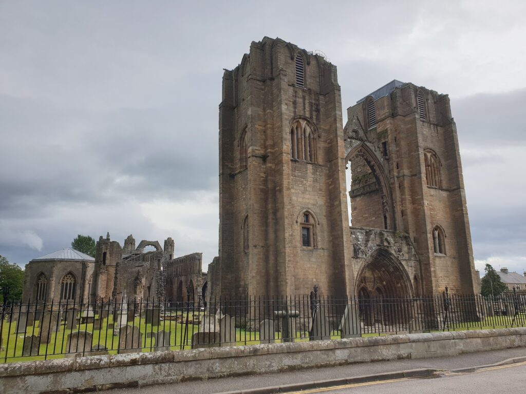
Elgin feels like a town of regional importance and it has the appearance of a place with a fair slice of history behind it. There are some good 19th century public buildings, including the impressively domed Dr Gray’s hospital, and a pleasant town centre with proper shops arranged around the church of St Giles. The Duke of Gordon monument, a tall column on nearby Lady Hill, overlooks proceedings. In a park to the north of the town centre are the extensive ruins of Elgin Cathedral, the “Lantern of the North”, complete with its almost intact, twin towered west front and still-roofed chapter house. It was founded in 1224 and must have been something to behold before it was reduced to ruins. The job of destruction was started in the reformation of 1562 – when the lead was stripped from the roof – and largely finished off by Cromwell’s soldiers in the mid-17th century.
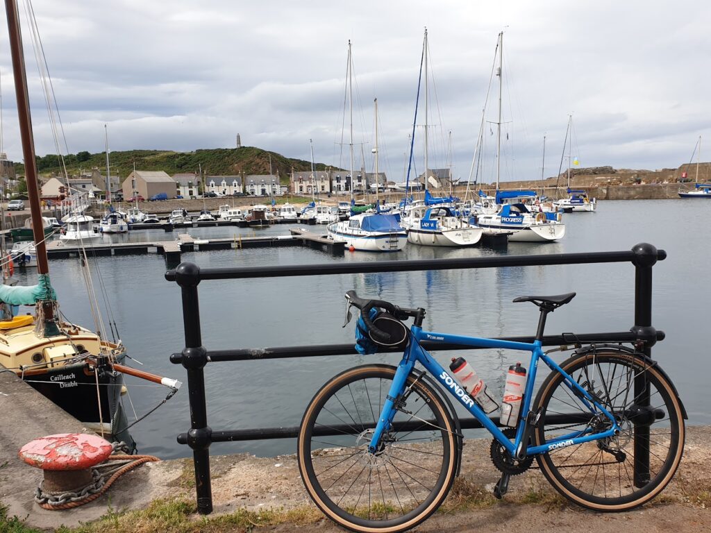
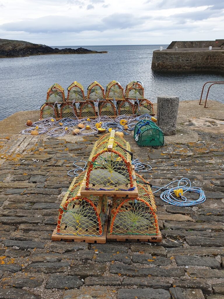
Leaving Elgin by way of National Cycle Route 1, I followed quiet lanes through fields and trees a few miles inland from the Moray Firth. I bridged the River Spey within sight of the sea on the old railway viaduct, as a group of canoeists passed underneath. Soon afterwards, I hit the sea front at Portgordon, the first of a whole series of coastal settlements with quaint harbours nestled beneath dunes or low cliffs, that lined the coast for the next 24 miles. This section of the ride was delightful. Despite the many distinctive terraces of red stone cottages in each of Portgordon, Findochty, Portknockie, Cullen and Portsoy, there was hardly anyone about. Traffic, to say the least, was not an issue! The only exception was Buckie, a proper commercial harbour with big working boats and active boatyards. I suppose these places are really only on the way to each other. I didn’t mind at all; but I couldn’t help thinking that if these places were in Cornwall or Devon they would be mobbed at this time of year. Instead, I saw barely a shop, let alone a cafe or pub. I don’t really know where everyone was; but it wasn’t here!
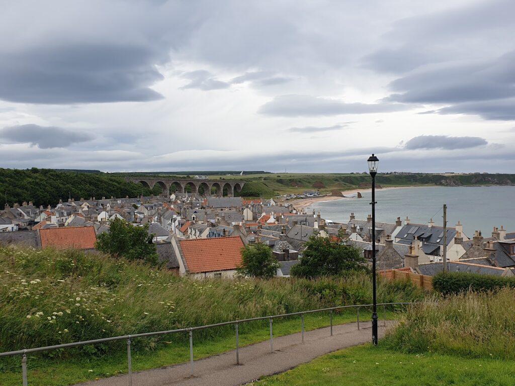
Things picked up a little in Cullen, the most seaside-like of these places, which was framed by no fewer than 3 railway viaducts that formed part of the now-defunct Moray railway. The small streets of terraced cottages by the seafront were as quiet as ever; but as I emerged up through the arch of the third viaduct, I found myself in the broad main street of Cullen’s upper town, an altogether busier and quite different feeling world of vintage shops, cafes and a hotel. It was lunchtime and here I was in the place of invention of Cullen Skink, a delicious thick soup made of smoked haddock, potatoes and onions, enjoyed all across Scotland. There was only one thing to do.
Passing through Portsoy, I left the main road and followed quiet lanes and a cycle path along the dunes and into the old county town of Banff, which sits on a headland where the River Deveron reaches the sea, looking across at its twin settlement of Macduff across a fine old stone bridge of many arches. Banff had been signed all the way from Elgin and it was a place of substance. There are several fine old civic buildings; and a couple of faded stately homes, but the whole town, despite its imposing location, has seen better days. Most of the grand old banks and the old post office stood empty and sad looking. Some of the shops that were occupied were takeaways or charity shops. It was as if the soul had been sucked out of it. After some searching, I found an open cafe on a side street. The Delight Cafe was actually really cosy: a finalist of Scottish Cafe of the Year, in fact. I settled in and charged my phone. It was almost 4pm, and I took the opportunity to check what lay ahead of me. Which is when I discovered that all my poking around in quaint harbours had seriously set me back. I still had no less than 70 miles to cycle!
Wasting no more time, I hit the road. Cycle Route 1 was heading my way, so I followed it inland (and into the wind) along the Deveron valley for 12 miles to the small town of Turriff, where I headed east once again across rolling, open country through fields of wheat, mixed up with pastures containing cows and pigs. The predominant colour was golf-course green, while the hedgerows contained wild roses of white and red. Yellowhammers sang all around me. It was all very pleasant in the evening sunshine, without ever really being worth stopping for a photograph. It reminded me a lot of crossing the Lincolnshire Wolds on the way to the east coast; unremarkable but attractive with long, straight, quiet lanes. I passed through a handful of pleasant villages and then things flattened out and I took to the main road for the final few miles into Peterhead.
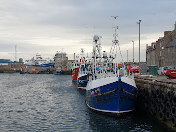
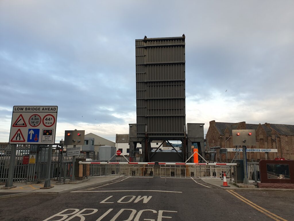
Peterhead is the end of the road. And it felt like it. It is the most easterly point on OS map 30, and it marked the conclusion of my fourth coast-to-coast journey across northern Scotland, all the way from Benbecula on OS map 22. It is a big port with a sizeable fishing fleet and the large harbour was host to a flotilla of big, modern boats very much larger and more serious looking than anything I had seen earlier in the day. The town was rather run-down and – except for the spanking new police station – had seen better times. It was all rather jarring and a bit of a shock to the system. I could have stayed longer – and I felt I owed it more of a chance to share some of its history – but I was starving and it was already past 8pm. I had 30 miles into the wind ahead of me. I needed to eat! That was more of a challenge than it sounds in Peterhead on a Tuesday evening, so for once in my life I was genuinely pleased to find a Wetherspoons. Needs must and all that. But I have to give credit where it is due: it was “Tuesday Steak Night” and for barely a tenner I polished off an excellent steak with jacket potato and vegetables, and a pint of something deliciously dark. The engine had fuel once more! I was away just before 9pm, the sun still shining brightly.
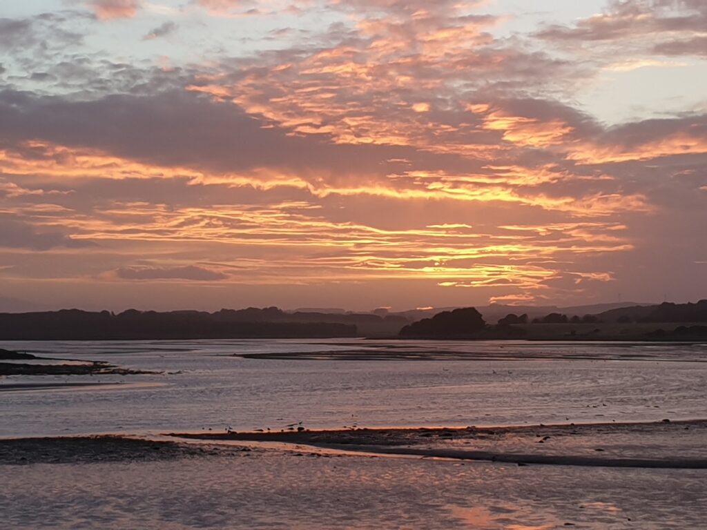
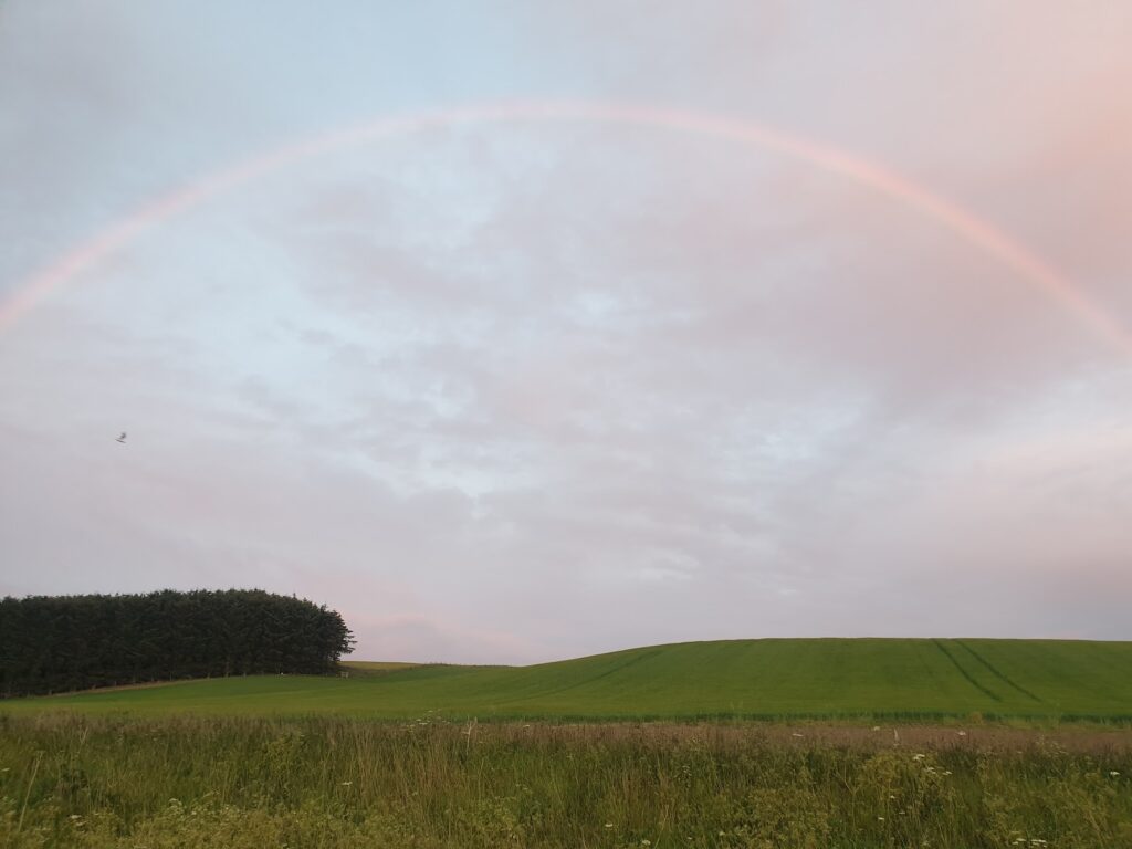
By 10pm, despite the wind’s best efforts to slow me, I was halfway to Aberdeen along deserted roads. As the sun dropped below the horizon, I was treated to one of those special rare moments of nature when the evening light became quite surreal. I found myself alone, crossing the tidal estuary of the River Ythan, surrounded on both sides by dunes, on my right over the distant low hills a sunset of spectacular beauty, and on my left an enormous and complete rainbow above the sea. It made all the effort worthwhile. Wow!
In the gathering gloom of the summer twilight, I pushed through the last hour to Aberdeen. A few miles to the north, I passed the entrance to the Trump International Golf Links, the Donald’s controversial new Aberdeenshire golf course, recently constructed on beautiful dunes that look across at the winking lights of a huge off-shore windfarm. The next turning along the same road is the Cock and Bull Inn. Coincidence?
And then, all of a sudden, I was back in a big city with tall tower blocks and dual carriageways, B&Q and KFC. I must say I preferred the emptiness; but I was certainly glad to reach journey’s end, a cup of tea, a hot shower, and bed!
Today (Wed) – by contrast – is a gentle travel day, as I get the train from Aberdeen to Glasgow. From there I have a morning train ride from Glasgow all the way to Mallaig (5 hours), and then a 3.5 hour evening ferry ride out to South Uist. It is a lot of sitting still; but I think I earned it. In any case, that is what it takes to get over to Barra (and OS map 31) from Aberdeen to start the next coast-to-coast. So, that is what I must do!
2 replies on “Maps 28, 29, 30”
Wow what a day! The Cullen Skink sounds interesting and the pint of something dark also (for some mysterious reason I always seem to focus on your description of refreshments between all the cycling!). I’m imagining cycling along those deserted roads in the fading sunlight with you – that must have been quite an experience. Looking forward to reading the rest of your adventures – good luck with all the complicated transport plans.
Well done on your fourth crossing, great effort!