
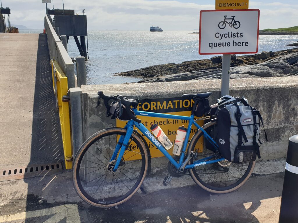
What a difference a day makes. I was lucky to have the option to stay inside for most of yesterday, and happy to take it. Today began overcast and windy; but the clouds soon blew away to leave a bracing northerly breeze and warm, bright sunshine. Excellent conditions for seeing the island of Coll, and I had until the ferry arrived at 12.30pm to do just that.
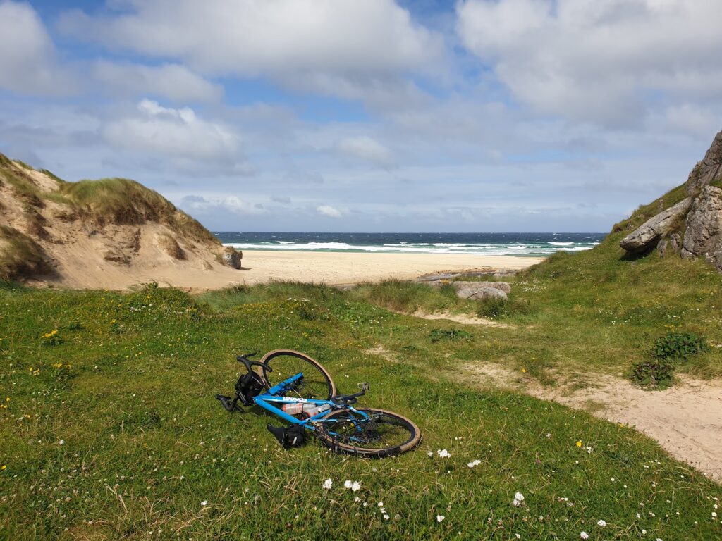
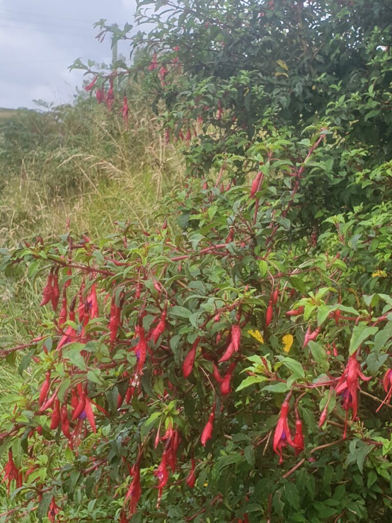
Leaving my bags behind at the bunkhouse in Arinagour, I set off with the wind behind me and cycled towards the south-westerly tip of Coll. After about 5 miles, near the small airstrip, the diminutive B8070 runs out and a couple of tracks take you across the flower covered machair to different beaches. These beaches are of the white sand variety, devoid of people, and in the sunshine the sand shone and the sea was a vibrant light blue, adorned with many ”white horses” caused by the strong wind. Big waves crashed against the sand. Shapes on the horizon revealed other nearby islands, both large and mountainous (like Mull to the east, my next map) and small and flat, like tiny Soa a mile or so to the south, and many other islets. None of these were visible yesterday. It was like a new world.
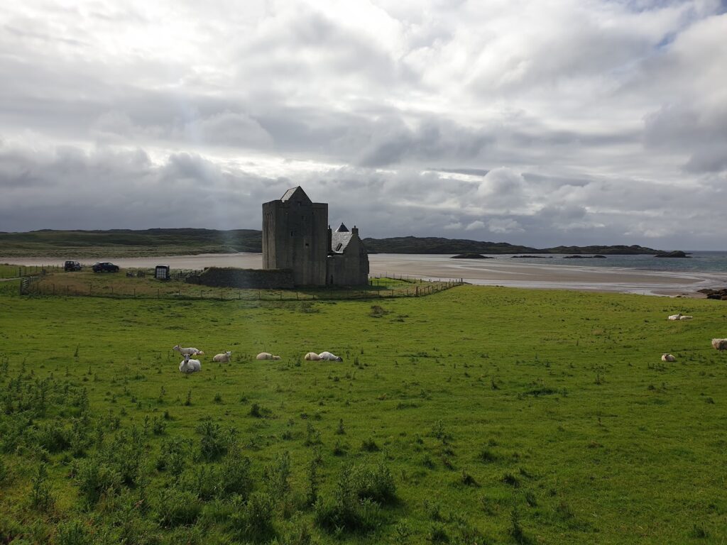
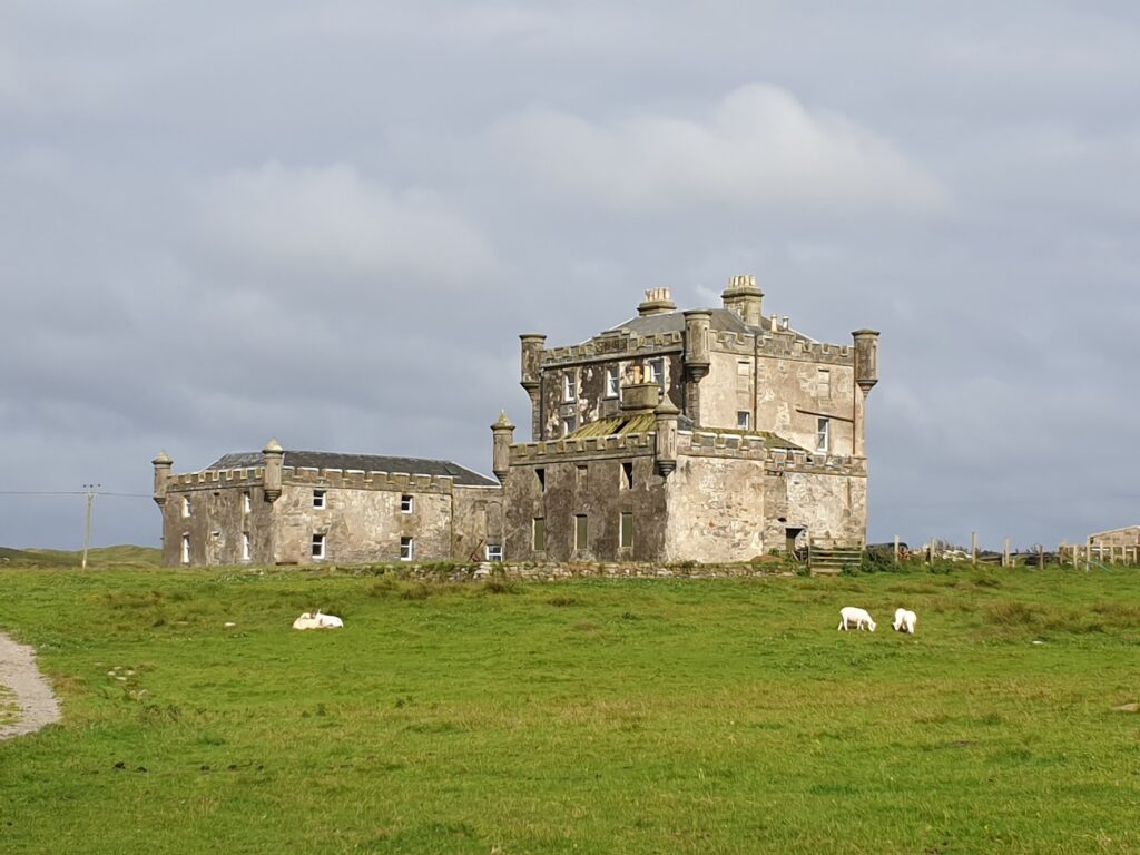
Overlooking the first beach and its bay was the unusual looking Breachacha Castle, an almost window free stone building with tall vertical sides and an adjacent round turret. Behind it, in a state of partial renovation, stands a newer, larger mock-castle. It was all rather odd in this isolated setting and you wondered what possessed someone to build it, or take it on in its dilapidated state. There were vehicles and signs of life at both castles, however. So what do I know.
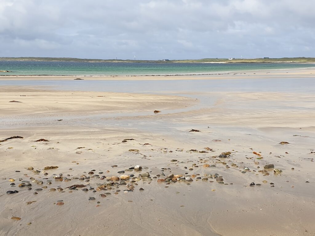
A little beyond here I visited the far south west of the island which contains a long range of tall sand dunes protecting the island from the Atlantic. I ventured out over the dunes and onto the sand and saw vast, sweeping Crossapol bay arcing away a mile or more towards Tiree. Just north over the dunes is another large beach, Feall Bay, facing the opposite direction, creating a narrow isthmus of land that joins Calgary Point, at the eastern tip, to the rest of Coll. It is all managed as a nature reserve and traffic is banned. I was the only one there.
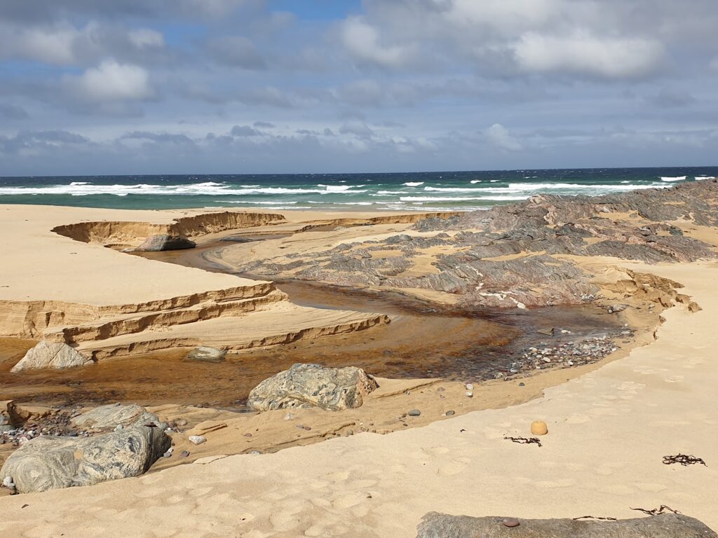
Heading north from here was about 2 miles of tarmac and then on the other side of a gate, more dunes and a sandy track through grass and flowers that was just about rideable on my bike. It was quite an adventure and I felt far from civilization. After a mile or so a small stream breached the grassy dunes and gave access to the beach. I went to look and, despite being sand-blasted by the wind, was captivated by the elemental beauty of the scene that confronted me. It was an assault on the senses: the Atlantic wind, the waves, the sea air, the brilliant colours, the meandering stream cutting its way through the beach to the sea. I could have stayed a long time. Except I wanted to keep the skin on my bare legs, and I wanted to see more of Coll and still catch the ferry. So I took pictures and left.
A little further on, behind some extensive, neatly kept white buildings, the tarmac returned. These buildings, it transpired, are the Hebridean Centre, headquarters of Project Trust, where Isabel came for volunteer orientation. I’m pleased I managed to follow in her footsteps. I know the pandemic was hard on this charity and its work, and I really hope it can recover. They do wonderful work and help shape many lives for the better.
I was now on the B8071, soon to become the B8072, and heading on a roller coaster towards the northern tip of Coll, into the wind. There were quite a few vehicles that passed the other way. Ferry traffic, I guessed. This 6 miles or so of road represents a good half of the entire road network of Coll and, if anything, is even smaller and narrower. Grass grows thickly up the middle of the road along its whole length, leaving just room for a tyre either side. Higher up the island today I was treated to wonderful views of mountainous Rum and the more plateau like shape of Eigg, off to the north. But then it was time to turn around and be blown back to pretty Arinagour, my bags, and the ferry.
The 3 hour voyage back to Oban took me past much of OS map 47 -and indeed right through it, in a nautical sense. However without my own boat, or a lot of money to charter someone else’s, a trip in and back out of Oban was unavoidable. Our voyage along the narrow Sound of Mull was most scenic and almost quite dramatic. For a few minutes, while we all enjoyed the novelty of warm sun on the open deck, we began a detour to aid a yacht that was taking on water; but luckily for all involved, I suspect, a smaller Calmac ferry and the Oban lifeboat were quickly in attendance. We all arrived back safely in a sunny and colourful Oban harbour just before 4pm.
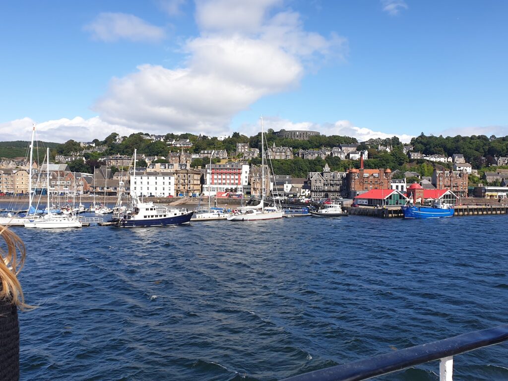
Oban is a transport hub, a holiday destination in its own right, and the main town for a great many miles around. It is always a hive of activity on both land and water. I had decisions to make and provisions to buy in the next hour before I began my journey, by a different ferry, back in the general direction from which I had just come. This next section of my trip will be unofficial non-map miles until I reach the top of map 47 sometime tomorrow. But I will use the opportunity to see places I never seen before. More of that to come. Hopefully I will remember to switch on Strava at the right point, too. I forgot today, so my travels around Coll are unrecorded. But I was there and it counts. I have photos and witnesses.
One reply on “Map 46 – Coll”
Some pretty places there 🙂