
Things seem to be looking up for Scotrail. On a day when the rest of the country was beset by more train strikes, Scotrail ran a normal service. And by normal, I don’t mean their emergency timetable of late; but their full blown reinstated timetable of yesteryear. So it’s nice to be able to report good news and I am very grateful to them.
I wasn’t altogether sure this would be the case until I reached Montrose station at the end of another lovely day of cycling and the completion of another map coast-to-coast. No worries: despite the doubts voiced by those I met on the way, I was always confident and they didn’t let me down. Which is a good thing, since I had accommodation booked in central Glasgow and a train bike reservation to take me back up to Oban – for what should be the final time – the next morning. In the end it all worked very smoothly, just as it has at the end of previous coast to coasts. Each time I have reached the east coast, from Aberdeen south, I have been whisked back with minimum fuss to Glasgow, usually while consuming my dinner on board (fish and chips tonight), for the quickest way to reach the islands on the west side of the country the next day.
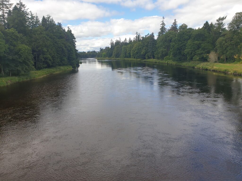
But let’s get back to where today all began. After my overnight stop in Aberfeldy, I checked out at 10.30am after quite a loud, late night. I didn’t mind; it was playing to my natural body clock anyway. But I needed to get moving. The first section, along the banks of the River Tay as far as Dunkeld, was delightful. It had rained overnight and everywhere still had that damp, just washed appearance as it glistened in the weak sun. This was lush, fertile country, with long grass, rhododendrons, big trees, and large country estates. Ninety minutes of the quietest cycling on pretty lanes brought me to the very busy A9. Luckily I only had to ride alongside it briefly, on a raised cycle path across a big bridge over the Tay, before peeling away, back underneath the bridge and along another lovely cycle track through woodland to the river bank. The Tay by now was a substantial river and I saw rafters and small fishing boats out on it.
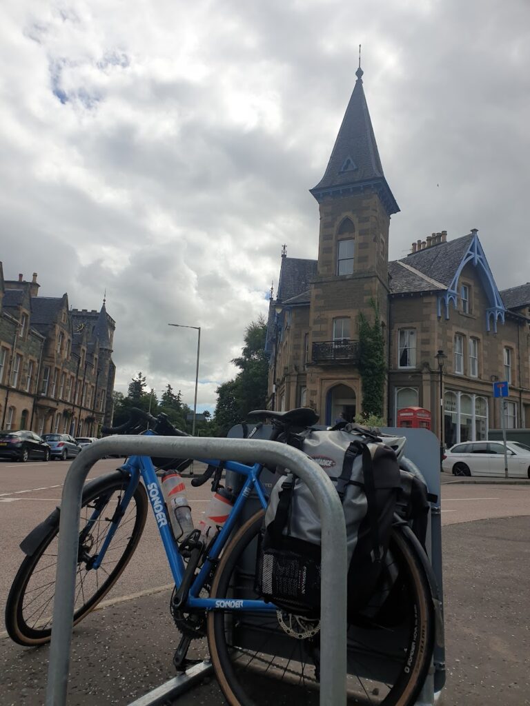
In a couple of miles, the track brought me to the small and attractive town of Dunkeld, right past the partly ruined cathedral. Dunkeld is linked to its slightly larger but less illustrious neighbour of Birnham (of Macbeth fame) by a graceful, many arched stone bridge over the Tay. Dunkeld has the smaller, older buildings, the fancy shops and cafes and the tourists. Birnham has a collection of much larger, rather fine Victorian gothic buildings housing things like hotels, civic libraries and a lovely arts centre, with a very impressive modern extension that really works. I had a most enjoyable early lunch here. It was a place I felt I could happily come back to.
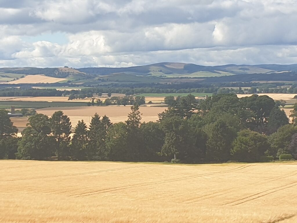
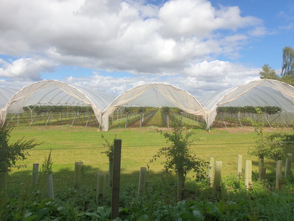
I followed theTay downstream for a few more miles, and then began a long, enjoyable journey, aided by the wind, along the pleasant and abundant rural vale of Strathmore, between two ranges of hills to the north (the Angus Glens) and south (the Sidlaw Hills). All around were fields of golden wheat, as well as potatoes and, more unusually, large quantities of soft fruit, mostly growing at easy picking height in long poly tunnels, open at the ends. This area is known for its strawberries and raspberries and it was quite a sight to see them all, waiting to be picked. As I rode down a small road between fields, I saw ahead of me what looked like a ramblers club crossing the road. When I reached them, I realised it was not that at all. These were migrant workers, over here to pick fruit. I had read recently that (since Brexit in particular) farmers have been looking further afield to find pickers. The article I read mentioned Nepal as a new source of labour. I cant be sure; but I have been to Nepal and from their general appearance, it seemed to me like that was what I was looking at. What a very odd world we are living in!
Every 12 miles or so in this area of rich farmland, you reach a small town. First was Cupar Angus, which has seen better days, then Forfar, a more substantial and vibrant place with a long high street. For almost the first time in Scotland, I was faced with the choice of multiple routes and I didn’t have a pre-set route planned. It wasn’t a problem: this whole area is perfect for cycling and any of the long straight country lanes afforded sweeping views in the afternoon sunshine. As usual, there was next to no traffic. I was happy.
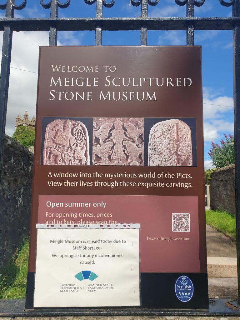
I made for Meigle, a village on a road junction, but also the site of some exquisite Pictish sculptured stones. I know this to be true; but I didn’t see them, sadly. I just saw the outside of the small museum in which they are kept. It was closed due to staff shortages. Hey ho.
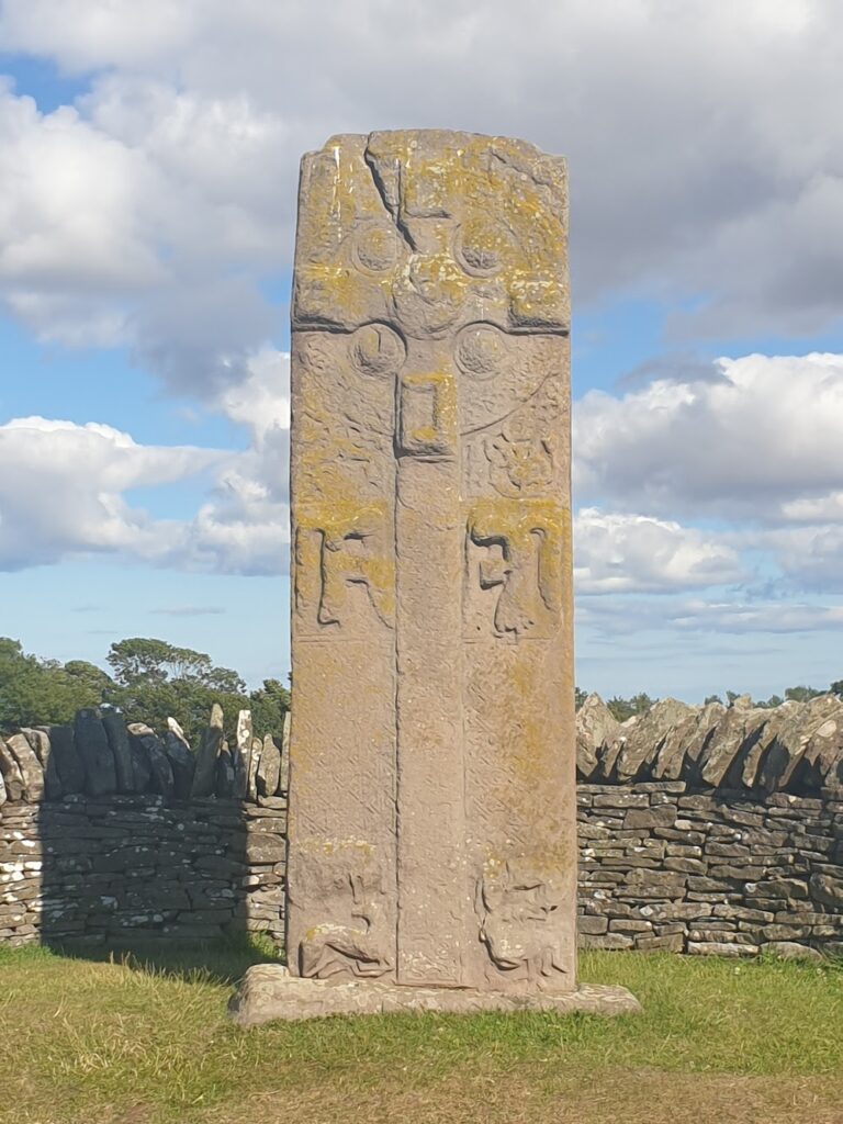
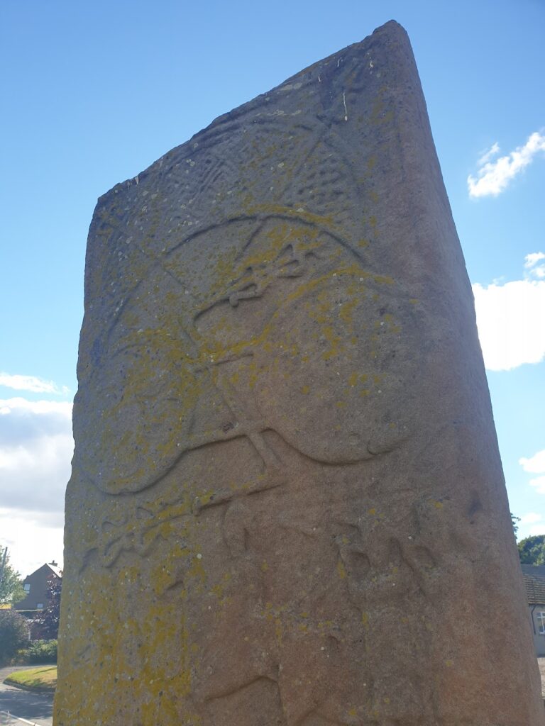
Beyond Forfar, I had a choice to make. Time was on my side and it was a lovely evening, so I went for the slightly longer option that included a visit to Brechin. On the way, I made up for my Meigle disappointment with more unexpected Pictish stones, right by the side of the road at Aberlemno. There are 4 of them, and they range in age from 500 to 800 AD. The most impressive is a cross-slab, showing that christianity was alive and well in these Pictish lands. The front shows an obvious Celtic style cross. On the back, it looked to me suspiciously like someone had carved a bicycle! You decide.
Signs welcomed me to the Cathedral City and Fair-trade City of Brechin, home of Brechin City football team. But it’s not. A city, that is. It is a town. Scotland (according to none other then Scotland.org) officially has 8 cities: Edinburgh, Glasgow, Aberdeen, Dundee, Inverness, Perth, Stirling and – new for 2022 to mark the Queen’s Diamond Jubilee – Dunfermline. And that’s it. Brechin may indeed have a mediaeval cathedral (although that is also a moot point, since the Church of Scotland is no longer governed by bishops, and therefore doesn’t do cathedrals these days); but as other towns with cathedrals, present or past, across Britain will confirm, that does not a city make. Sorry Brechin.
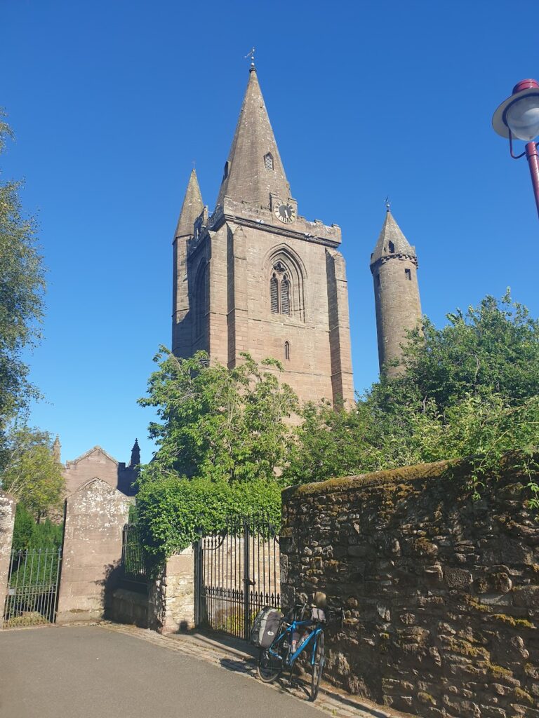
It was a nice place, though. Its cathedral looked like it would be worth exploring, except at 5.25pm all gates to the churchyard were firmly padlocked. You can’t even really get a good view since it sits below the town centre and is hemmed in by high walls and buildings on all sides. Standing right next to the cathedral is one of only two examples in Scotland of a mediaeval round tower, of the sort seen quite commonly in Ireland (where more then 60 survive, 12 in complete form). There is also one at Peel cathedral in the Isle of Man, since you asked. Brechin’s was built before the adjacent cathedral, in the early 11th century. It stands 25m tall, so you could see the top of it over the wall.
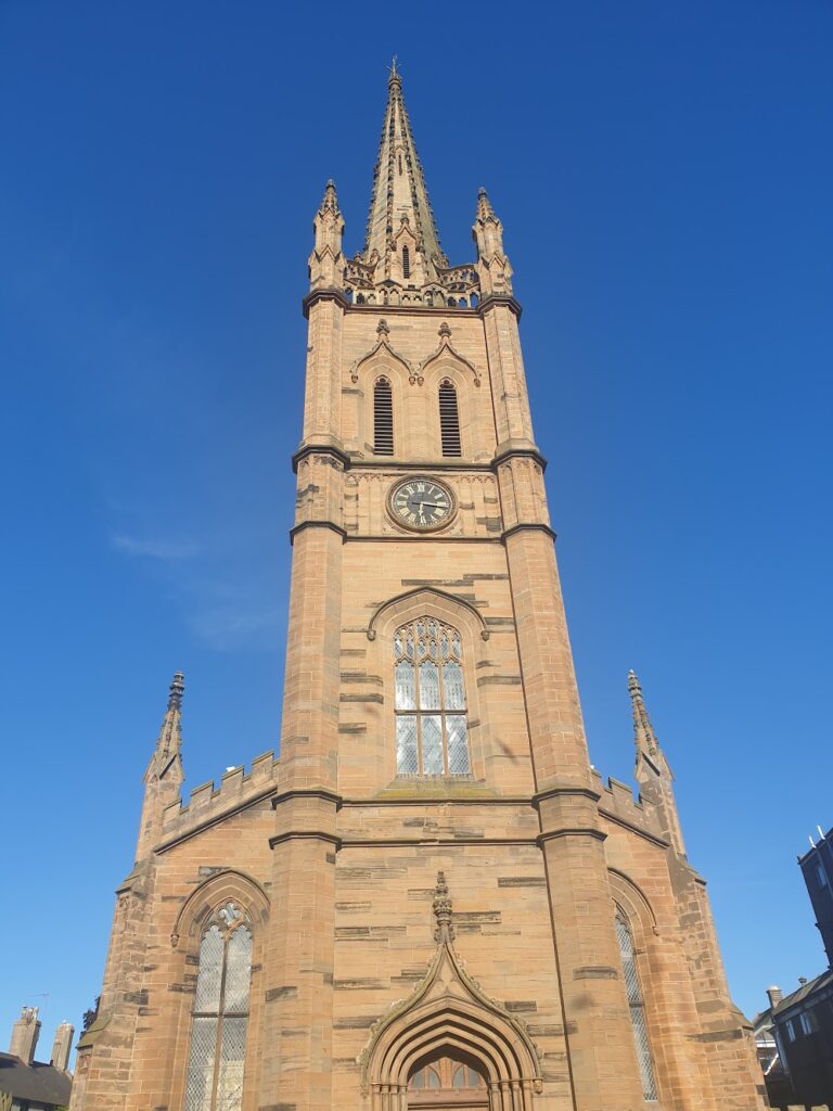
I knocked off the last 9 miles to Montrose, on the coast, in short order. You could see it from quite a distance. The town sits between the sand dunes (now used for playing golf) and a large tidal basin – the largest inland salt water basin in the UK, no less, and an important habitat for Mute Swans – that was full this evening and shone bright blue, reflecting the sky above. Behind the basin, acting like a beacon to adventure cyclists, is the magnificent 19th century tower and spire of Old and St Andrew’s church. It rises 220 feet above the flat land around it, and dominates the town from every direction.
Montrose itself is a mixed bag. The cobbled town centre has a feeling of faded grandeur, with a few empty shops and closed hotels. But a couple of streets back towards the sea it becomes positively genteel in appearance, with streets of pretty stone cottages arranged around wide greens. The golf clubs look very well appointed, and then you reach the sea and the beach, which looked like a nice place to be when the tide was out. It isn’t a developed seaside: there was only one place to buy food, and that sold only burgers. So I rode back into town and found a chip shop near the sizeable port, which occupies the stretch of water between the sea and the tidal basin. It seems to be a busy place at the moment. There were several large, modern boats tied up and I would guess they were in some way connected to the offshore energy business. So maybe the future is bright for Montrose. I hope so.
And so my 6th Scottish OS map coast to coast was complete. And in doing so, a half century of maps has been visited. I will wave my bat briefly towards the pavilion; but there is much more work to be done. No time for celebrations, I still have 150 maps to cross in three months. The maths is easy. The cycling less so. I’m not worried – yet – by the size of the task ahead. I am almost through the islands now and approaching the stage where three maps a day should be a regular event. I only need to average two. Should be a piece of cake.
One reply on “Maps 52, 53, 54 – Tay Valley & Angus”
It looks like a bike to me!