
Today I feel I did full justice to OS map 55. I pretty much spent all day in it and covered it from one side to the other. It was a long day. The trouble is that you can’t really cross it in anything other then a very zig-zaggy line, thanks to a plethora of natural barriers. However it is these same barriers that give this region its character and beauty. All you can do is go where the roads and the ferries go and enjoy the ride.
There was a lot of water involved today. First, I cycled away from my destination to experience another one of the Slate Islands: Luing. After a late night of conversation and a sumptuous breakfast, including 2 (two) small boxes of Frosties, I managed to make the 10am ferry across the narrow Cuan Sound, landing in sunshine on Luing, pronounced ”Ling”, a lumpy, green, verdant island famous not only for slate; but also for its hardy breed of cattle, of which I saw plenty.

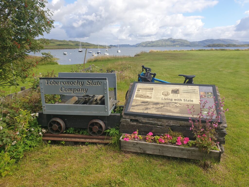
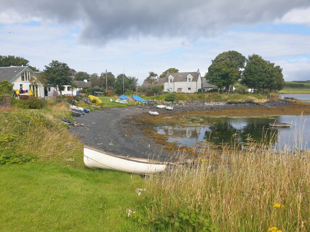
I cycled the six miles down to the foot of the island to the village of Toberonochy, another community of preserved slate workers’ whitewashed terraced cottages, with pretty gardens and a variety of small boats strewn about the grass. I looked out from the quiet quay, where once slate was exported in large quantities, across the fast flowing tides rushing through between me and the island of Shuna, which sits between Luing and the mainland to the east. It was a peaceful spot.
I cycled back up the island, branching off twice to follow small roads to the south and west coast of the island. The first took me to a remote, decaying wooden jetty at Blackmill Bay, where in the 19th century coastal steamers from Glasgow and coal puffers used to call, delivering and collecting passengers, cargo and even animals. Few clues remain of that busy time.
Further up the island is the main village, Cullipool, a pleasant place strung along the west coast looking out towards Fladda lighthouse and its near neighbour, the isle of Belnahua. This was another slate producing island, smaller and more isolated than Easdale and now abandoned and despoiled. Even from my vantage point a mile and a half away you could see the clear effects of man’s industry.
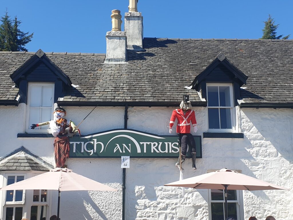
Crossing back to Seil, I collected my bags from Uta at my Airbnb and shared a tea break. I think we could have chatted forever; but I still had 65 miles to cycle, so I said goodbye and headed back north towards the mainland. All along the road were entries in the Seil scarecrow festival, many of which were really excellent. I especially liked the somersaulting mountain biker, and the paddle boarder in the middle of a small lake that I genuinely took to be a real person. Very imaginative and well executed.
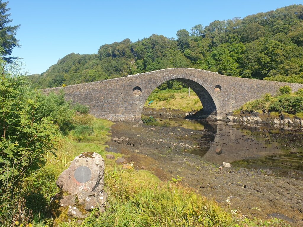
At Clachan, by a cheerful pub, is the Bridge Over the Atlantic, a high arched stone bridge that since the 18th century has linked Seil to the mainland and given it a lifeline. The sea rushed through the narrow channel at a serious pace under the bridge, giving the grandiose title a little credence.
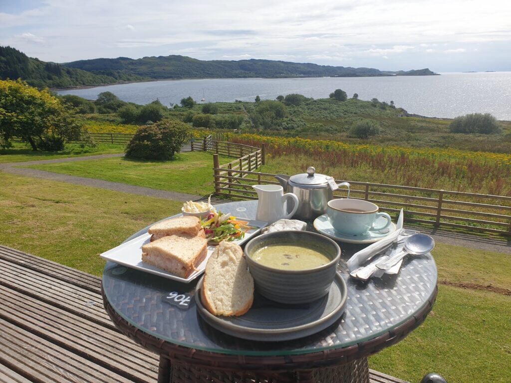
Back on the mainland, I turned south on the main road that runs from Oban to Lochgilphead, the two main towns around here. It wasn’t busy. I passed a few bays filled with expensive yachts and finally gave in to my hunger when I reached the Loch Melfort Hotel at Arduaine, where the view from their outdoor terrace over Asknish Bay was, frankly, superb. The soup and the crab and prawn sandwich combo wasn’t half bad either. If I was going to take time out from cycling, this was a very good way to do it. At this stage it was all warm sunshine and blue skies. As forecast.
Then the weather began to change. As forecast. A cool breeze blew grey clouds in from the south as I made my way up and over the significant climb the road makes away from the sea at Ardfern. After a long descent, I reached the small village of Kilmartin, which is surrounded by all manner of prehistoric burial mounds, cairns and stone circles. There is a fine view to the south from its modest hilltop, down over the dramatic low-lying vale and wetlands of Moine Mhor, and the Crinan Canal. On previous visits here I have enjoyed visiting these ancient mystical sites, as well as the tea room attached to the museum, next to the church. But the whole museum complex is now under major redevelopment until 2023. It was also starting to rain. Only one thing for it. I crossed the road and holed up in the hotel bar, a place of temporary safety and sustenance ahead of the 35 miles of nothing much that I knew lay ahead of me.
It turned out to be a wise move. The rain now set in with no intention of leaving, and I simply had to ride on through it. My waterproof gloves kept my hands nice and warm; but from the waist down I was soaking wet in no time. Still, if you are going to ride in persistently refreshing rain for 3 hours, this is the place to do it. My route took me all the way up the east side of Loch Awe along the narrow, smooth and flat B840, which continues to hug the tree lined shore of this huge freshwater loch for twenty miles. Loch Awe is the longest of Scotland’s freshwater lochs. I would sooner it was still dry and sunny; but it was impressive nevertheless. I had the tiny road to myself. Almost literally. I think I averaged a vehicle every two miles.
The last time I cycled along here, I was with a much younger version of my son, Jude, on our first father/son cycling adventure to Arran, Islay and Jura. He was probably eleven or so. On our last morning, we caught the early passenger ferry from Jura to Tayvallich and then had a fairly slow race against the clock to make a train heading to Glasgow at Dalmally station, at the top of Loch Awe. That was 43 miles of cycling on a small bike for a young boy. It was mostly flat, but not entirely. He made it comfortably and I remember the astonishment of the lady with the refreshment trolley on the train, when she asked where we had come from. I was a proud Dad that day.
We also had a family holiday here in a Forestry Commission log cabin when I was 17, on the opposite west shore, halfway up the loch in the hamlet of Dalavich. From Portinnisherrich, on my side, I could look across today and see where it was, just a km or so away by canoe. Google maps says it would take two hours to cycle the 20 miles the journey would take by road!
Finally emerging on another really quiet A road, I climbed for a mile or so and then seemed to descend for the remaining eight miles all the way into Inveraray, which lies near the top of Loch Fyne, tonight shrouded in mist. By the time I was dry, my clothes were drying and the bike was under cover in the hostel bike shed, there was only time to nip to the local shop for a Pot Noodle, some biscuits, some chocolate and a couple of beers. I’m not carrying those over the mountains tomorrow, so I will have to drink them.
One reply on “Map 55 – Crossing the Atlantic”
This whole venture just gets more amazing. We are off to stay beside Loch Awe in a few weeks and were in Strachur, over Loch Fyne from Inveraray, in April. Will definitely visit some of the places you have been. Thanks again for sharing this fabulous journey 👍