
Monday was a lovely sunny, breezy day with excellent visibility for enjoying some magnificent scenery. And enjoy it we most certainly did, pretty much from the start of proceedings right through to the finish.
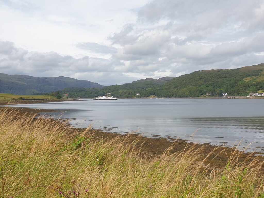
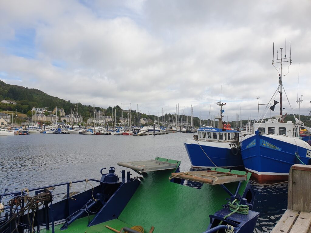
We began with a quick, 5 mile ride into Tarbert along the A83. It wasn’t too busy but it did have big lorries and buses that bore down upon us impatiently, so it was a relief to get away from that and ride along the pretty harbour in Tarbert, which is shared between an active fishing fleet and a large yachting presence. I like Tarbert; it is a colourful place with plenty going on, as well as being a ferry terminus for the 30 minute trip across Loch Fyne to Portavadie on the Cowal peninsula. Today, it was busy with yachts coming and going and people doing their daily business, including quite a few who seemed to have popped across as foot passengers on the ferry for some local service or other.
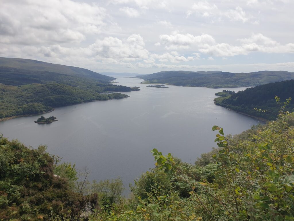
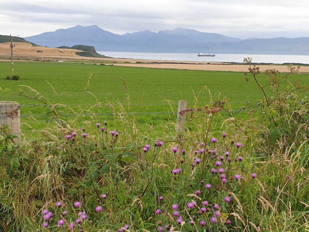
The trip over to the other side of Loch Fyne was a delight. We stood out on the passenger deck in the warm sun and drank in the surroundings, with the wooded hills of the Kintyre peninsula to the west and the Cowal peninsula to the east. The broad sea loch is perhaps five miles wide and many more miles long, and the yacht masts sheltering in Tarbert harbour slowly receded as we made our way over. About half way across, the dramatic outline of Arran, some miles to the south, came clearly into view. It was an impressive sight that drew the eye, with serious looking mountains displaying crenellated summit ridges against the blue sky, framed by the two long fingers of the mainland, and Loch Fyne in the foreground.
Disembarking at Portavadie, an exclusive yachting development, we rode up and over a small road across the Cowal peninsula and down steeply to the attractive village of Tighnabruich, on the Kyles of Bute, looking across to the wild upper end of the island of Bute. This area is ridiculously pretty, and consists of many fine old stone houses overlooking the water’s edge, each with a view to die for. We rode up the waterfront past the pier and as far as the boatyard, where yachts are serviced, to see the view straight down the channel between Cowal and Bute, with Arran again providing the drama at the end. On a day like today it was all enchanting, and you imagined living here and admiring that view every day. On our last visit, it had been filthy and wet and we had missed all of this. Which of these, you wondered, was the more usual?
From Tighnabruich, it was an amazing ride around the Kyles of Bute for the next 80 minutes until we reached the quiet village of Colintraive, just across the water from north east Bute. To get here required a ride of 8 miles north and then another 8 miles south again to get around the water’s edge, reaching an apex a few miles north of the tip of Bute. The first part of this journey took us over 500 feet up and then 500 feet back down again, with some breathtaking views from the highest point. On the way south, we clung to the coastline and stayed low. It was all a delight.
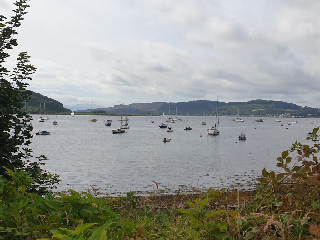
There is a ferry that joins pretty Colintraive with Bute, across the narrow strait, and it is then a flat 10 miles or so along the shore all the way into the main town of Rothesay. From Port Bannatyne (a village with a large marina) onwards the shore is lined with a procession of stately, stone built Victorian and Edwardian houses with double bay fronts, long front gardens and fancy ironwork, each with its own uninterrupted view of the Clyde and the hills of Cowal beyond. The grand houses continue for a couple of miles, all the way into the town centre, and beyond on the other side for another couple of miles at least. You would struggle to find a more attractive or more continuous collection of dwellings. There is no denying that the coastal approach to Rothesay from either side is truly lovely. Even the period street lights have highly ornate iron finials. From a distance the town is a picture of Victorian splendour and affluence.
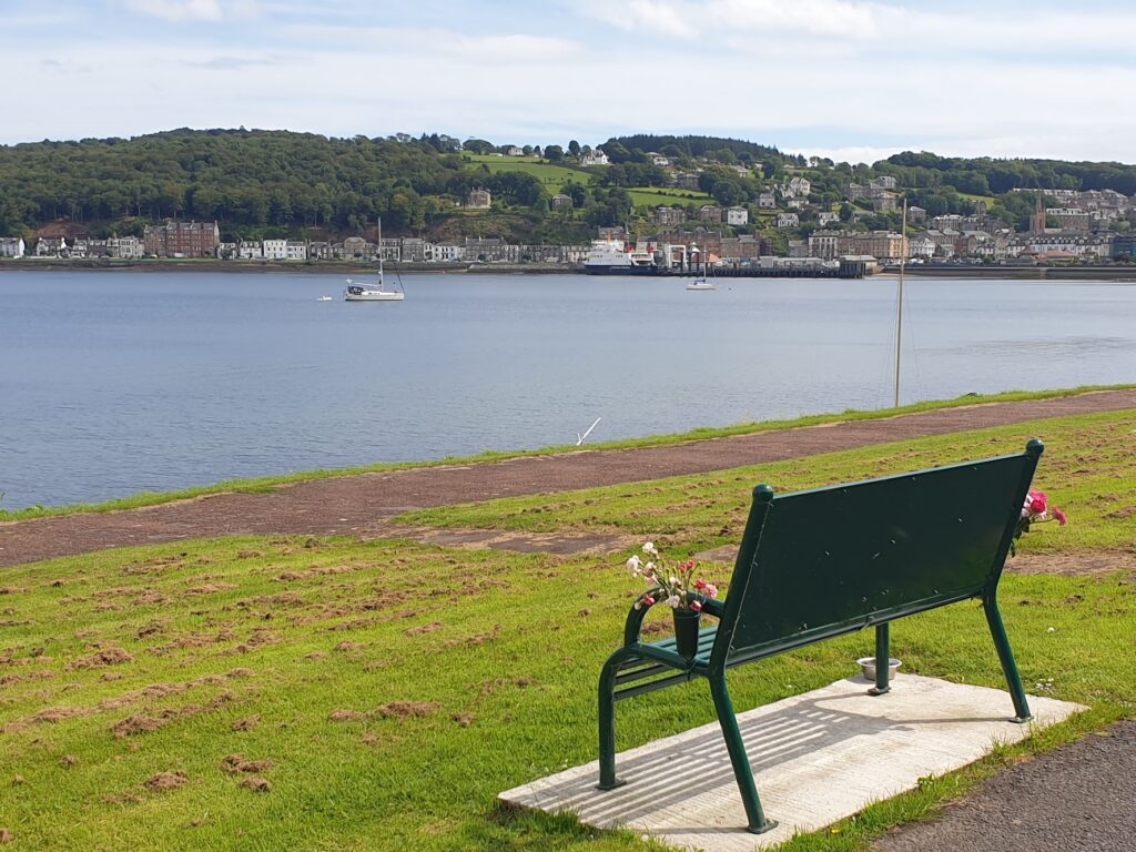
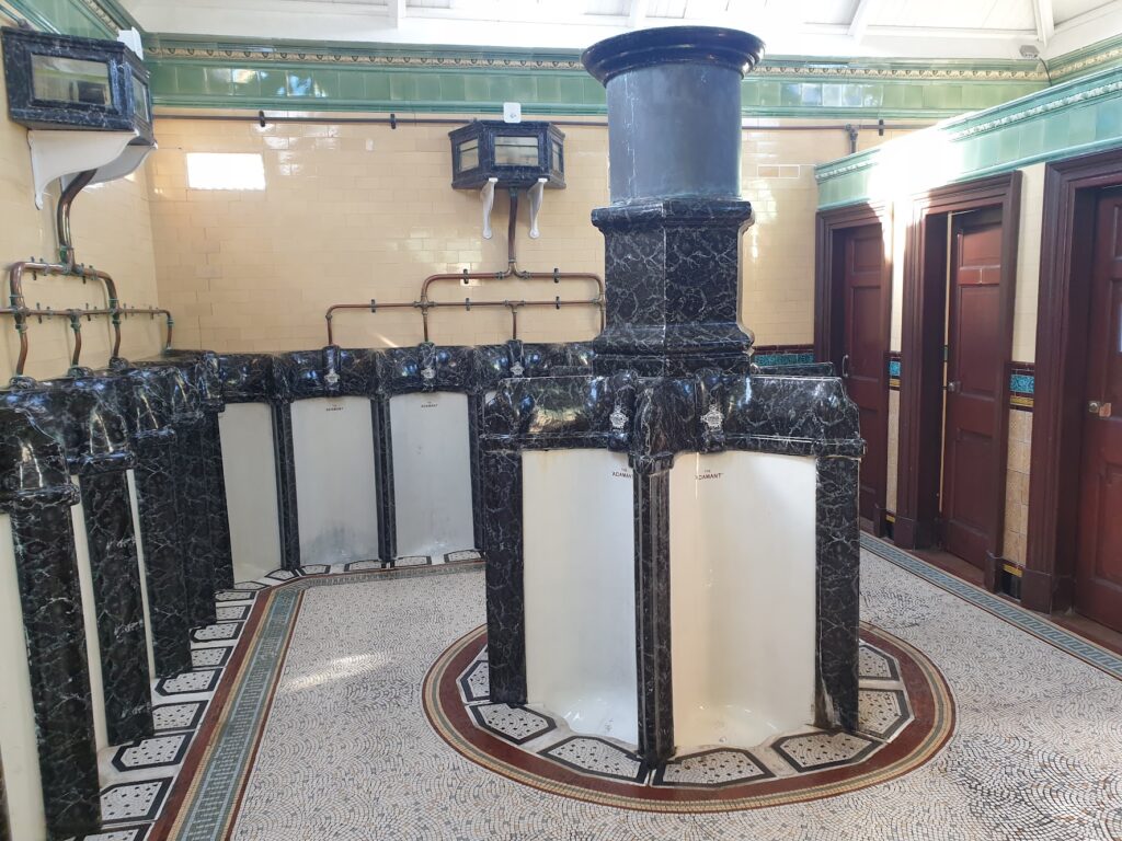
The town centre, however, is crumbling. There are many empty shops and some of the older buildings are held up by scaffolding. There are highlights, such as the ornate Victorian pavilion surrounded by floral gardens and putting greens, and the much older, moated Rothesay Castle a couple of streets back. There is even a Serpentine Street, not altogether unlike the more famous version in San Francisco, snaking it’s way downhill into the town. The ferry terminal is the centre piece of the bay, providing colourful activity as the hourly boats come and go, filling up with, and discharging, passengers and vehicles from and into the town centre. And right next to the ferry are the rightly celebrated Victorian public conveniences, which knock Stronachlachar (see previous Trossachs post) for six.
I find it hard to think of a place that manages at once to be so graceful and charming on the one hand, and so downbeat and sad on the other. I am a glass half full person and I tried to focus on the many good bits. It is really only the town centre, and the buildings containing the shops and bars in particular, where it gives you real cause for dejection. There are signs of hope; but for every one, there is another sign of decay. Rothesay has all the ingredients to be somewhere really special. The views are amazing. The houses are lovely. The island is verdant. There is much here that is good. But it will take a lot, you feel, to turn the town around to something approaching its former glory. I wish it well.
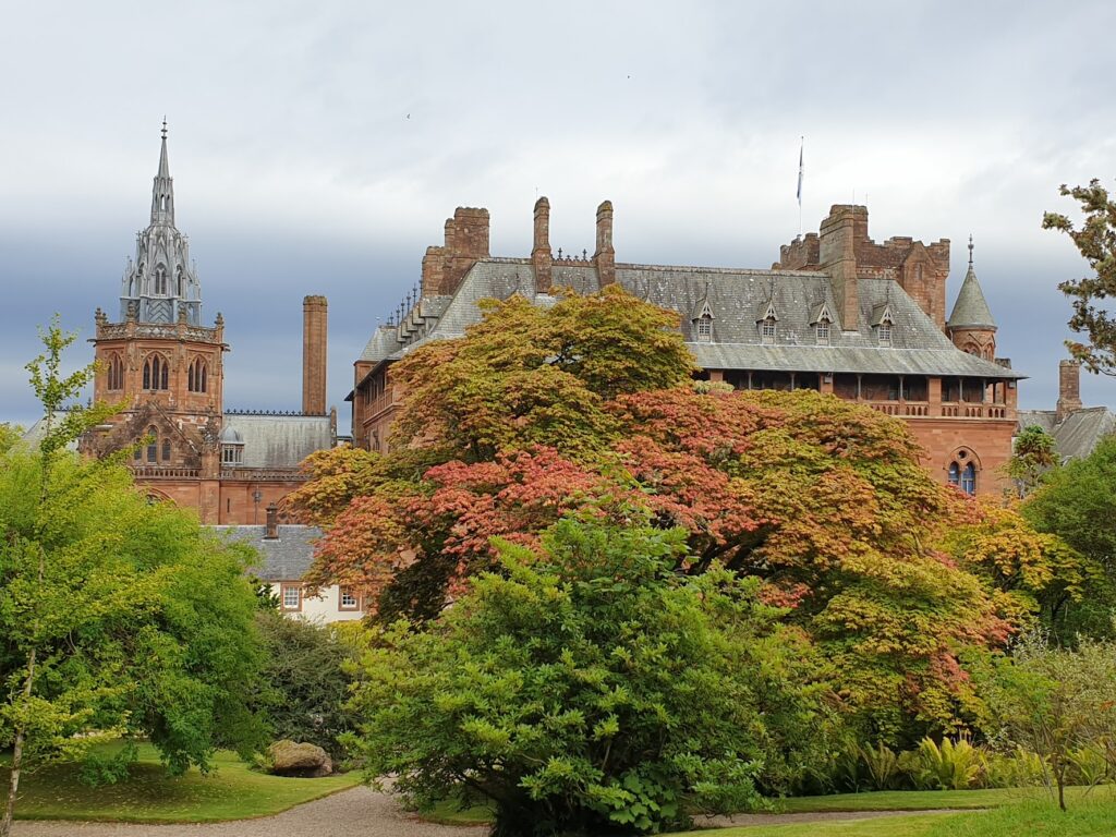
We cycled beyond Rothesay past the grand mansions along the lovely coast road until we reached the entrance to Mount Stuart, the home of the Marquis of Bute. It is an enormous country estate whose surrounding park, with its amazing collection of trees from around the world, runs right down to the sea. The house itself, if you can call it a house, is a huge red sandstone pile with an ornate chapel attached at one end. It really is vast. It could easily be a town hall in a large German city, and it wouldn’t be out of place. It was begun in 1879 by the third marquis, who was the richest man in Britain at the time. Everything is on an enormous scale. There are some beautiful gardens, including a glasshouse and a large vegetable and cut flower garden that has not yet been reclaimed from the weeds since the effects and neglects of the pandemic furlough period.
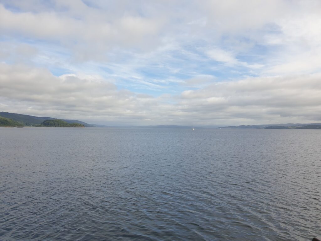
We cycled as far as you can to the bottom end of Bute, where the genteel village of Kilchattan Bay does an impression of Rothesay in miniature. It was calm in the evening sun and there were people splashing around off the pier in kayaks. It looked like fun. You have very good views here over to Great Cumbrae Island and the Ayrshire coast beyond, including the white towers of Hunterston power station, gleaming in the sun. We would be heading that way tomorrow for the next map. Not so far beyond lies Glasgow; but it seemed a world away right now.
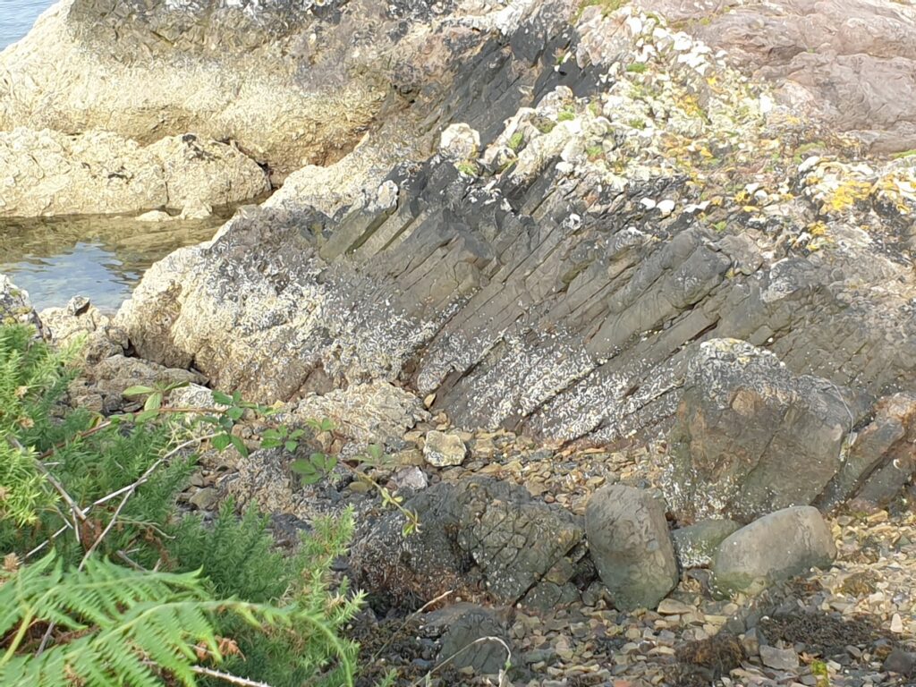
There are some significant rock formations on the beach here. But for the signboard I would have missed them. However, this is apparently one of the best places in the world to view columnar sandstone. Which we did. So there.
One reply on “Map 62 – Bute-iful”
Not heard of the columnar sandstone before – very impressive, as are the Victorian loos, amazing place to take a leak, if needed 🙂