
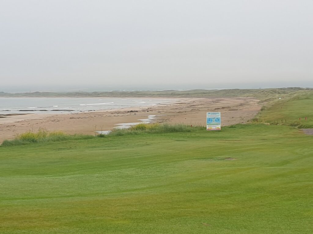
Last night’s rain in Campbeltown kept me confined to barracks; but I awoke to a dry, if rather cloudy, morning so I made an early start (for me, at any rate – any day when I am cycling before 8am is early). I was able to cross the Kintyre peninsula to the west coast and back – a round trip of 10 miles – and still be in time for my hotel cooked breakfast, which seemed important. The ride was pretty flat and I was surprised how large an expanse of low lying farmland there is around here. This is also where the airport is located, just inland from the sand dunes of the broad and sandy Machrihanish Bay, which also plays host to what I judged on appearance to be a rather exclusive golf club.
The village of Machrihanish, where the club house is, sits at the southern end of the extensive Links of Machrihanish. It is a quiet village at the end of the road, made up mostly of large houses, and a big, smart hotel to accommodate the wealthy visitors. It all felt a different world to its larger neighbour 5 miles away.
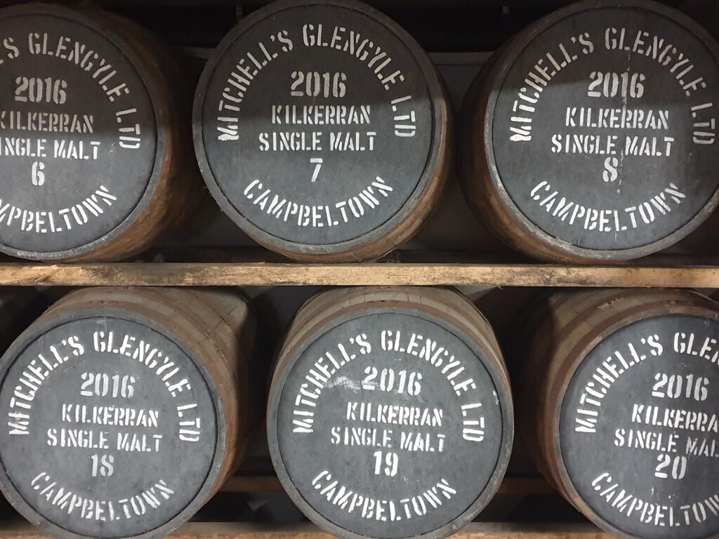
After breakfast, I completed my catch up from yesterday by riding to the very bottom of the Mull of Kintyre and the village of Southend. It lies 10 miles south of Campbeltown, which I had always thought of as being at the bottom. It isn’t though. There is a whole extra lumpy bulge of land below the flat area, and a network of lanes and farms and forests covering it. The lighthouse on the actual Mull of Kintyre sits something like 300 feet up above the sea on remote cliffs the best part of a tortuous 20 mile drive south west of Campbeltown. Now that’s remote. But I had other places to be and felt content to have reached two extremities of OS Map 68 before 11am. In any case I was due back in Campbeltown for a very important reason: an 11.30am tour of the Glengyle Distillery, where Kilkerran single malt whisky is made.
Campbeltown is considered a distinct Whisky region in its own right (one of five, the others being Speyside, Highland, Lowland and Islay; although some say that there is sixth, Island, that covers island whiskies not from Islay). It was once home to as many as 36 distilleries. It was the self-proclaimed “Whisky Capital of the World” but the industry collapsed in the early part of the twentieth century and it hit a low of just one remaining active distillery in the 1930s after it’s main US market disappeared during prohibition and the Great Depression. It is now back up to three operating distilleries and ground has been broken on two more. Given the recent loss of the Campbeltown creamery, and its associated jobs, this expansion is welcome news. Milk from Kintyre is now driven hundreds of miles to be turned into cheese.
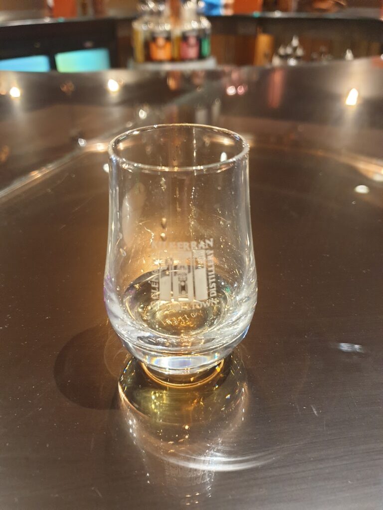
Anyway, whisky brings some tourists to the town, and today I was among them. The reopening for production of the Glengyle distillery by the owners of Springbank occurred as recently as 2005, after the purchase and complete renovation of the original premises, as well as sourcing and installing the entire range of second-hand production equipment from other distilleries around the country. This initiative probably saved Campbeltown’s status as a region. It produces whisky for around 3 months each year, from September onwards, using the barley and the staff otherwise employed at the sister Springbank distillery. Their ability to expand is dependent on their ability to add extra warehousing space to store more whisky, a task which they had already made some progress on just before the pandemic.
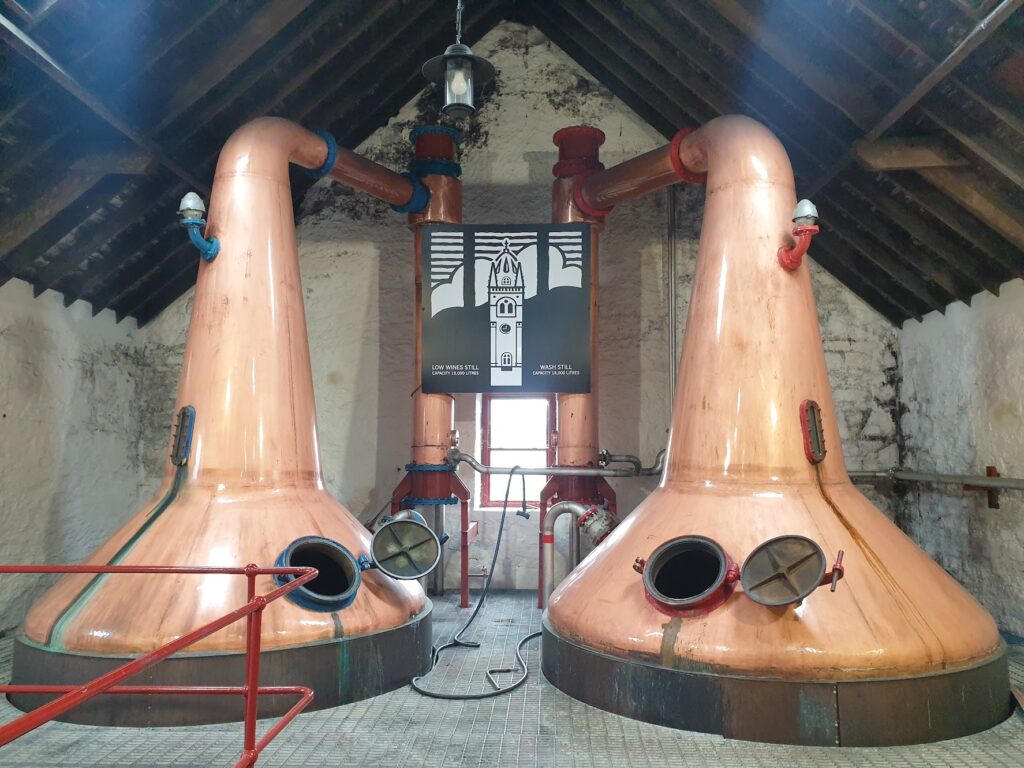
Whisky tours are not always my thing; but this one was excellent and I recommend it. It was also very good value at ten pounds, for which you got not only an hour’s guided tour; but also a dram of the very likeable, mildly peated Kilkerran 12 year old, and a miniature of a distillery exclusive release, and your tasting glass to keep! Bargain!
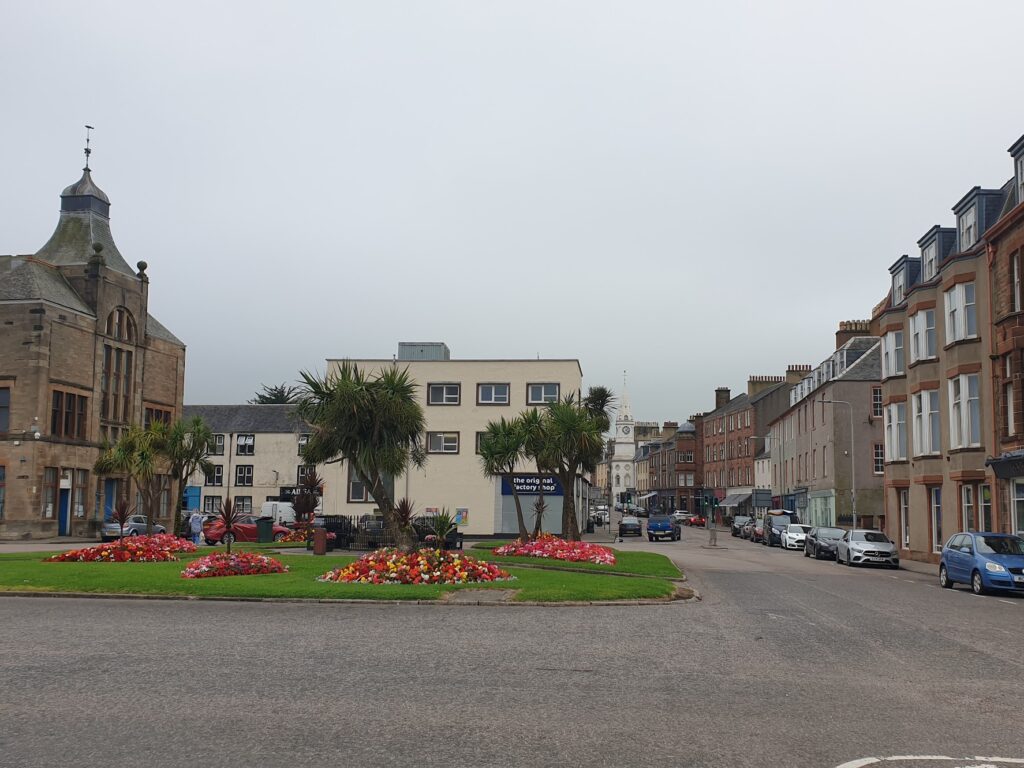
I have mixed feelings about Campbeltown, having finally got there in person. It takes a lot of reaching (their amateur football team has regular round trips of 200 plus miles for away matches) and in some ways it underwhelms. However, there is enough here and nearby to reward your efforts, I think, and although it has the inevitable empty shops and closed hotel in its high street, it also manages to offer a good number of smart and interesting shops, bars and restaurants to leave you feeling that it is, at worst, going through a transition. It’s isolation is both a draw and a curse. Kintyre calls itself the mainland island, and that is well observed. Just have a look at a map and see how very long this cul-de-sac really is. It is also mainland Britain’s most westerly town, adding another extremity to my growing collection. But like it or not, it was time to leave. I had a ferry to catch and 40 miles of cycling to do first!
There are two roads joining Campbeltown to the rest of the world. The main A83 runs down the west coast. The smaller and much quieter B842 runs up Kintyre’s inside leg, so to speak, right opposite the west coast of Arran, across Kilbrannan Sound. At the mountainous top of Arran, this road gives up and crosses over to join the A83, which is then the only meaningful choice north through Tarbert and right up to Lochgilphead. But since Arran, and OS map 69, was my target today, it was my road of choice. There is just one settlement along the B842 that offers a shop, tearoom and pub, and that is Carradale. The road as far as Carradale was actually bigger than many I have got used to; but beyond here until it reaches the Arran ferry at tiny Claonaig, it is single track with passing places. For all of its length it undulates and I counted at least five separate places where the road plunged downwards towards sea level around steep, hairpin bends. These required real caution on a road that had seen just enough moisture from above, and contained just enough traffic, to make these moments potentially dangerous. But I avoided trouble and made the customary afternoon tearoom stop at my only real option in Carradale, which was handily about half way through my journey. Luckily this was open on a Monday, because – according to the owner – not much else in Kintyre is, which is why they changed their own hours. For that, and indeed the very existence of the Blackbird tearoom, I thank them. It was nice enough still to sit outside for my scone with jam and cream; but a bit later on the drizzle set in for long enough to require a rain jacket stop.
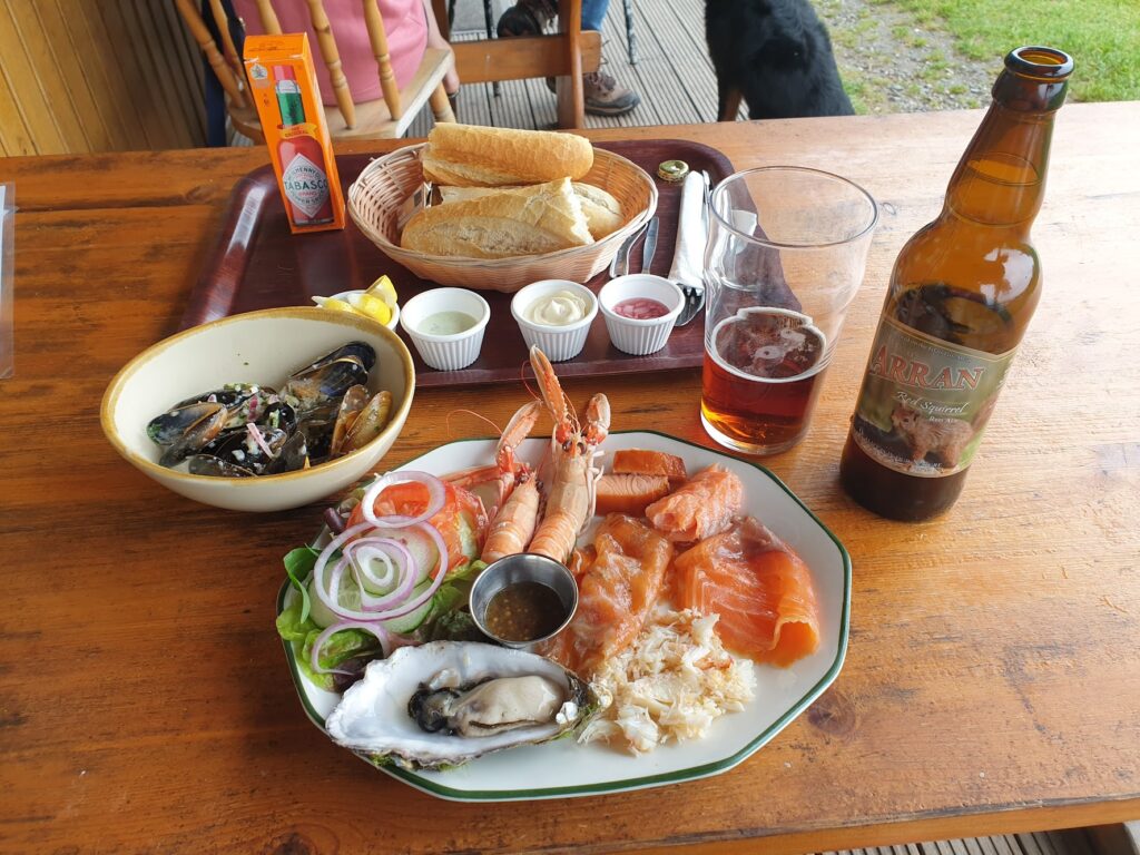
I feared really bad weather setting in, and I feared not reaching the last ferry to Arran at 7pm. But neither happened. A third fear was not getting any dinner to eat that evening. I missed the chance to buy emergency supplies in Carradale shop, because it closed while I was still on tearoom business. I knew that there was likely to be nothing at 7.30pm on a Monday night in Lochranza on Arran (and I was right), and that left just one option, if I got there soon enough. Two miles beyond the ferry terminal in Claonaig is the tiny village of Skipness, right at the end of the road. It is a pretty place with incredible views on a nice day over to Arran. There is an ancient ruined castle you can visit during daylight hours; but critically for me this evening, there is also a seafood shack, open all week until 7pm. I arrived about 5.45pm and sat outside under cover to enjoy their seafood platter, which was an absolute joy. It really shows the importance of planning ahead on a day like today in a place as remote as this. You either go hungry or eat the most magnificent food imaginable. For me, tonight, there was no middle ground. A great end to a good day.
One reply on “Maps 68 & 69 – Kintyre: the Mainland Island”
Looks far healthier than your go to fish and chips diet!