
Today was a special day for a few reasons. For starters, I would be riding in the company of my good friend Rob, with whom I share many interests (including cycling and exploring new places). It would also be my last day of cycling before a break to join my family on a short holiday (and even long distance adventure cyclists need holidays). Today was also the day I would be crossing the Yorkshire Moors National Park, which is always an exciting prospect. And perhaps best of all, the bonus of reaching the coast in Whitby, one of the best towns on the British coast, where we would be meeting my lovely wife for fish and chips and a well-earned pint or two.
So it was with some disappointment that I looked out of my bedroom window in Richmond to see a grey, drizzly morning. The forecast was for better weather ahead and I am by nature an optimist, so I set off to rendezvous with Rob confident that things would improve. I was feeling so sure that I didn’t even put my coat on! The first few miles were, in any case, really just a matter of getting there. I had a few miles of dreary main road to the busy roundabout and motorway services at Scotch Corner; but then things got better very quickly as I passed through quiet and attractive villages and along back lanes until I reached Croft-on-Tees, just south of Darlington. Here a fine stone bridge spans the River Tees, now much wider than it had been for yesterday’s crossings (actual and abortive). It took me temporarily out of Yorkshire and “Richmondshire”, whatever that may be, and back into County Durham, “Land of the Prince Bishops”, which I suppose I must have first entered off the ferry in South Shields.
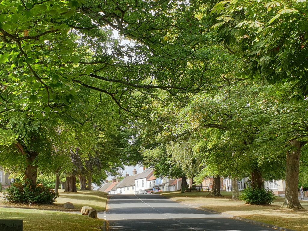
I refer here to the historical county boundaries, before things all got carved up and redrawn in the 1970s. As a lover of cricket and a native of Yorkshire, that always feels like the best approach to these thorny matters. I don’t know what the modern day natives of Teesside would have to say about it. I might have gone to Middlesbrough to find out if it’s biggest draw, the transporter bridge, was operating. Rob, who knows about these things, suggested the current outlook for the bridge is not great. I hope that turns out to be wrong. There are very few transporter bridges left anywhere and the only other one remaining in Britain is in Newport, South Wales. We will perhaps revisit this topic in a later missive, when I get to that part of the country. But returning to the present, I found myself in the large and handsome village of Hurworth-on-Tees, complete with an impressive range of local facilities that included the Mustard Tree cafe, where Rob was waiting. It was a surprise to both of us that neither of us had ever heard of this pleasant place before. But we hadn’t. And the same could be said for the next few villages, all of which seemed very pleasant and prosperous in this gentle countryside between the Dales and the Moors.
We crossed the twisting River Tees again, this time going north into Yorkshire to be on its south bank, which was counter intuitive, and then at the charming village of Hutton Rudby, one of its tributaries, the River Leven, which was flowing towards the Tees but away from the sea. And at lunchtime, we found ourselves entering the small and handsome town of Stokesley. It is quite unusual to find a town that appears not to contain any ugly modern eyesores; but as far as I could see, Stokesley was uniformly lovely. The sun was now out and we sat on a bench in a wide green surrounded by fine Georgian buildings and ate food that we had each brought with us. In Rob’s case, this was intentional. In my case, it was the triumphant rediscovery of forgotten oatcakes and cheese. Rob had brought enough “not for rabbits” salad for two, and the whole thing was rather splendid.
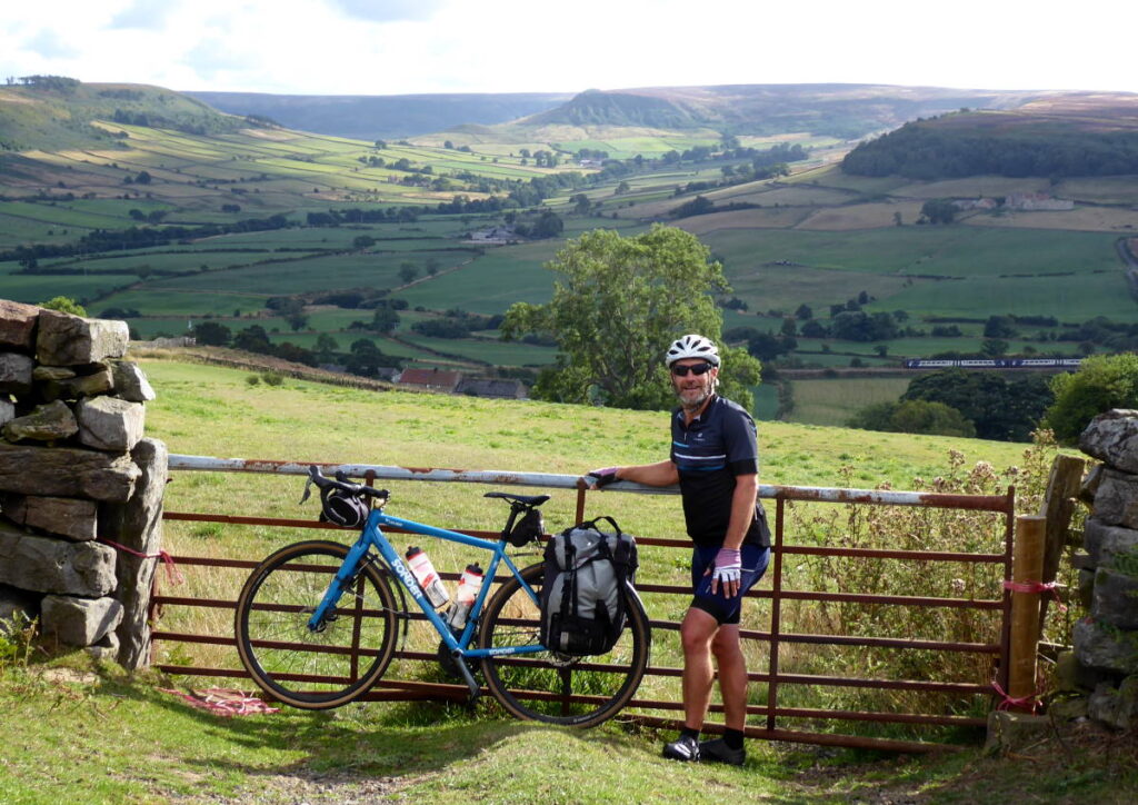
After Stokesley it was time to cross the North Yorkshire Moors. They had been creeping up on us from afar, and now they rose dramatically in front of us. Our plan was essentially to follow the valley of the River Esk east, all the way to Whitby where it dramatically reaches the sea. There is a small train line that snakes it’s way along this route, joining Whitby to Middlesbrough, with stations in many of the small villages along the way. However, there is no room for a road to take the same level route. The network of small lanes that connects villages like Castleton, Danby, Lealholm and others is peppered with many a steep hill, some as steep as 1 in 4, and pretty long as well. As a cyclist, you are faced with a succession of serious ups and downs, and you certainly earn the magnificent views.
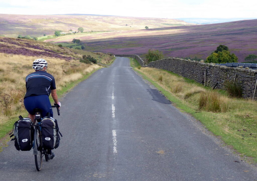
But it wasn’t a race. Rob was in charge of route planning and he even managed to squeeze in a section of relatively gentle off-roading that probably saved at least one big climb. Slowly but surely we made our way over the moors and through the valleys, always with stunning views to the south, always surrounded by purple heather.
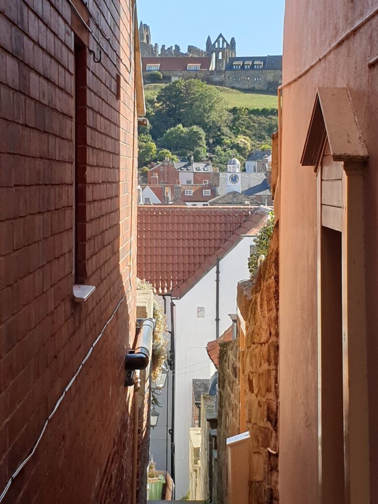
Eventually we emerged onto a main road and decided to ride the last 6 miles into Whitby amongst the fast moving traffic. For a couple of miles I was unsure of the wisdom of this move. But then, Whitby came unmistakably into view, 4 miles below us along the coast. The outline of the ruined abbey up on the cliffs above the town acted like a beacon and the road sloped obligingly downwards for the whole of the rest of the way. I loved it! We rode the last mile along the cliff top sea front and down to the river where we found beer, and then Jenni found us.
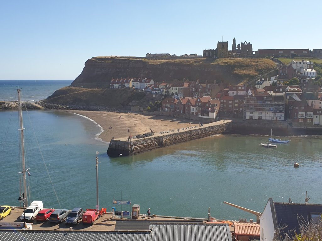
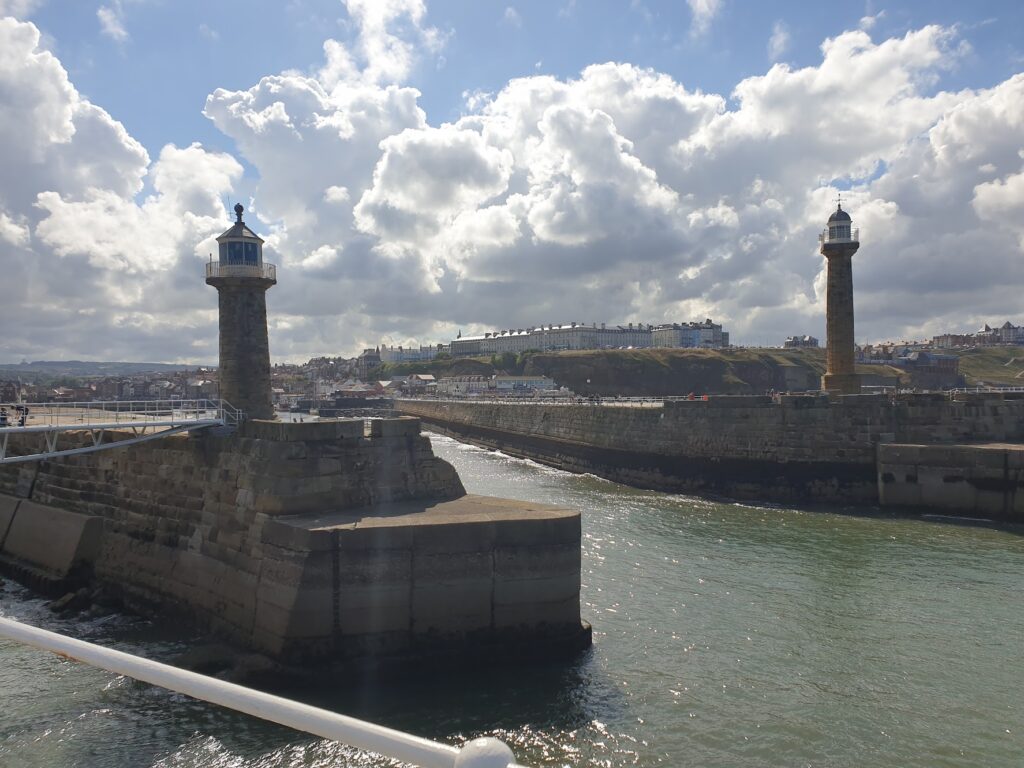
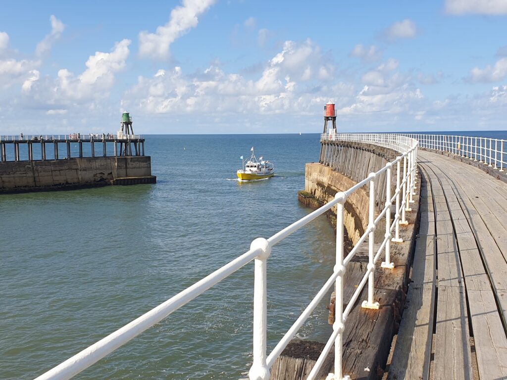
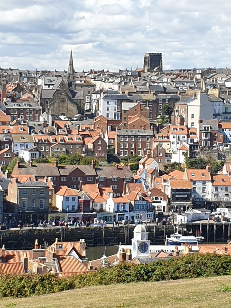
Whitby is quite simply a delight. It was busy with visitors; but it generally is, and on a sunny afternoon like this, they just added to the scene. The place is a picture. Its uneven red roofs huddle on either side of the harbour that is formed by the estuary of the River Esk, full of boats of all types, and sheltered by the two long, curved pier arms that reach out into the sea at the harbour entrance. The abbey ruins preside over the town, looking down from their clifftop location to the east, with the famous 199 stone steps leading up from the old town beneath.
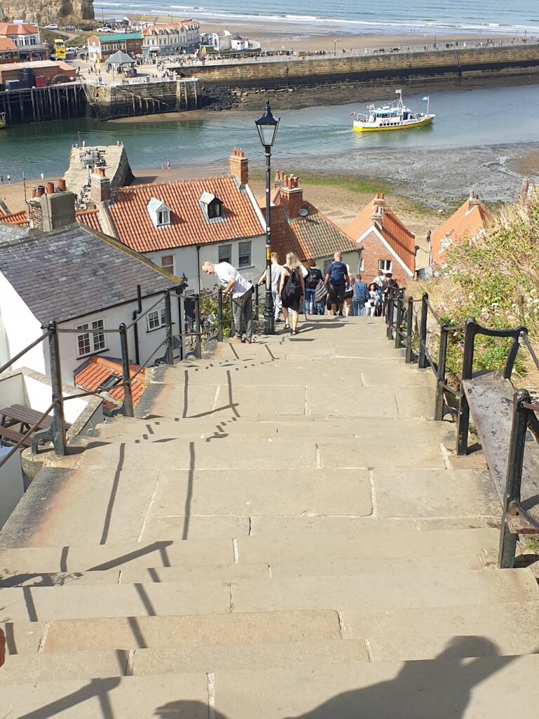
There is a lovely beach and a long run of colourful wooden beach huts beneath the cliffs to the west, on top of which is the almost complete Royal Crescent, now home to a collection of guesthouses. The streets in between comprise all manner of small businesses and homes, twisting and turning down to the water. There are endless nooks and crannies to explore and countless cafes and fish and chip shops to distract you. I was glad to be spending the night here and I spent the next day taking endless photos as we wandered around. It is a place for all seasons and for people with many different interests, and it seems to be equally alluring to all.
And so that brings this chapter of my adventure – after twelve coast to coast journeys – to a temporary pause. I will be cycling again from 13th September after I return from a short family holiday. There are few times these days when my wife, two kids and I all manage to spend time together, so the next week or so is precious. After that, it will be full steam ahead until the end of October, and hopefully I will make it to map 204 by the target I originally set myself. I now have a plan of sorts and I will publish it in the coming days. You are welcome to join me if you can.
One reply on “Maps 93 & 94 – the North Yorkshire Moors & Whitby”
Thanks for a splendid day’s riding! Good luck with the rest of the trip – hope I can join you again at some point. My blog of the day is on my website at e2e.bike