
The weather forecast for today was terrible. It was the same dreadful stuff everywhere, as far as I could tell. I arrived in Aberystwyth late the evening before from my epic coast to coast train journey, just as the first spots of rain were starting to fall. Overnight the winds really got up and the rain got heavy. This was supposed to last most of the morning before things improved, and it wasn’t weather to be out in, especially if that meant riding over high Welsh mountain passes. So there was no point at all in trying to get an early start. Which was fine with me. But I still had to get to Ludlow. In England. Over the mountains. Before darkness fell. Tricky.
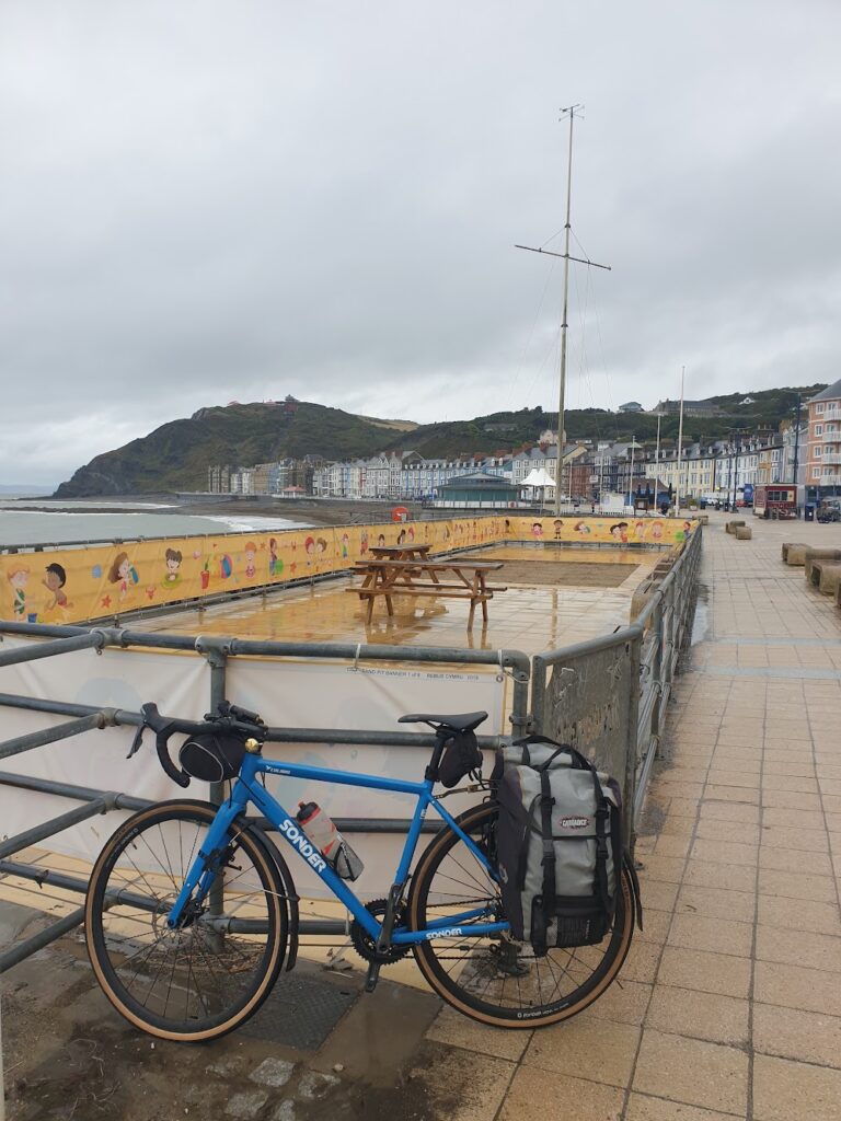
I decided my best strategy was to trust my legs to get me through the late miles, and not depart until late morning in the hope that things might have improved enough to make cycling a reasonable proposition. I started by having a look at the seafront, which was blustery but not as bad as all that. Aberystwyth has been called (according to one old railway poster I saw) ”The Brighton of Wales”. That isn’t very accurate; but it does have a long promenade lined with Victorian hotels and a pier of sorts. But behind this rise tall cliffs and an incline railway. The town is as big as it gets in mid Wales and it takes on extra significance as the home of the University of Wales. It all sits in the valley of the River Ystwyth at the point it joins the sea. It seemed like a jolly sort of place to me on the whole, with lots of brightly painted houses.
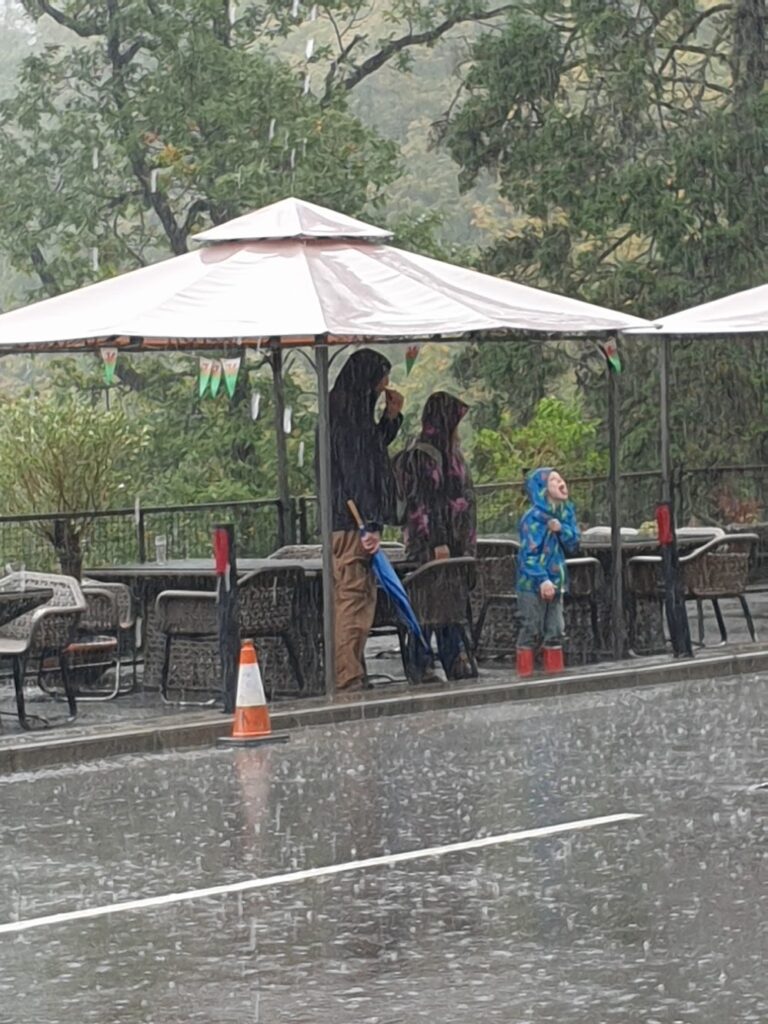
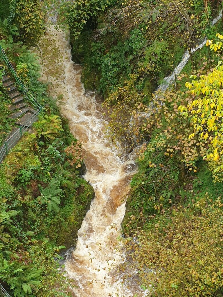
As I left town, the rain stopped and it stayed dry all the way until I reached Devils Bridge, an hour high up the valley by road or steam train, where there is a series of waterfalls that were quite spectacular after all the recent rain. There is also a large hotel here and, since there was only a mountain pass ahead of me, I stopped for lunch and sat outside under the hotel veranda. It was at this point that the rain returned, just as a large party of Dutch tourists arrived for lunch. I blamed their guide for the weather and he apologised. But the rain carried on, pretty persistently hard, for another 45 minutes or so. My fellow outdoor diners and I watched as the sky slowly improved from the west until, all once, the rain stopped and we had bright blue above us. Time to cycle.
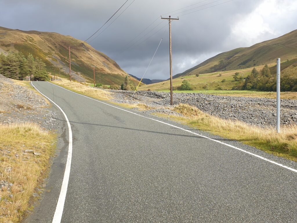
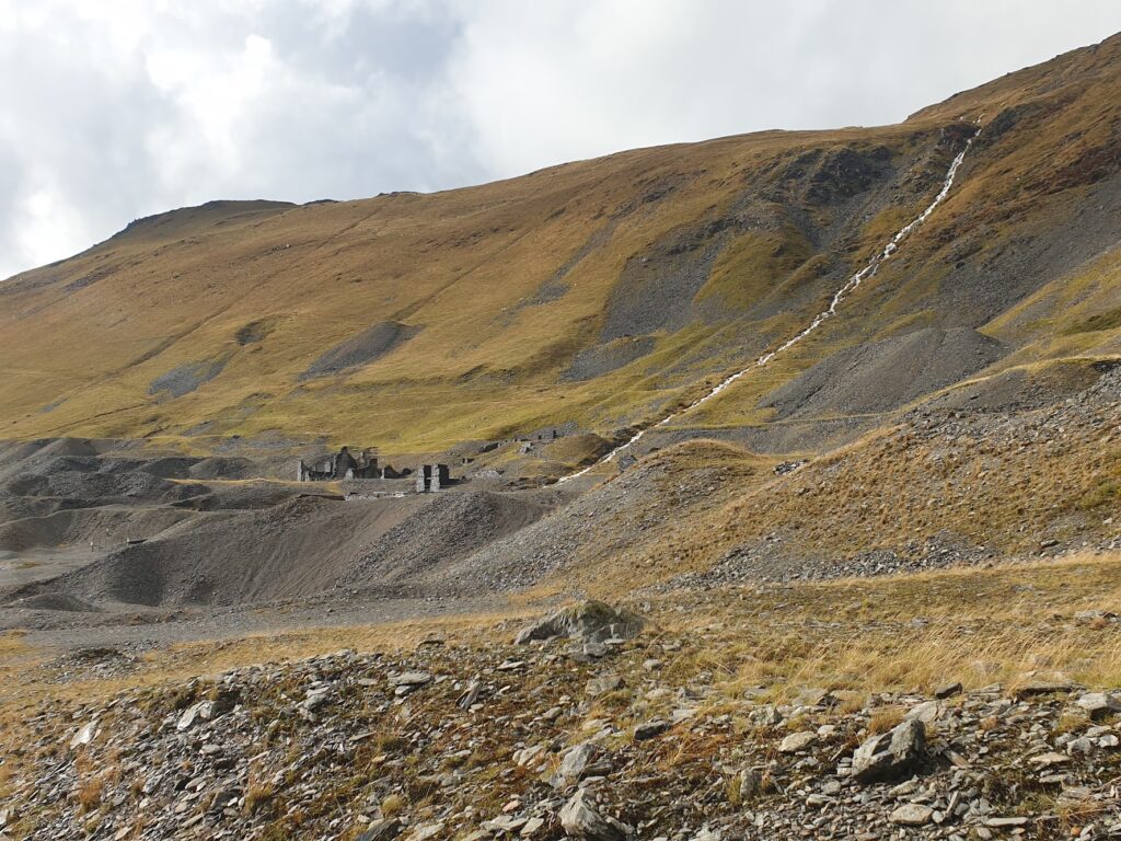
I knew that I would now be challenged to get to Ludlow in the remaining daylight; but at least it was dry. The next section of the ride proved spectacular beyond expectation. A few miles on I dropped down into Cwmystwyth and set off along a dramatic section of valley with high sides and a broad, boulder strewn valley bottom, with the river churning along in full spate. It felt like a glacial river valley in the Himalayas in the bright, wet conditions, with the shells of stone buildings above the road adding to the sense of drama. For many centuries this had been a major mining area for non-ferrous metals, especially lead, zinc and silver. The average age of death of miners here was as low as 32 due to acute lead poisoning. Today there is no mining; but the landscape has changed forever. Waterfalls gushed down from above on all sides and it was a hugely atmospheric place.
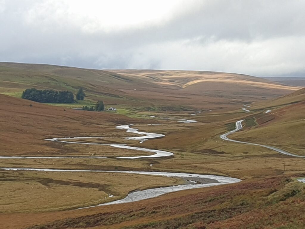
After a couple of miles I emerged into more typical moorland mountain scenery, the fast flowing river following the small road closely as it wound its way higher up to the watershed. I had all of this pretty much to myself and it was a land of huge vistas that changed with every turn. I was barely past the highest point when the infant River Elan took over in a similarly frothing mood, making its way east, away from the sea. When that made a sharp turn south, towards the reservoirs of the Elan Valley, I had one more summit to crest at over 1,600 feet and then an epic descent of several miles. I dropped at speed right down to the small town of Rhayader, which sits on the upper reaches of the River Wye, whose waters flow south to the Bristol Channel. The whole experience of crossing the mountains today had been truly exhilarating. But I still had 45 miles to go and it was five past four on an October afternoon. Sunset was just after 6.30pm.
Notwithstanding, I decided that I really needed food and that this was my best chance to get some. Mid Wales contains a lot of empty space. Never pass an open cafe. Except that here they all seemed to have shut before 4pm. The only option I could see was a Turkish Kebab shop. Oh well, needs must. In five minutes I had a ”small” kebab in front of me (it was huge) and I wolfed it down as fast as anyone could. Now, fully fuelled, it was time to ride like the wind. And I did. I absolutely flew through green, hilly country along the mostly empty, fairly level A44 and then made short work of the main road up and over to the small town of Knighton. Here I picked up the valley of the River Teme and found that the road into England was flat, passing in between hills until the final few more undulating miles to Ludlow, which I reached at exactly 7.14pm, before it was truly dark. Now, I admit I had a strong following wind, but even so, that was pretty decent riding fully loaded with panniers. So, despite the weather, my strategy paid off. I enjoyed all 86 miles of epic cycling across the impressive mid Wales mountains, virtually traffic free, and all in daylight. Just. It was a memorable day and I am so glad I didn’t miss it, or have reason to curse it. If anything the earlier rain made it more special. Not a day I will forget in a hurry.
3 replies on “Maps 135, 136, 137 – Beating the rain”
Sounds like a great day’s cycling Mark. I looked up the route on Google Maps – it’s very impressive that you could manage all that in one rain-affected day. You must be in pretty amazing cycling condition after all this!
the photo of the river Elan is stunning. What a cycle!
Epic day! Well done