
There are days in this adventure when you cannot altogether avoid a large conurbation. One of the biggest anywhere is the West Midlands and it stands inconveniently in between Ludlow and Rugby, my two end points today. Finding a reasonable and acceptably direct cycle route between them was as tough a route planning challenge as any so far, perhaps the hardest, and so I enlisted the indomitable Mrs W to help me. At home, the night before, she could spread all the necessary paper maps out on our large kitchen table, whereas I had OS maps only on my tiny phone screen. It took her over an hour, but she did it! I received message after message containing lists of places on her carefully threaded route. That gave me enough dots that I could see how to join them one at a time as I went. It was a fiddly business; but it worked.
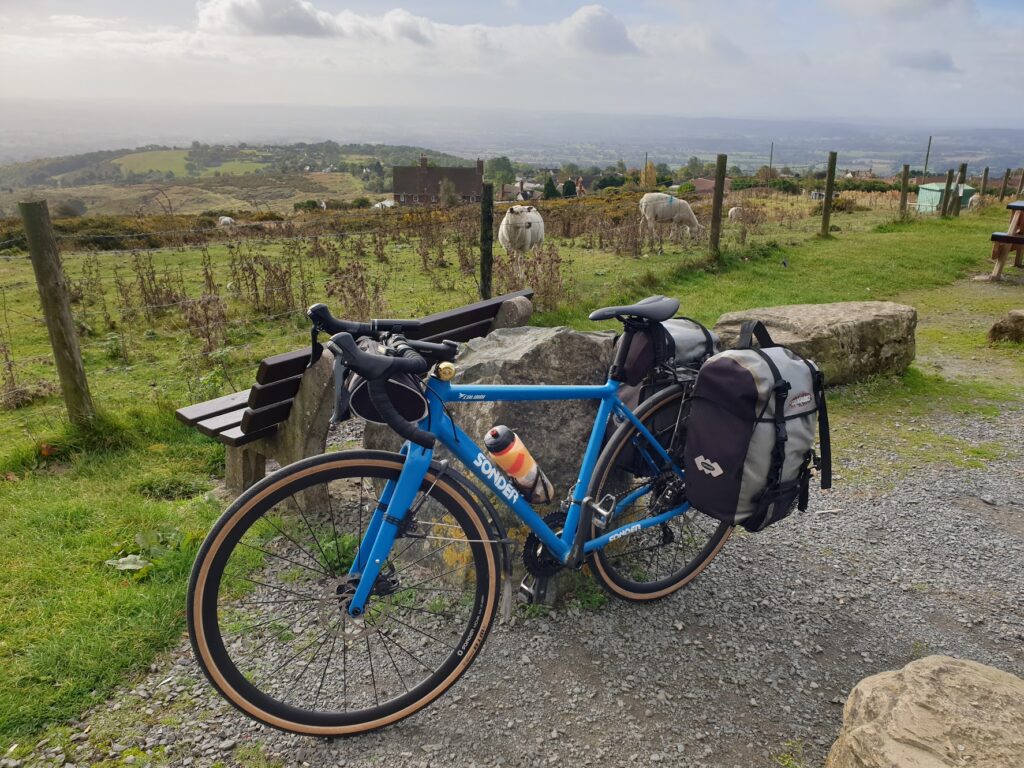
After yesterday’s exceptional ride, my expectations needed resetting. I knew today would not be the same in many ways, and that any big hills would come near the start. I also knew to expect more traffic as the day went on. But I had a lovely, sunny day, once again, and a following breeze, which are the best things you can wish for whatever your day may offer. And so it proved, a day of many twists and turns to achieve a green and attractive corridor through a heavily populated region, crisscrossed by many motorways and dual carriageways that I needed to avoid at all costs. Part of what made it harder was that I was once again in a part of the country that I really don’t know. That is a good thing, of course, from the point of view of curiosity and discovery. But it takes away your ability to rely on previous experiences and instinct. So I followed my instructions and made the most of being led.
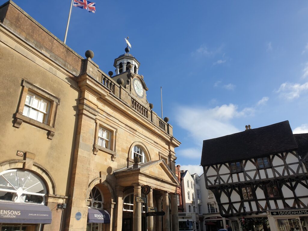
To the east of Ludlow stand the Clee Hills. They are big: the principal two (Brown Clee – Shropshire’s highest point – and Titterstone Clee) reach over 1,700 feet. And my route took me almost over the top. Within a few miles of Ludlow I was climbing steeply up to villages perched high up with huge, sweeping views of the land to the south and west, right out to the Malvern Hills and the higher parts of mid Wales, among many other points. It was a dramatic vista, somewhat hazy due to the position of the sun; but unexpectedly far reaching. It is said that there is nothing higher to the east until you reach the Urals in Russia, and Radio Moscow has been picked up here, hence the name of the former pub in Cleehill, “The Kremlin”. I passed over a cattle grid and into a great big area of common grazing land up on the hill, before a long, fast descent back down into the very pleasant small town of Cleobury Mortimer, ”The Gateway to the Shropshire Hills”. Here a timely coffee shop presented itself to me, with seats out in the sun and a warm breakfast roll! There were some fine old buildings in the tree lined high street, but none more notable than the 12th century church, which had an obviously twisted spire. We are not quite talking Chesterfield here, whose large church spire is famously off kilter and acts as the iconic symbol of most things linked to that large Derbyshire town on the edge of the Peak District. But it wasn’t so very far off, I thought, for somewhere much less well known.
The next section of riding was equally pleasant, taking me through a sizeable part of the Wyre Forest. This reminded me of Sherwood Forest, an old and handsome wood of autumnal, deciduous trees with bracken growing underneath. It must have been how much of England once looked before the oaks were all cut down to build warships in the middle ages and the land given over to grazing sheep. Now we are one of the least forested countries in Europe and we need every tree to help fight climate change. The forest continued for a few miles and then I arrived, just like that, in the Severn Valley the stately town of Bewdley.
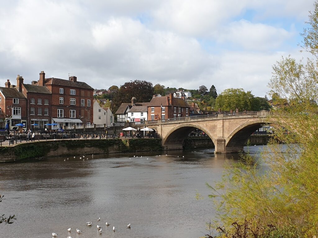
I knew of Bewdley mostly from television footage of repeated floods in recent times (climate change at work). It has an old stone bridge over the Severn and its banks are lined with handsome red brick Georgian houses. The big sandstone church in the market place is also Georgian in appearance and stands like an island between the queues of traffic waiting to cross the narrow bridge. The Severn Valley steam railway brings people here from Bridgnorth and Kidderminster, and it seemed like a place where wealthy folk might spend their money in its boutiques and restaurants.
From here onwards the really fiddly stuff began. I was propelled from one attractive commuter village to another, now on a country lane, now on a suburban road. The main roads I crossed were all busy with rushing traffic heading north or south into Birmingham, or Bromsgrove or Redditch. I crossed big roads like the A5 and the A38 with care and felt glad to be mostly occupying the quieter spaces in between. There were some quaint, leafy places, too, like Cookley and Belbroughton and Barnt Green, nestled in the slopes of the Clent and Lickey Hills. You could be fooled into believing you were in the Surrey Hills near Guildford, such were the trappings of wealth in evidence around here.
What I didn’t find was the cafe I now really wanted. It was just starting to get serious when I stumbled upon a lovely pub with a large, sunny garden near the top of Weatheroak Hill. It had its own brewery and clearly did food, but I was too late (or early) for that. Except, thank goodness, they had some enormous hot sausage rolls. One of these and a pint of their Icknield IPA revived me nicely. My pint was named after the old Roman road that ran right across my route here. Icknield Street ran from the Roman Fosse Way in the Cotswolds roughly north east to Templeborough, which is on the edge of Rotherham in today’s world. Well, something has to be.
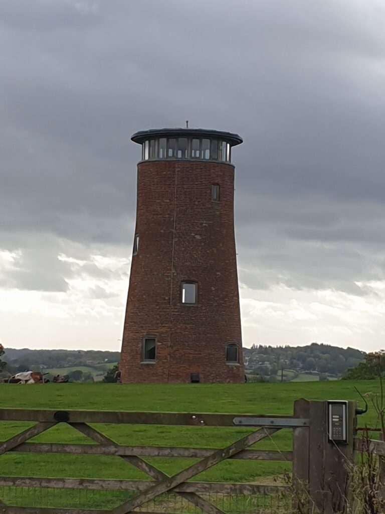
Duly refreshed, I reached the top of the hill where a converted windmill with a glass roofed top storey commanded a panoramic view of the local countryside. It is obviously not a bad area for walking, because I came across a group of teenagers in the pub car park doing their Duke of Edinburgh expedition. You can spot them very easily because they all have very big backpacks, travel in groups, and look (and often are) lost! I crossed through more affluent suburbs like Knowle, just next to Solihull, and reflected that all the Land Rovers and Range Rovers and Jaguars being driven past me on these busy roads were built just down the road. Once, through my work, I had a tour of the huge Solihull Land Rover factory. We watched a bare chassis grow into a finished car, that was driven away off the production line without ever having stopped moving. This involved minimal human input and lots of amazing robots doing nearly all the work. All very space age, I thought. Quite amazing.
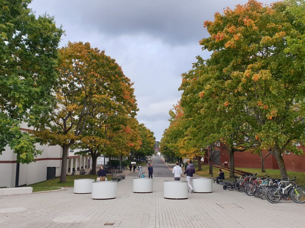
I successfully negotiated the complications of suburban school pickup time, during which a plentiful supply of the aforementioned luxury vehicles were out and about using all of their advanced and expensive 4×4 capability. Not. And I popped out on the south side of Coventry with my route taking me right through the heart of Warwick University Campus, which isn’t in Warwick at all, by the way. It is impressive, though. It looked like a lot of clever young folk were visiting for open day tours, and there was even one young man doing a spot of modelling in a sharp suit in front of one of the modern faculty buildings. It all felt a little futuristic and bold: a view of the next generation in the making, perhaps. I think I would would enjoy being a student here, based on first impressions. Or more likely a lecturer, let’s be honest. But probably neither.
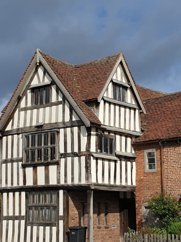
From here I followed the signs to Stoneleigh, a pretty estate village for Stoneleigh Abbey, with thatched, brick buildings arranged around a green. And the next place I reached, just before tea time as promised, was Rugby, where old friends of ours live just along the road from the famous school where the eponymous game was invented. And so began another lovely evening of catching up after too far long.
All things considered, another very enjoyable day of cycling. Quite a departure from the empty roads of mid Wales, perhaps; but a successful navigation of potentially tricky waters, and the promise of quieter times ahead.
One reply on “Maps 138, 139, 140 – Clee, Wyre, Clent and Lickey”
Missed you! we were in Fishguard yesterday disembarking the Rosslare sailing. See you later in the month.