
When the spinner sent me WNW, I knew it would be a tricky business. My straight line sent me over the highest hills of the Peak District and then through the Manchester conurbation, close to the city centre and out on the other side, via large industrial towns, to somewhere on the south side of the Ribble Estuary, an area of vast salt marshes. Then, it carried on to slice right through the Isle of Man and out the other side, over the Irish Sea, to land in Belfast and continue across part of the United Kingdom as far as Derry / Londonderry, as we must now call it, where it disappeared into the Republic of Ireland. All of those places, or pretty close to them, are conveniently linked together by ferries, so I felt a certain responsibility to do just that. I like a ferry, and this 2024 adventure has relatively few opportunities to ride them. Furthermore, these would all be new ones to me, which is always a draw.
The whole trip depended on the once weekly ferry service from Douglas, IOM to Belfast, which only runs in the summer. It was therefore now or not at all. Jenni fancied coming along on the non-cycling bits of the trip, since she had never laid foot on either the Isle of Man or Northern Ireland. So we made the necessary reservations and I set off to cycle the first section to Manchester, from where I could not only reach the coast in a moderate day of cycling, but also get home easily to sleep in my own bed.
But cycling to Manchester is a tricky business. My first issue was the lack of useful roads over the hills. I don’t usually head out from home in this direction because you are pretty much confined to main roads, and therefore traffic, and it is also quite challenging to make a satisfying loop. This latter part was not important today, but I still had the business of cycling over the Snake Pass – a lovely but lonely route that carries the A57 from Sheffield towards Glossop and Manchester. It is a notorious road, often closed due to snow in winter, that I know very well from behind the wheel of a car, but rarely as a cyclist.
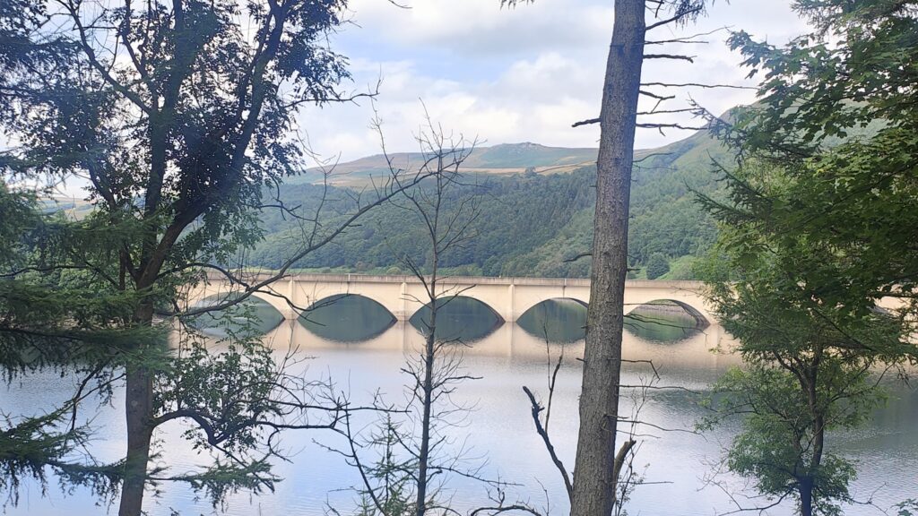
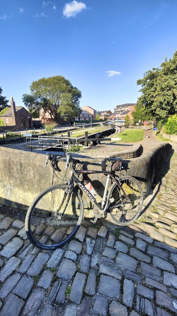
I realised that if I was willing to ride a gravel bike I could avoid traffic for at least the first hour from home by skirting the south shore of Ladybower Reservoir. Then it would be a case of getting to the top of the pass at 1,680 feet above sea level, before several miles of exhilarating descent to Glossop, the first settlement on the west side of the Kinder plateau. And then what?
Glossop marks the start of a traffic choked corridor into Manchester. It would be no fun. What to do? I found an answer in a conversation with a group of retired cyclists from Sheffield who I met on a train home from Manchester a couple of weeks ago. They had just ridden out into the Peak from central Manchester all the way along canal towpaths. From Stalybridge, a few miles beyond Glossop, I could do the same, staying remarkably close to my line in the process. And since I was on a gravel bike anyway, why not?
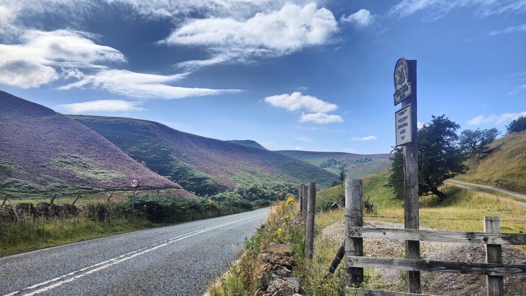
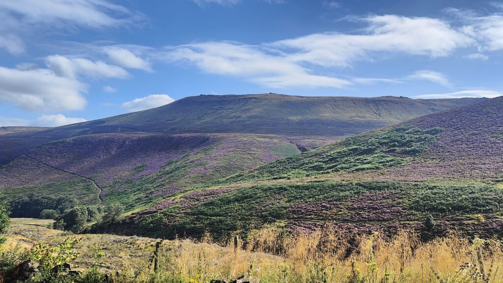
And thus my afternoon ride unfolded in glorious sunshine. The off road section along the old tramway to Ladybower Dam and beyond was, as expected, a pleasure. The Snake Pass, thereafter, was surprisingly quiet and therefore not the experience I had feared. The descent to Glossop was a ten minute thrill down through the purple heather, along miles of sweeping, curving main road, with the newly high rise skyline of Manchester shining in the far distance below me. No one passed me. Then, at the bottom, I avoided several miles of busy traffic through the linear sprawl of Glossop town by deviating through Old Glossop, which is a little known gem.
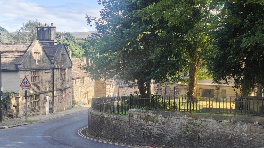
Until the 1840s, Old Glossop was the only Glossop. It was the growth and mass industrialisation of the cotton industry that led to the building of larger mills lower down the valley, creating Howardstown, now Glossop, a mile or so away. After that, Old Glossop was left behind as a backwater and saw little development. The result is a delightful collection of the large parish church, a few pubs, a school and some old stone cottages, all grouped together around quiet lanes and very easily missed altogether. I paused to take a photo and fell into conversation with an elderly fellow who was enjoying a pint outside one of the pubs. He turned out to be a lifelong resident and world authority on Old Glossop and he was keen to share his knowledge. He spoke of carvings above doorways that indicated the presence of a brothel, and of uniquely vertical coping stones on the wall around the churchyard, just over the road from us. I found myself wanting to know more, and he handed me a business card, with a website. I promised to get in touch, and I will.
But today, I had to push on. I got myself as far as Stalybridge without major incident, despite heavy traffic on the usual, unavoidable, long hill up to the traffic lights at Mottram. I don’t know how people live around here. For many hours a week, you are effectively trapped, surrounded by long queues of traffic inching along towards the motorways near Manchester. It is a bottleneck that appears to have defied the road planners for decades. The solution seems to be that there is no solution, with all other options rejected because they would spoil protected, beautiful and scientifically significant land. There is a regular train into Manchester, but unless you are heading into the hills, all motor traffic is at the mercy of the queues. And they can be very bad. I pity these residents. I couldn’t live here.
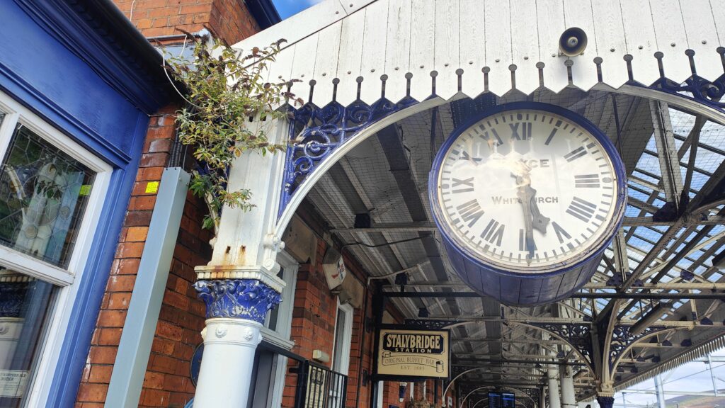
Stalybridge, and it’s neighbouring towns and villages, are also largely products of the industrial revolution, with many a large, brick mill along the valley bottoms. They aren’t the prettiest places: something of a mixture of nice and not so nice, I thought. But Stalybridge, as well as its canal, has a relic of a bygone age that I wanted to visit. It has a train station on the line from Manchester to Huddersfield and Leeds, and on platform 3 is a handsome old railway clock, and – even better – the country’s best preserved railway buffet, founded in 1885 and still a fully functioning real ale pub. The clock is a replica, but the original can be viewed, fully restored, in York’s National Railway Museum.
The first section of the Ashton canal towpath was a bit tricky and poorly maintained. The area was quite industrialised and at one stage I found myself dumped into an Asda car park. But a few miles later, things improved dramatically and the towpath – a few old, cobbled sections notwithstanding – was a fine, traffic free way right into the centre of Manchester.
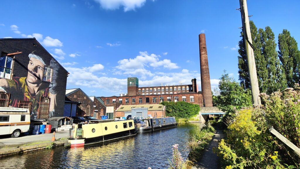
Along the way I saw much new development, especially in the last couple of miles between Manchester City’s futuristic Etihad Stadium and Piccadilly Canal Basin. This is the new Manchester, a mixture of new and repurposed old buildings, that seems to be very popular as a place to enjoy a modern, urban lifestyle. It is very much an area under transition, but there is a lot to like and it is certainly breathing new life into East Manchester, a traditionally poor area that certainly needed a boost. You can more or less watch the regeneration happening with each visit and the development shows no sign of slowing down. It all began with the building of the Commonwealth Games Stadium (now City’s home ground) for the 2002 games, and the nearby velodrome. Once that anchor was in place, the rest duly followed.
And before I knew it, I was at Manchester Piccadilly station, waiting to board my train home. An hour later, I was riding up our driveway. Part one of this complicated trip was successfully completed.