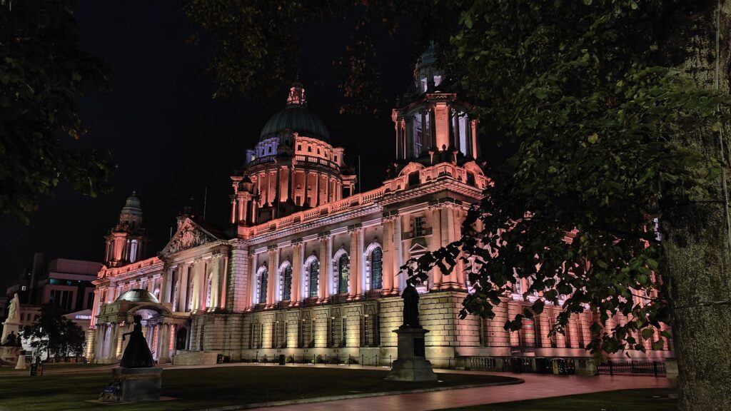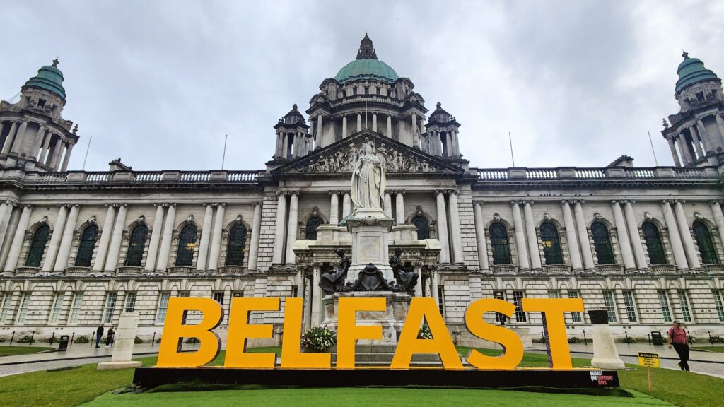
Sunday morning in Belfast was a quiet time to be leaving the city. I was a little short on sleep but it was a beautiful day and I had a chance to see and spend a whole day somewhere I had never been before. My straight line WNW ran directly between the province’s two largest cities: Belfast and Derry / Londonderry (as we must call it to avoid causing offence to anyone on either side of the sectarian divide here). The route was doable in a day of cycling, with a train back to Belfast that would depart from the banks of the River Foyle at 5.38pm. They left every two hours and took two hours to make the journey. If I missed it, there was one more in the evening; but I wanted to have dinner in Belfast with Jenni, so it was a firm deadline.
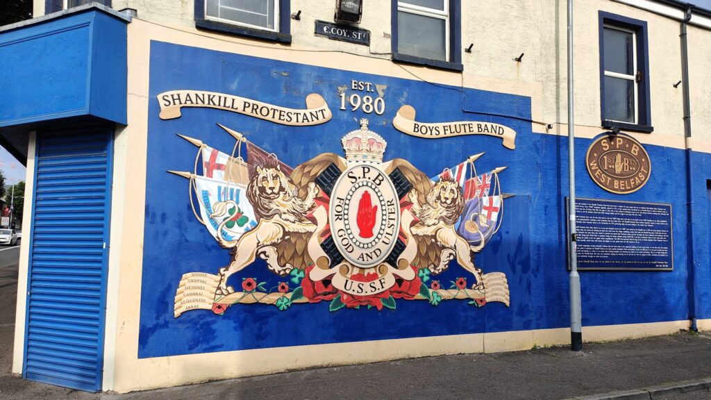
Within a couple of miles of our hotel I found myself cycling along the Shankill Road, right through the heart of Unionist territory in this divided city. Not for the last time today, I was quite taken aback by the number of British and Northern Ireland flags flying from lampposts, buildings, even from archways over the road. There were also murals on buildings, religious and royalist edicts, and a large branch of Shankill Rangers supporters club. You were left in absolutely no doubt about where the sympathies of the local people lay. The many flags fluttered briskly in the strong breeze (into which I would be cycling all day) and in the sunshine it was quite a striking sight; rather jolly, but for the inescapable political reasons behind it.
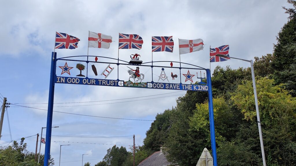
I hadn’t been to an area like this before and I wasn’t fully prepared for it. I was even more surprised to find that many towns and villages on my route today were just as lavishly bedecked in Loyalist colours, including the flag of the Orange Order. I notably did not see the equivalent opposite display in other places, leading me to assume that they were either more mixed communities, or maybe that the majority Catholic villages felt less need to visually assert their presence. It is a complicated and deep-rooted problem and things are so much better here now than in most of my lifetime; but feelings very clearly still run deep. Of course there is nothing wrong in displaying national, or even tribal, pride and association. You see it in many places around the world. But coming from a country that is otherwise relatively flag-light, I have always felt that the people who push their identity or allegiance most overtly must feel in some way insecure. If you are sure of who you are and where your place is, you don’t need to keep saying so. Do you?
Another issue today was my lack of a decent map. The OS Landranger series of 1:50,000 scale maps does not extend to any part of Ireland (it is a separate series), so I was unprepared for good route finding. That left me rather in the hands of Google maps, which is always a risky business. Regular readers may recall some of the issues that caused me in Washington State last year. I almost came to a similar fate this morning.
I needed to get from Belfast, which is ringed by mountains to the west, to the top of Lough Neagh, the UK’s largest lake by surface area, which I would reach at the town of Antrim. I was surprised how quickly the city gave way to country lanes, but according to Google maps that was all fine. And it was, until I turned right to find the tarmac disappearing and my way forward receding into a rough green lane that ran through nowhere much at all for a good couple of very uncertain miles. At one point it crossed a large stream and I did well to stay dry. But things did improve and I got onto some long, straight roads to make up for lost time.
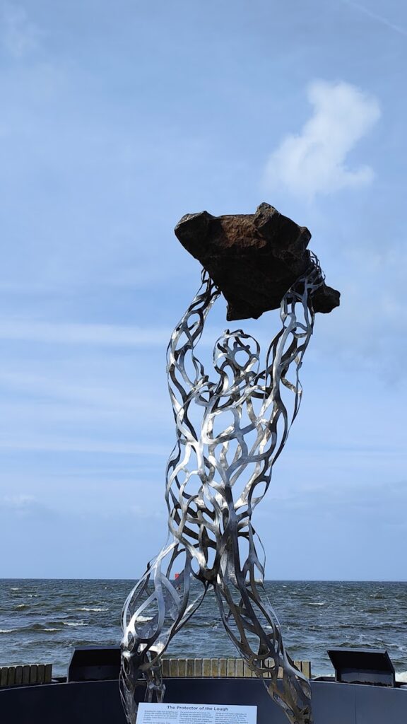
Antrim was pleasant. It provided breakfast in the sun under more British flags, and a chance to nip right to the shoreside of Lough Neagh. I’m really glad that I made the extra effort to see it. It’s big! There were waves today with the wind whipping across the water, and you couldn’t see the far side, nine miles away, giving it a feeling of an even larger body of water, a bit like the Great Lakes in America. There was a cool modern statue, The Protector of the Lough, caught in the act of throwing a large rock out towards the lake. People were strolling around the country park and it was all very nice.
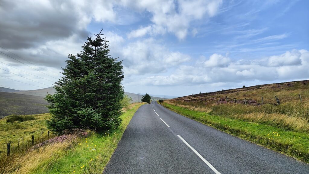
From here onwards I skirted the upper shore without getting much of a view, before a quick waterside tea stop in Toome, where the Lower Bann leaves the lake. Then I rode on to Magherafelt, which was a nice enough town, and from there into the smaller roads and settlements of the Sperrin mountains. Here I was made to climb some fairly big hills. It was a little like the Snake Pass again, only without traffic. The hills were round and bare and pretty featureless. It was an area for appreciating the whole, rather than the individual parts. At one point I came across a gathering of maybe fifty old tractors who were about to set off on a charity convoy along my road. An onlooker encouraged me to stay ahead of them for my own good, so I kept going. They must have got delayed, because I never saw them again.
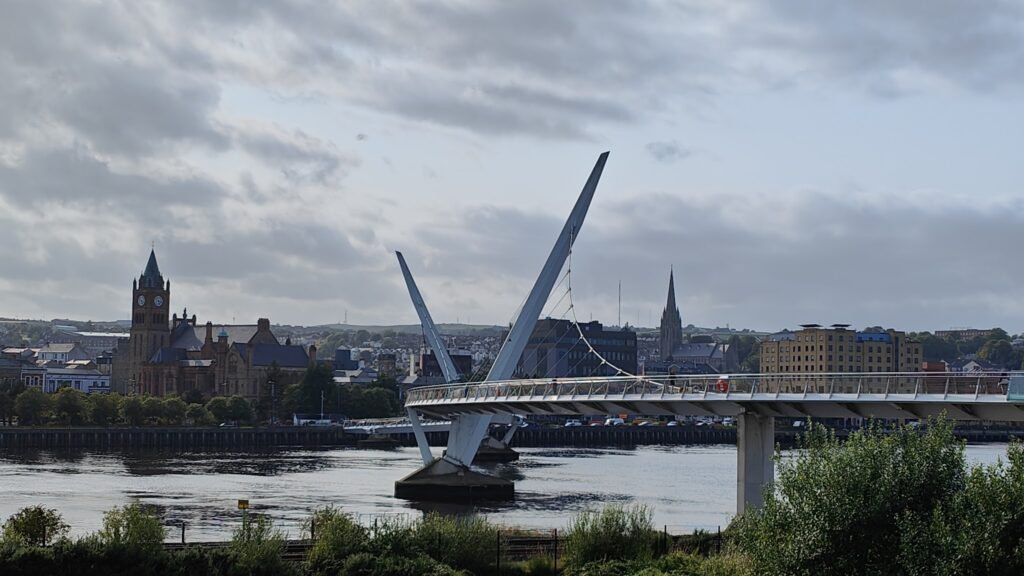
Eventually, late in the afternoon, I found myself on the far side of the Sperrins and within ten miles of my destination. This was when I made an error of navigation, not helped by the lack of signposting, and caused myself a few unnecessary miles. But they were pretty ones that I managed to ride quickly, and it brought me to the banks of the broad River Foyle a few miles south of Derry. I passed through a heavily flagged up village called Newbuildings and then had the chance to appreciate the city skyline from across the water. It looks like an impressive place from this distance. There were several spires and towers rising on the far bank like they were sitting on an island.
There is only one road bridge across to the city centre, but it is a double decker. However, the attractive train station sits on the east bank, at the end of the rail line. Just beyond it, connected along a cycle trail, lies the brilliant Peace Bridge, a modern footbridge opened in June 2011. It curves gracefully over the water to the Guildhall and the 400 year old city walls, its suspension towers set at angles like sails. It was designed partly by the same architects who created the excellent eyelid pedestrian bridge in Newcastle and brings together the largely Protestant Waterside community on the east side with the largely Catholic Cityside community opposite. It was certainly being enjoyed by many people this sunny afternoon, myself included.
Quite a few of these folk ended up on the same train as me, and the journey along Lough Foyle and the north coast was beautiful in the evening sunshine. Two hours later, I had crossed back to the other side of the province again, and was back in Belfast. Here, we learned that getting dinner after 8pm on a Sunday evening is a challenge. After some angst and several failed attempts, we found a lovely Asian place and had a great time. It was a good end to a very good day in a new place that felt, at a stroke, both familiar and oddly different to home.