
My straight line NW is a long one and it crosses two stretches of water in the Hebrides to end at Huisnis on Harris, a long way from home in every sense. There is a real chance it will be difficult to get there in half decent weather this late in the summer, so the start couldn’t come soon enough. After completing my unfinished business in the SW, I now had a chance to get 3 days closer, before I was required in Montenegro for a family holiday. A stretch of more calm, dry, sunny weather was promised and it was too good an opportunity to waste. In that time I could reach Scotland, and on the way look forward to some amazing days of cycling.
The first day, as always, was supposed to launch me away from the centre of my compass in Hathersage along a new line not yet previously travelled. But here is the thing: you can’t really do that going NW. The closest you can get initially would follow exactly one of the routes I used to go NNW or WNW. There is nothing in between for many miles except the empty moorland of the Dark Peak. No way through. Even on the few occasions when the line encounters a road, it bisects a trans-Pennine route that does nothing at all for my push NW.
After much soul searching, I decided that the best route to preserve the spirit of this project was one that peels off from my WNW line at Stalybridge. From here I could trace a line that didn’t have to zigzag too much and regained the desired path at the earliest opportunity. It would have to do. Since the first section to Stalybridge was all busy main roads, and I had already cycled it once this summer, I decided that my rules allowed me to start from the point where I wasn’t repeating myself, also known as the platform at Stalybridge station. So I went that far from home by train, feeling quite virtuous about it all.
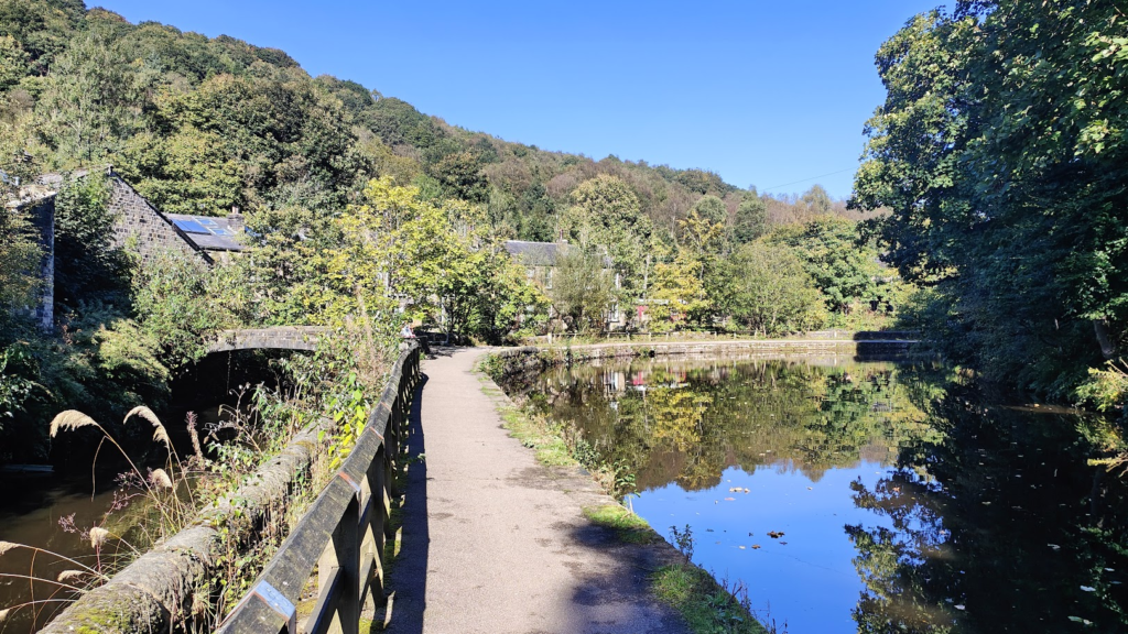
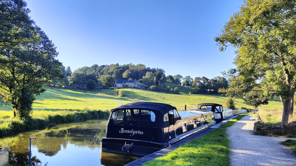
Last time I was in Stalybridge I followed the Huddersfield canal west towards the centre of Manchester. This time I did the opposite and followed the towpath out into the hills and the area know as Saddleworth. The canal, train line and main road all squeeze in to the same narrow valley here, with Saddleworth Moor and the Pennine hills of the Dark Peak forming a natural barrier to the east.
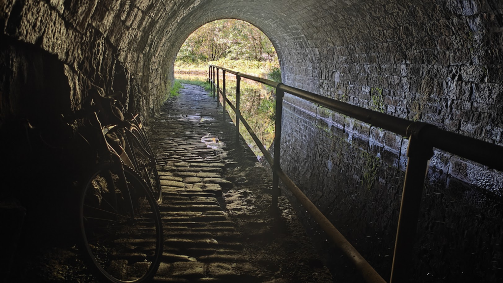
Knowing I would have plenty of canal side riding like this today, I chose a gravel bike better suited to the uneven conditions I would encounter. I was right to do so. These towpaths are part of the national cycle network, but they wouldn’t be good on a road bike most of the time. There are a few sections of smooth, wide path where you might be fooled, but then you will find yourself riding over stone cobbles, or around muddy puddles. It makes for somewhat slower progress, but it avoids all traffic and is generally a very attractive way to go.
My first section of canal took me as far as the large and rather gentrified village of Uppermill, where I left for the lanes and climbed quite abruptly up to the traditional old stone-built village of Dobcross. I was only a few miles away from Oldham (not known for its scenic beauty), but this lovely green, rolling landscape felt a million miles from anywhere like that.
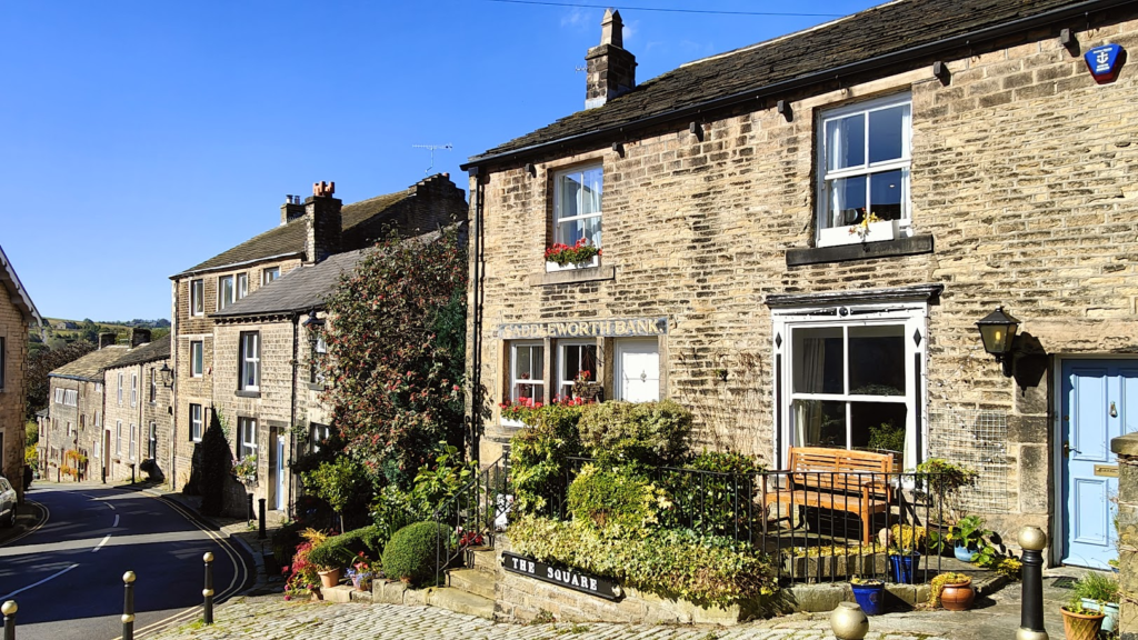
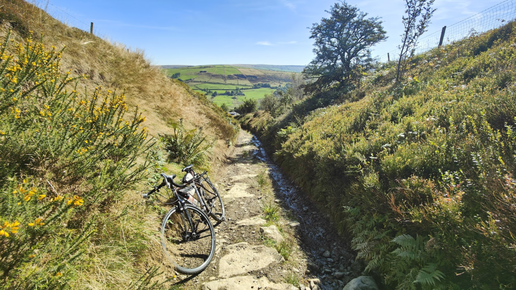
There is a collection of villages here that are all really attractive, and they all have silly sounding names starting with D: Dobcross, Diggle, Delph, Denshaw. It’s not an area I know, but I resolved to come back. It’s not so far from home after all. I was having so much fun that I very nearly missed my last chance to connect with Denshaw, and rescued things only by cycling along a very tiny lane that led past farms until it gave up altogether and required me to push my bike steeply through rough boulders for perhaps ten minutes until I once again picked up tarmac. But all the time the views were gorgeous. A builder at one of the properties I passed on a steep uphill stretch was impressed by my efforts. “Good on yer, mate” he said. “You’ll have calves like bricks!” He probably knew what lay ahead.
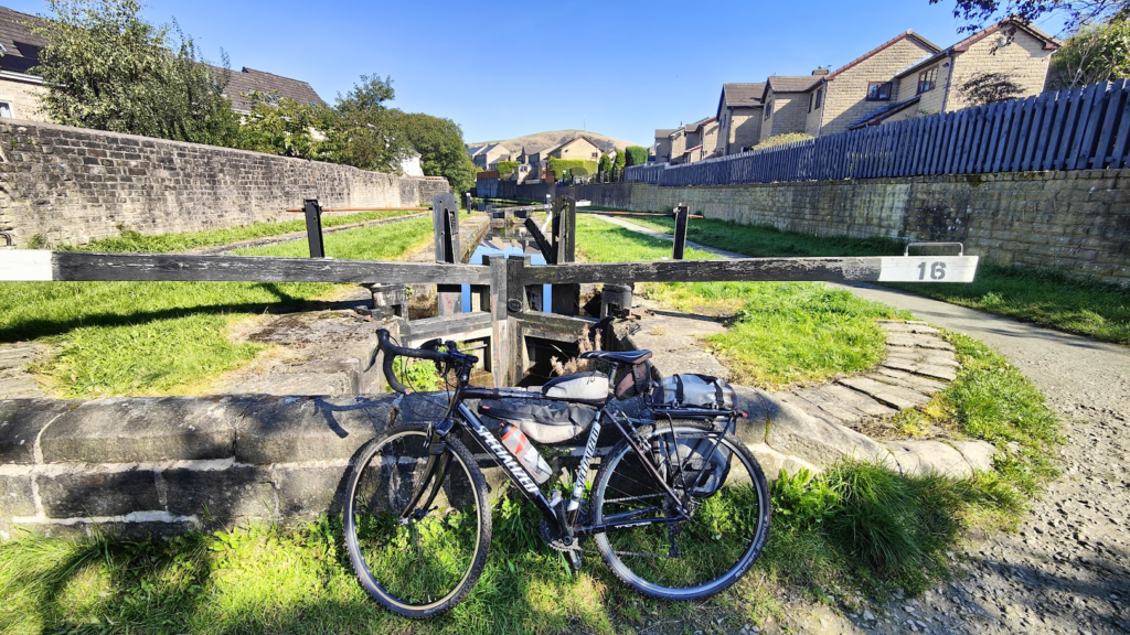
Back on track, I had to skirt the built up area either side of the M62 motorway near Rochdale, passing through places like Milnrow and Littleborough, which sit in deep valleys. All around here was once the home of textile mills, but these were nice enough places now and I soon found my way back onto another canal – this time the Rochdale Canal – one of three that crosses the Pennines.
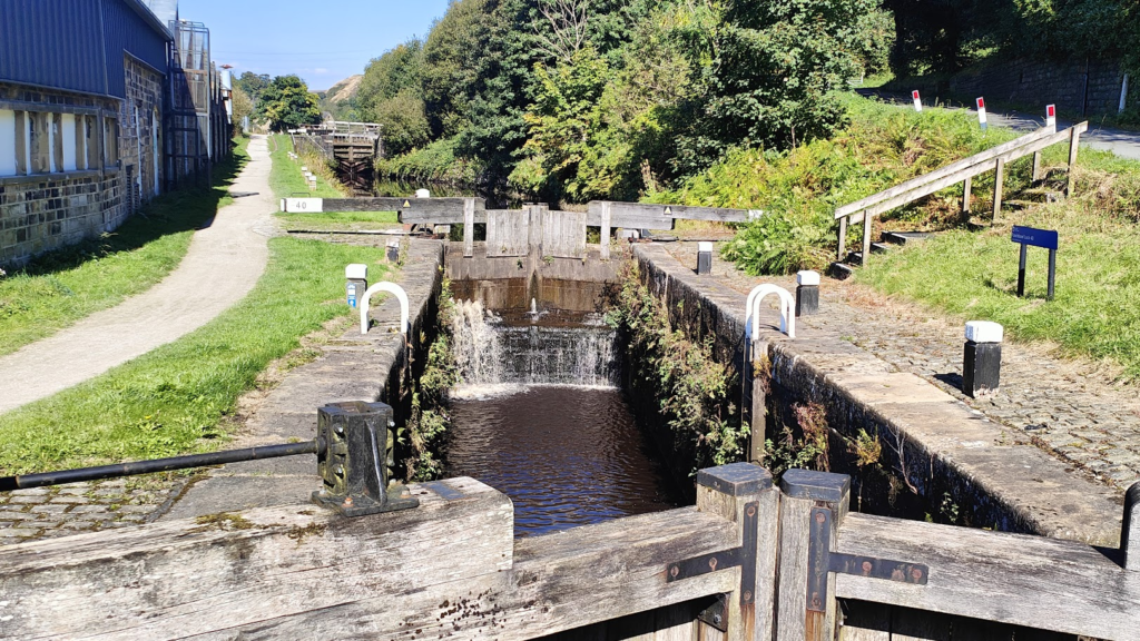
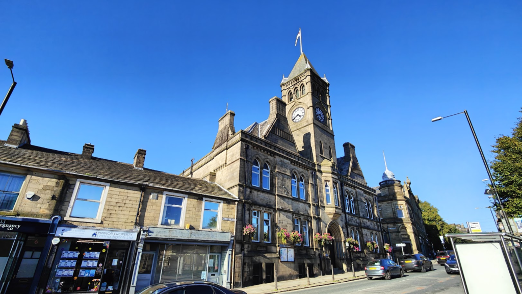
This towpath took me along a section of many locks up and then down again and into the town of Todmorden, on a tributary of the River Calder, where it was now decidedly time for lunch. The larger settlements in this area are all deep in the valleys, with high green hills and outcrops of gritstone looming above. At Todmorden, two main valleys meet, giving the town three fingers, if you will. At the meeting point stands an audaciously grand chapel-like building, dominating the middle of town. This is in fact the Town Hall, built in the neo-classical style almost like a Greek Parthenon; but close to a Victorian railway viaduct.
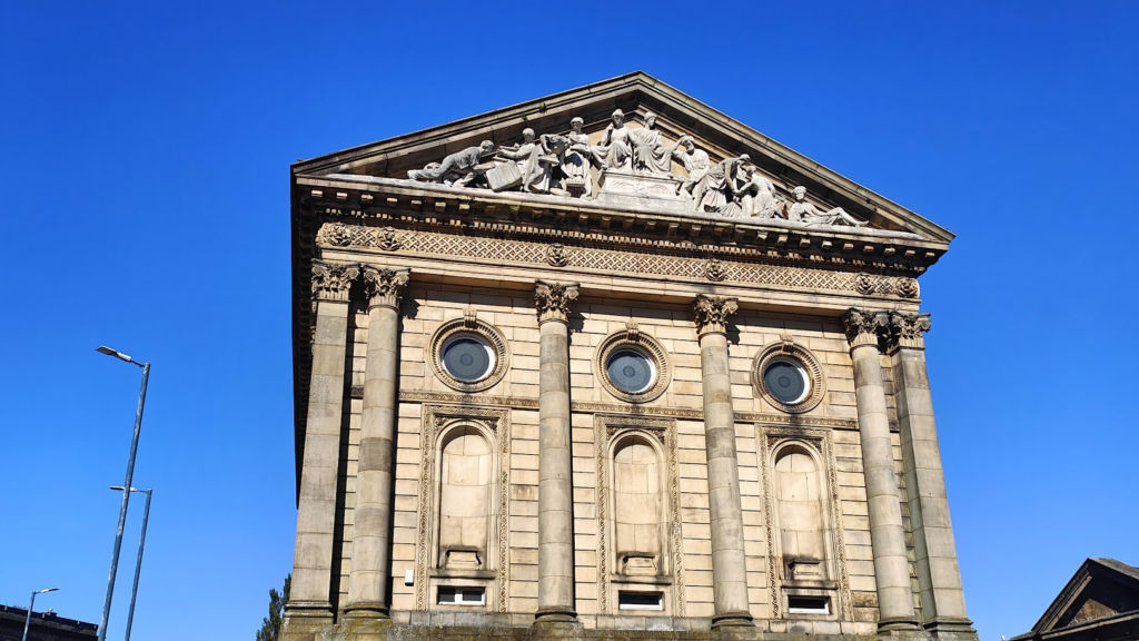
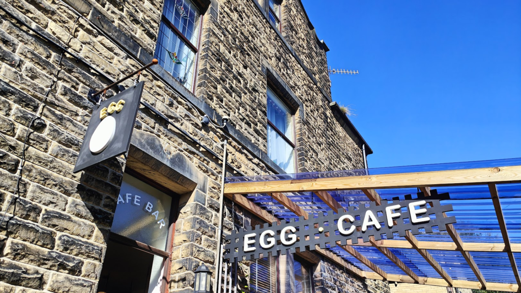
I nosed about for a suitable lunch spot and homed in on a modest looking place with an outdoor terrace. It was called The Egg Cafe and its straightforward menu did indeed feature many an egg-based dish; although, perhaps surprisingly, they also had many vegan items on sale, which contained not a single egg between them! I decided to cover all bases and went for the vegan bubble and squeak with added eggs. I sat among the women with toddlers in the sunshine and enjoyed my half hour in Todmorden. This is Yorkshire / Lancashire border country and Todmorden lies just on the Yorkshire side of the divide, 8 miles from Burnley and 9 miles from Halifax. Until 1888, the town was split between the two counties, before sensibly being placed entirely in the West Riding. The town hall was built over the original county boundary and its carved stonework gives a nod to each county.
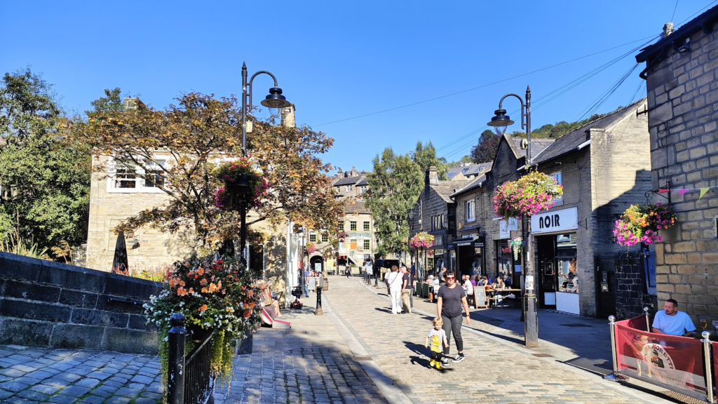
I now had another five miles of canal to get me to the town of Hebden Bridge, on the way to Halifax. It was leafy and pleasant and avoided the single main road. Hebden Bridge – another mill town – has clearly arrived in the 21st century. There were all manner of fancy and slightly alternative shops and businesses lining both the main road and a pedestrian area spread alongside a tributary stream, with an old mill and several small footbridges – with adjacent ducks – adding to the scene. It was busy with folk enjoying the weather and felt like another place to come back to and see again when I have more time. And the next section of my ride makes that more likely to occur, because it was memorable.
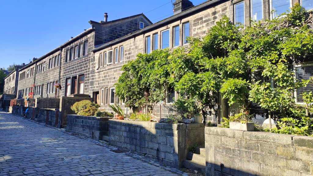
High above Hebden Bridge, a couple of miles up a steep road, is the hillside village of Heptonstall. Here, most ordinary traffic is banned, and as you pause to catch your breath, the road narrows and the old stone buildings close in around a long stretch of cobbles, making life as a cyclist extra hard. Luckily there is hardly any other traffic and you can move slowly and admire the timeless surroundings. It must get plenty of visitors; but it wasn’t touristy like, say, nearby Haworth (of Bronte fame). This felt like a real place, underlined by the sudden appearance of a large school bus behind me, followed soon by an old school building above the cobbles. It was letting out time and the little kids treated the road like a pedestrianised street, which must be what they are used to here. I won’t pretend this combination of gradient, bus, cobbles and oblivious families made life simple for me; but I made it through and so did they.
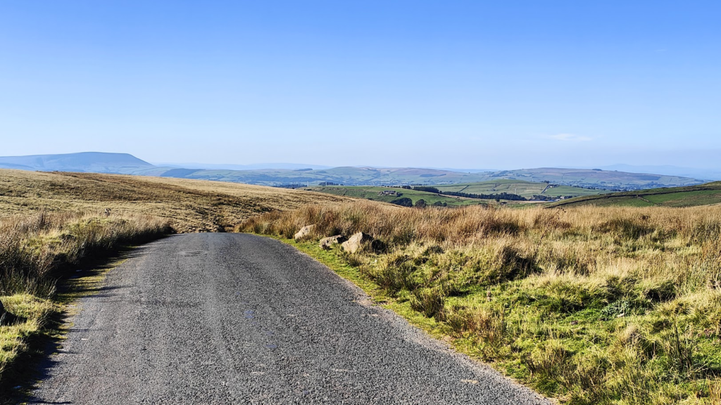
And beyond, quite quickly, I was in remote upland country, following a small road that wound its way right across the top of the moors and valleys ten miles into Lancashire and the town of Colne. The whole undulating journey was captivating and truly beautiful. And I basically had it to myself.
Reaching Colne, just up the valley from Burnley, I was brought steeply back downhill geographically, and also back down to earth in a human sense. It wasn’t the worst place I have been. But it was a sudden and rather sharp contrast. It is a town of steep streets of mostly terraced houses, speaking of rapid growth during the Industrial revolution. The main street through the town centre had its moments. There was a handsome town hall with a clock tower at the top, and a nice old church. But as soon as I got a couple of miles north again, the natural beauty returned in a gentler form, and the factories and rows of terraced housing felt like a temporary blot in the valley bottom.
At Foulridge, which is much nicer than it sounds, I encountered my third trans-Pennine canal of the day, the Leeds and Liverpool. This section, between Skipton and Burnley, is very pretty and it made for more good cycling as far as Barnoldswick, a place I had stayed with Jenni in 2022. We were told back then (by some men in a pub) it was a place best avoided; but couldn’t see why. I had a closer look today and found it a perfectly pleasant small town. Not only that, but I was starting to get nice views of Pendle Hill, and further north of the Yorkshire Dales rising behind gentler country on the edge of the Forest of Bowland. It was a golden evening and everything looked superb.
And so it continued as I made my quiet way along pretty lanes towards the looming outlines of Pen-y-ghent and – further away – Ingleborough, two of the famous Yorkshire Dales “3 Peaks” that people try to climb in a single day. An hour later – after crossing the busy A65 bypass – I was easing my way into Giggleswick, which in turn becomes the larger Settle (of railway fame) on the far side of the River Ribble. Settle is the main local town for this area. It is a quaint place, in a no-nonsense, Yorkshire way, with an old fashioned market place and steep, narrow streets leading away behind into the hills. High above the town, on a bluff, is a flagpole flying a Union Jack. I could see it from the bedroom window of my very comfortable bnb, which was separated from the market place by a very comfortable pub, serving excellent beer and food – and providing a live jazz band this evening! Not a bad end to a really excellent day.