
I learned quite a few things today and one of them is that the old name for Orkney Mainland is Pomona. You don’t see it on an OS Landranger map; but you do see it on older hand-drawn ones. It is also the name of a pub and a cafe in Kirkwall. Pomona was the Roman goddess of fruitful abundance, and from what we saw today, it is an appropriate name, certainly compared to anything so far on this trip. Mainland Orkney is a land of lush green fields, broad freshwater lochs and low, undulating, heather-topped hills, providing enough shelter for trees to get well above waist height, which is as much as most ever manage on Shetland. It presents pleasing, seemingly endless views at every turn and in every direction, with the horizon sometimes featuring the surrounding sea, or to the south-west the mountains of the island of Hoy. Fruitful abundance is not too far fetched, especially for this latitude.
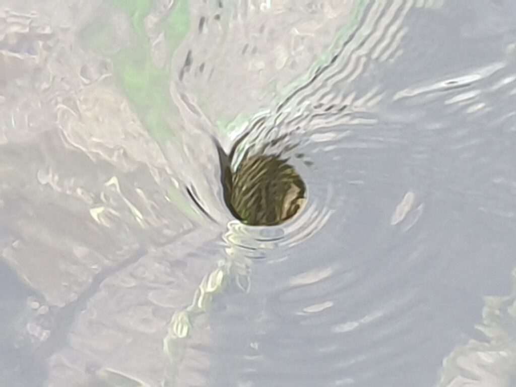
We began our ride today by visiting the logical north-western extremity of Pomona, the Brough of Birsay. I am quite partial to a tidal causeway, and this lump of grassy headland is accessible on foot from 2 hours after high tide, or 10am in our case. At this time the receding sea formed clear rock pools either side of where we walked, much to the delight of a plastic spade holding small child, whose parents had already given up hope of reaching the far end of the causeway. Our own progress was delayed momentarily by a strange vortex that had formed in one place in the surface of the water, quite unlike anything I had seen before.
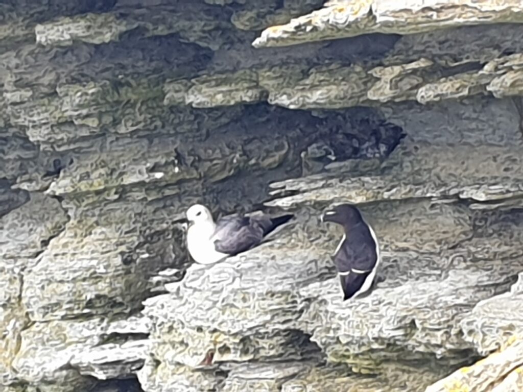
On the Brough itself the first thing you reach is a complex of low walls that still clearly identify a Viking settlement, with evidence of Pictish occupation before that. There is a lot of history around here, some very old indeed, and together it forms the UNESCO Heart of Neolithic Orkney World Heritage Site. More of that later. We walked up to the lighthouse on the Brough of Birsay, beyond which are cliffs where many sea birds make their nests. We had amazing views of more puffins, gannets and gulls; but our bird of the day was the guillemot, a close relative of the puffin (they both belong to the Auk family). Guillemots are often found in large colonies and can be seen in the air, in the sea, or perched on the ledges of cliffs. While the puffin beats most birds on the cuteness front, the guillemot has a winning ninja-like appearance. I hadn’t seen them so close before. They didn’t seem bothered by us at all.
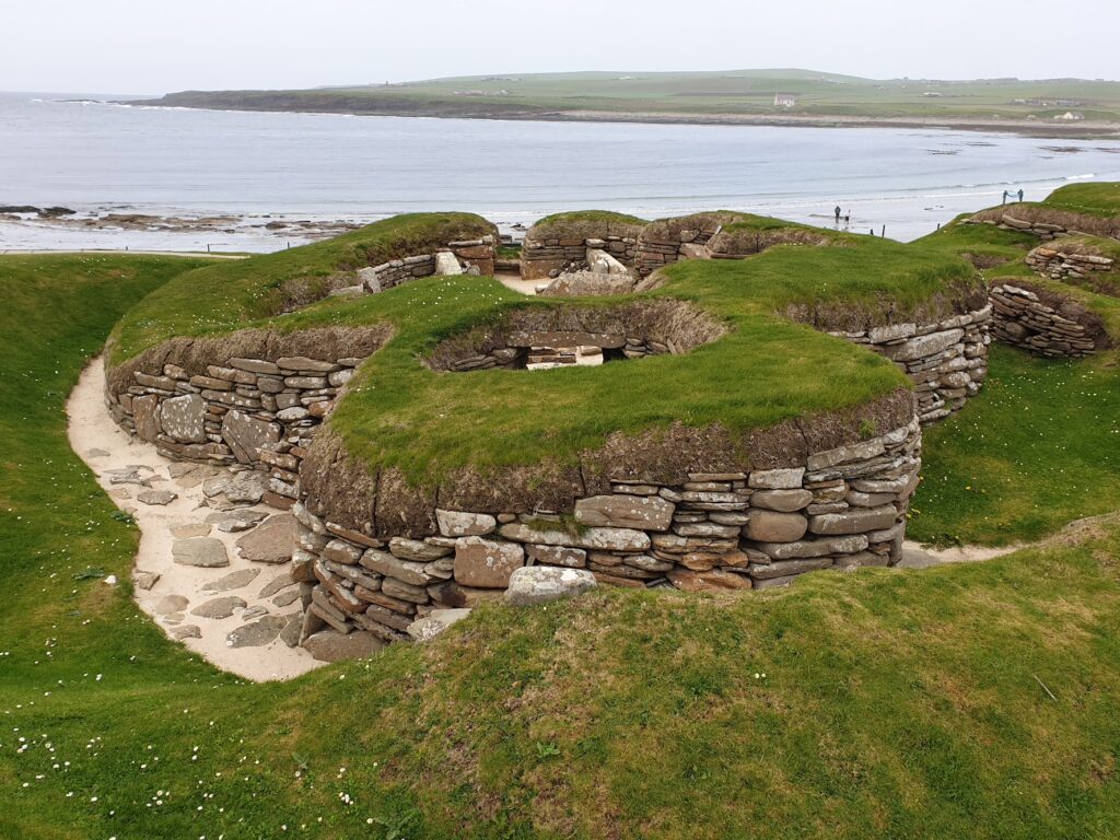
Next stop along the coast was the remarkable Skara Brae. Nothing was known of this place until a terrible storm in 1850 damaged sand dunes to such an extent that a whole stone age village was unearthed, complete with neolithic artefacts. It is the oldest known human settlement in Europe, and it pre-dates even the Pyramids of Giza and Stonehenge. Pretty old, then. About 5,000 years old and occupied for at least 600 years in fact. It was warmer then in Orkney, so presumably even more Pomona like, had Pomona been invented. The list of available food in the immediate vicinity read like a menu in a very fancy restaurant. Especially if that restaurant didn’t bother much with fruit or vegetables, except crab apples. And also if it served a variety of seabirds. But still, it didn’t appear to be a bad life, all things considered. No-one knows why the village came to an end.
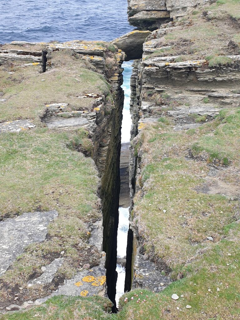
After a hearty neolithic lunch of Cullen Skink and a battery recharge for Jenni, we left Skara Brae and visited the cliffs at Yesnaby. This time the attraction was less birds and more towering cliff arches and pounding turquoise seas. That said, we had an amazing close encounter with a flying Tawny Owl as we cycled along the empty lanes to get there.
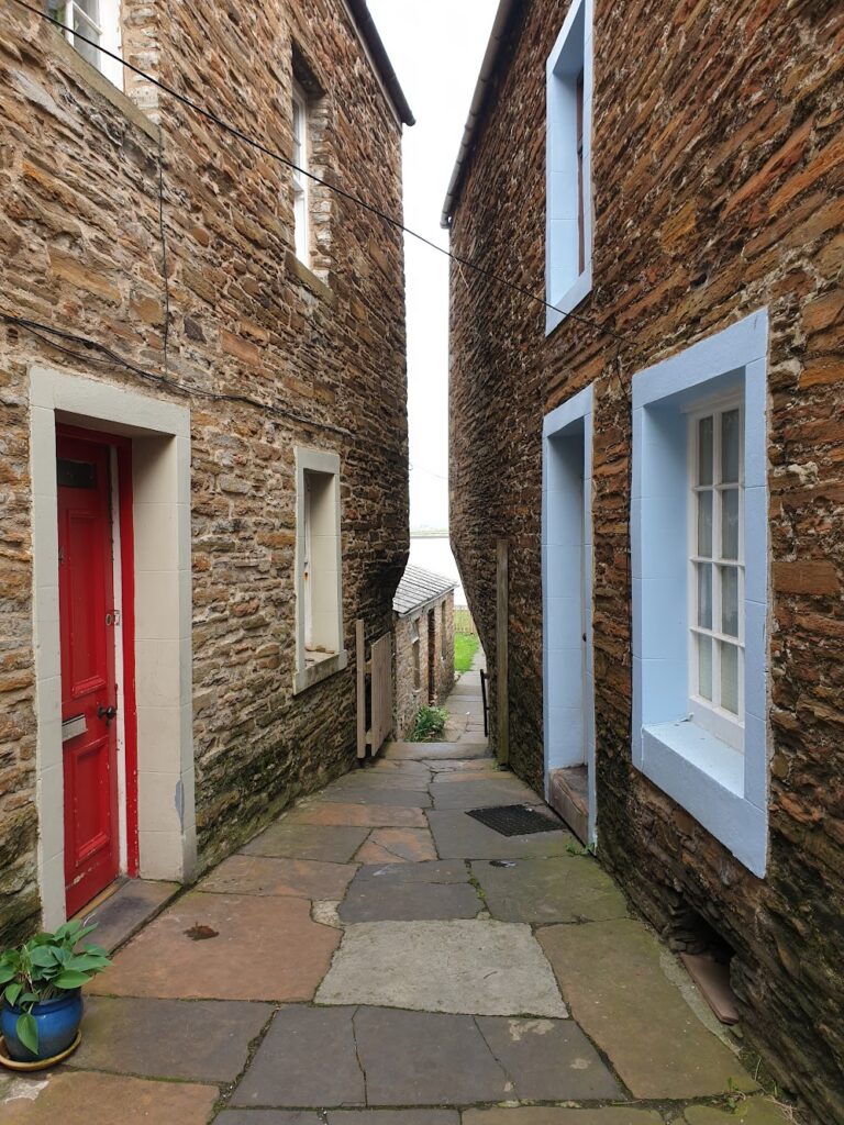
A few miles further on we reached Stromness, Orkney’s second town and, for many years, principal port. Despite its uniformly grey buildings, the place had a timeless character not unlike some of the better known (and better-heeled) Cornish ports. It felt like a real place to me. The main street runs parallel to the long natural harbour which is sheltered on both sides by hills. It is flagged with large, square stone slabs for its whole length, with a narrow strip of much smaller cobbles running up the centre. The buildings run more or less continuously along both sides, and the street narrows and changes its name with every twist and turn. Regular blue plaques on buildings called out famous explorers whose ships had once used Stromness as a first or last port of call in the days of discovery. Even the shop fronts appeared to belong to a different era, some now discretely housing galleries or bookshops, others more mundane businesses including a coal merchant. I liked it all.
We bought scampi and chips and ate it by the harbour in the hazy evening calm. The water was like a millpond and the streets were close to deserted. And then it was time for more ancient history. A few miles along the deserted main road to Kirkwall, on a narrow strip of land that separates 2 large lakes, stand the huge Stones of Stennes, a collection of tall megaliths with angular tops, and a mile or so beyond, the Ring of Brodgar stone circle. In the quiet of the evening, we had this World Heritage Site entirely to ourselves. The vastness of the landscape and the sky above gave the brooding stones a mystical feel, their true ancient purpose unknown. Whatever they represented to the people who put them there thousands of years ago, this was obviously a place of great significance. It was to me, too. This was where, on a windy morning in July 2008, I had parted ways from my cousin Alexis at the end of our 1,100 mile fundraising bike ride from Land’s End, just months after we each lost one of our parents to cancer. 14 years on, I still sensed an emotional connection. It was good that we were there alone. Just me, Jenni. the huge stones and Pomona.
One reply on “Map 6 – Orkney Mainland”
Sounds like a truly special day packed with memorable experiences. Great stuff.