
We didn’t really want to leave our lovely home for the last 2 nights; and our excellent airbnb hosts Hilary and Edward at their charming farm “Heima” (which we highly recommend); but after breakfast on a beautiful day it was time to head south towards the final map of the Northern Isles section of my adventure: OS Map 7 Orkney Southern Isles. It overlaps a little with map 6. Stromness just sneaks into both maps. We cycled down quiet lanes past green fields full of sheep with lambs and cows with calves. All around was the sound of birds, our constant soundtrack in these islands: skylarks, curlews, the occasional flying, honking geese, endless oyster catchers, and today, excitingly, a cuckoo! The sun shone and even the wind was taking it easy for the morning.
Our first map 7 excitement was in the middle of nowhere as we rejoined the “main” road that runs along the south coast of Mainland. At this insignificant road junction stood a futuristic looking contraption made from transparent perspex, the size of a small greenhouse, with a hydraulic roll over front to gain access to 2 metal bike stands inside. A sign identified it as “Designated Cycle Parking Area” so we gave it a go. I loved it. Why it is here precisely was not at all clear. How well it would stand regular use and abuse in a more populated setting is up for debate; but I hope this one, at least, sees some grateful cyclists.
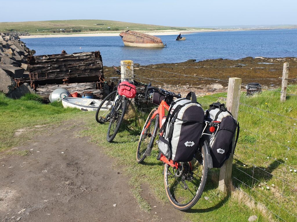
From here we followed the top of Scapa Flow to the Scapa distillery, prettily situated at one end of the sandy Scapa Bay, which is effectively Kirkwall on sea. We ate sandwiches at a picnic table next to an exhibit and memorial about the sinking of HMS Royal Oak in Scapa Flow in 1939 by a German submarine. Royal Oak had already seen service in WW1. Most of her crew were asleep inside the ship when she was struck by torpedo and 833 lives were lost. The wreck is now a war grave. It was this tragedy that prompted the building of the 4 Churchill Barriers, causeways linking together the islands of Mainland, Lamb Holm, Glimps Holm, Burray and South Ronaldsay to prevent enemy ships from entering Scapa Flow from the east. Later today that would be our route south. First, we had to revisit Kirkwall, hub of the road network and a precious battery charging opportunity for Jenni.
Kirkwall is a likeable place. It is easily the largest place in Orkney and has most things you would expect of a big town, even though it really isn’t that big. Like Stromness, the main street is narrow and flagged with big stone slabs. It winds from the waterfront, by the imposing sandstone Kirkwall Hotel, through a series of quirky, independent shops and cafes to emerge in front of Kirkwall’s biggest draw: the beautiful red sandstone St Magnus Cathedral. It was founded in the 11th century and built by the same craftsmen that worked on Durham Cathedral. And it shows. The interior is a procession of graceful Norman pillars and arches, not quite on Durham’s massive scale; but managing to make solid stone look light and graceful. It is a place of great beauty and a surprisingly large and imposing building in otherwise modest surroundings. The central spire dominates the skyline and is visible from land and sea as you approach the town. I have always had a thing for cathedrals. This isn’t the biggest or the tallest, but it is one of my favourites and it underlines the significance of this place for many centuries.
The other really big ticket item in Kirkwall is the Highland Park whisky distillery. We might well have visited; however the town was abuzz with a big story. A week ago a crane driver somehow failed to retract his crane before he drove along the street that runs past the distillery. It is about the only place in all of Orkney where there is something to hit: there are pipes across the road that transfer liquid and power from one half of the site to the other. The crane demolished the gantry, bringing the pipes down. It has caused the whole distillery to close. It seems production may not be able to start again for months, with losses of many millions of pounds. So it is a serious affair. Apparently the crane driver also tested positive for drink driving. Most of this information came from the Welsh former marine who ran the fancy distillery shop in the main street. He was visibly upset by having to tell visitors that they could not go on their organised distillery tour. Some had travelled many miles for this disappointment. Let’s hope they get things back up and running quickly. Aside from anything else, it is among my favourite single malts and in 10 years time it may be much harder to come by!
Cycling south from Kirkwall along a series of long, straight roads brought us to the first Churchill barrier and on the other side, the small island of Lamb Holm. Theres not much there today; but in WW2 it housed an Italian prisoner of war camp with several hundred prisoners captured in North Africa. Their job was to build the causeways between the islands running from north to south. Orkney was, of course, very different from Italy and the men missed much about their home. They were given 2 simple Nissan huts by the camp commander and these were placed end-to-end. Over the next few years of internment, they turned these rudimentary buildings into the most beautiful Italian chapel. They used only the most basic materials available to them, items salvaged from wrecked ships, tins of Bully Beef meat and whatever else was to hand. The interior is stunning and very moving. The craftsmanship is remarkable. The roof has been painted to look like 3 dimensional tiles and the ceiling above the alter is stunning in its colourful artistry. The main artist returned twice from Italy in the 1960s to renovate his work, and ties between the 2 communities remain strong.
We crossed 3 more causeways in the final few miles until reaching the southern-most island in Orkney, South Ronaldsay. Here lies the sheltered seaside village of St Margaret’s Hope and our hotel for the night. After dinner, the sun was still bright in the sky, so we got back on our bikes and rode the 6 empty miles south to the end of the road. From here, by the passenger ferry dock, you could just make out the Scottish mainland on the horizon. Tomorrow we will be on our way there to begin the complicated journey west to the top of the Hebrides and OS map 8. The Orkneys have been good to us. All 3 maps gave us different experiences and memories. We will be back to cycle its empty roads again.
4 replies on “Map 7: the End of the Isles”
Well done Wedgwoods, and keep it up!
😊😊😊
More lovely reading – cheers! I’m curious to learn how you do the complicated journey to your next destination
https://www.linkedin.com/feed/update/urn:li:activity:6930226134248787968/
More good stuff! Enjoying this!