
Today started early, and for me that is never easy. My alarm went off at 5.30am and I was on the ferry out of Stornoway at 7am. The sun, which had shown scant interest in the place on my visits thus far, stuck 2 fingers up at the forecast of heavy rain and made it all look about as nice as Stornoway can. A good way to remember it. The crossing was smooth and I made myself eat breakfast, knowing what lay ahead. Then I slept until just before we arrived in a very grey and cloudy Ullapool. The grand entrance we were treated to a week ago was not on offer today. The mountains were in hiding.
After a quick coffee to wake me up, I got on with the business of cycling north up the big hill out of Ullapool, and on into OS map 18. I know this is spectacular mountain country because I saw it twice through the van windows last week. That made me rather less disappointed about the weather today. It rained a bit, then stopped. There was a strong wind blowing everything from the sea towards the east, and I was mostly benefitting from its help. After 20 miles and an exciting long descent, I reached the tiny village of Elphin and gratefully called in at the Elphin Tea Room. Here I met a couple of German ladies from Bremen, mother and daughter I think. The older lady spoke English about as well as I speak German, which is to say not well at all, as we both demonstrated. The younger lady spoke fluent English however, and told me this was at least her 30th visit to the north of Scotland. There’s just nothing like this in Germany, she explained. She also told me that on one of these visits it was really warm and sunny. That’s not a great conversion rate.
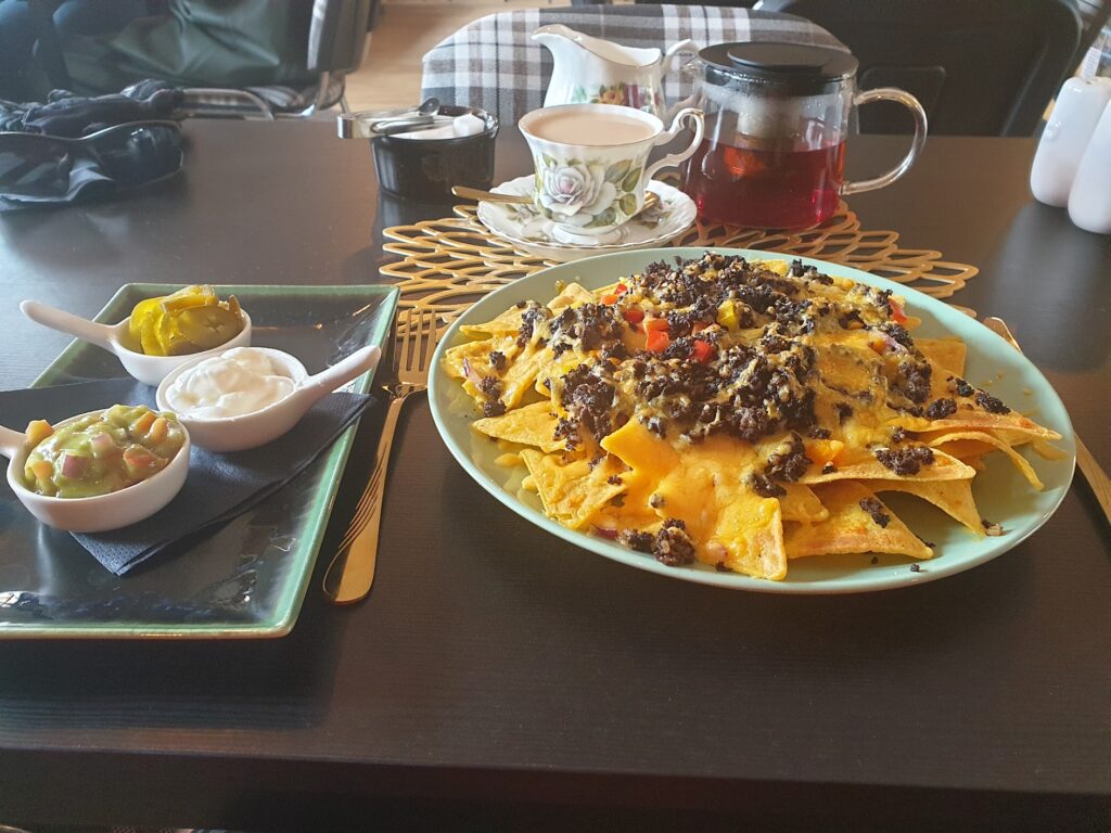
Just after Elphin I turned east and headed inland and away from the big mountains. It was another single track road and I had it to myself. This road, remember, is the only real option there is to complete this second coast-to-coast journey. It really is empty up here! The weather perked up as I headed east into open moorland and conifer plantations. I didn’t have high expectations for this ride scenically, but the cycling was good. I moved into a broad, green river valley, Glen Oykel, that reminded me of the landscapes the pioneers passed through in wagons during the westward expansion in America. It had a wide, bare, unsettled look about it, so rarely seen in crowded Britain. Descending to a bridge, I reached a hotel whose sign made it obvious that its chief reason for existence was fishing. I believe these are salmon rivers and they attract serious fishermen. A little later I came to a tiny settlement that unexpectedly had a tea room, so I stopped. It was lunchtime, after all. I wasn’t the only customer; but I felt rather conspicuously young, And there was something else odd about these men and women that I couldn’t work out. I ordered their special dish, loaded nachos, that came with large quantities of black pudding mixed in! When in Rome. It was great actually, and very filling. While I polished off a large plateful, I suddenly realised what was odd. All of the quite elderly people at the next table were siting eating their lunch wearing waist high fishing gaiters!
I pushed on again and reached Lairg, the self-styled “Crossroads of the North”. If you look on a map of the north of Scotland, it is about the only place you will see not on the coast. Several “main” roads, and the railway, intersect here. It has the only shops and petrol for miles around, as well as a hotel, fire station and Royal Mail sorting office. Its bank and police station have closed and their buildings are for sale. Lairg also sits next to a lot of water, just below the hydroelectric dam that holds back the the extensive waters of Loch Shin. Below the dam is a smaller lake the gives Lairg a kind of corniche. On a tiny island was the best duck house I have ever seen. We stopped in Lairg for sustenance in 2008 before our final northward push. I think the same tea room was still there, but it was closed and I had no need of it anyway.
I continued east and found myself on a superb road passing through the area know as Rogart. The countryside immediately took on a much more attractive appearance and for the next 15 miles I rode swiftly and easily through a long valley of green fields, flanked by rocky, gorse covered hillsides. There were farms spread around the valley and the sense of isolation was replaced with a picture of rural charm. It reminded me of the quieter parts of Cumbria on the fringes of the Lake District, less known or touristed. Except here it seemed to be just me. No one was coming from or going to Lairg this afternoon. The sun shone and the wide road seemed to slope gradually downhill for miles. The wind pushed me onwards and I fairly flew along. It was cycling heaven.
In no time I had reached the A9 main road that runs up the east coast. My plan had been to turn north east and ride as far as Helmsdale, a good 15 miles away, high on the coast of map 17. From there I had a train ticket south. Except that the hapless Scotrail had introduced an “Emergency Timetable” on Monday, 2 days ago, and my train had been cancelled. Now the only train I could get was from Tain, 13 miles south, at 7.40pm, more than 3 hours away. But first I had to get onto map 17 again, which I had momentarily left, to complete my coast to coast. So I turned north, with the wind helping me, and rode the 4 miles to Golspie, which is a large attractive village with a beach. A mile on from there was my new end point: Dunrobin Castle.
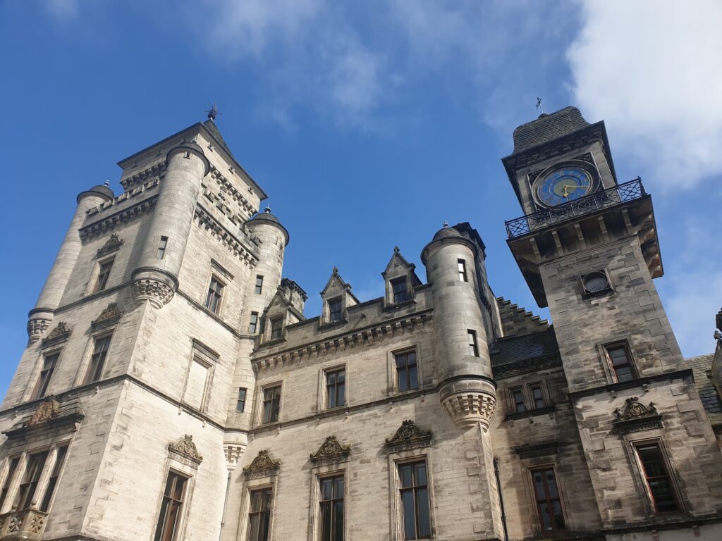
Dunrobin Castle is an extravagant 19th century 189 room pile, complete with turrets and huge clock tower, built for The Earl of Sutherland, right by the sea. It is surrounded by an estate with large trees, so not easy to see from far away. Today the house and gardens are a major tourist attraction. It also has its own railway station, where I took shelter from a passing shower. The wooden station building and station sign give it an air of importance. It is still used as a request stop and Prince Charles visited in August 2021 to mark the railway’s 150th anniversary. I returned to Golspie and took a photo of the sea. I had crossed the country in a day!
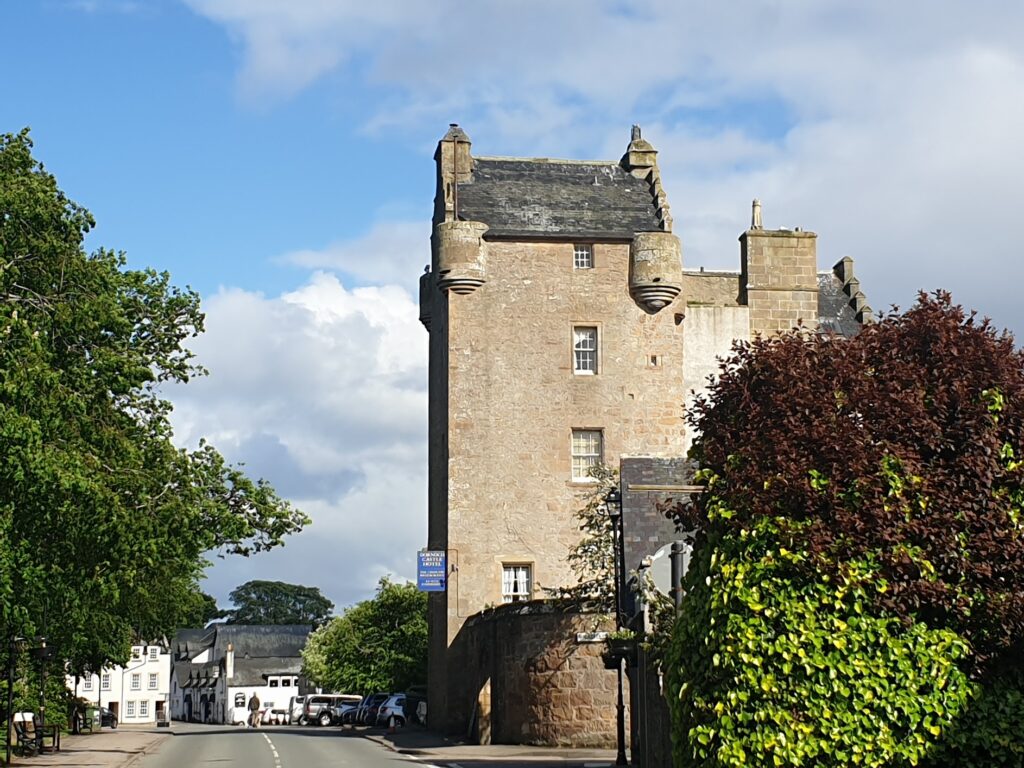
I turned back into the wind and pedalled back along the A9, then took a tiny road along the southern shore of the stunning Loch Fleet. The tide was out and the wet sand stretched away into the far distance. A family of Shelduck with about 10 tiny chicks were running in a tight but haphazard group across exposed beach. A little further on, at least 60 seals lay basking in the evening sun on a sand bank. It was all rather magical. A few miles further and I found myself in the beautiful, quiet little town of Dornoch, all warm sandstone coloured buildings arranged around its central feature, the ancient Cathedral. This is where Madonna’s son Rocco was christened the day before her wedding to Guy Ritchie in 2000. You can see why she chose it. It is a delightful and well-heeled place. I celebrated my unexpected visit with a pint in the sun, before making my way the last few miles to Tain, where I grabbed dinner and caught the only train running to my bnb in Dingwall. Tomorrow, I will take another rescheduled train from here towards map 18, the last of the May leg of my adventure!
2 replies on “Maps 15, 16 & 17”
Sounding good Mr W!
That’s a good day’s riding! Looking forward to seeing you soon