
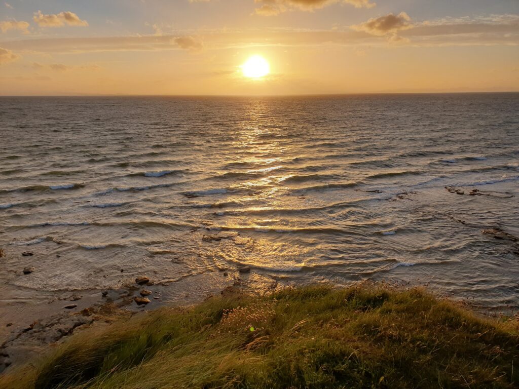
The sun returned today! What a welcome change from all the grey clouds and showers. I was starting to lose faith in the Scottish weather altogether; but a day of bright sunshine works wonders. It also brings the cyclists out. In the first couple of hours today I found myself waving hello to more people on bicycles than I have for ages. You always get a wave back. There is a bond between cyclists, especially on the open road.
My road was indeed pretty open, too, as I made my way through the fertile green farmland along the west and south sides of the attractive Beauly Firth. The name comes from the French “Beau Lieu” or beautiful place, and it is well named. I stopped in the small town of Beauly which seemed very prosperous. I took tea at a fancy deli in the high street and wandered around the red sandstone priory ruins, another victim of the 16th century reformation. A man in a kilt was giving tours in a distinctly English accent about life as a monk, laughing loudly at his own jokes, which weren’t funny.
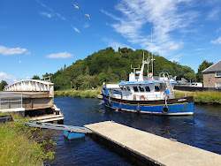
The approach to Inverness skirted the water’s edge. The tide was in and the waves lapped the shore and made white crests out in the Firth as it narrowed towards the Kessock suspension bridge ahead of me. I was heading back into the city and a world of people and traffic. But first I had to cross the Caledonian Canal, the navigable coast to coast waterway up the Great Glen from Fort William, 60 miles away via Loch Ness. I had the excitement of seeing the main road swing through 90 degrees to let three quite large boats pass though. There is something satisfying about seeing a queue of cars waiting for slow moving boats to glide past.
The centre of Inverness along the river looked a picture in the warm sunshine. I stopped and had some brunch looking over the water. It was weird being back in a busy, cosmopolitan world. I found my way out of town and tolerated the traffic for the first few miles until it died down. Now I was in a very different looking part of Scotland, leaving the mountains behind and entering the much greener, gentler Moray. The cycling was swift, helped on by a strong westerly breeze. I stopped at Cawdor, whose famous castle adorns the front of OS map 27 Nairn & Forres, River Findhorn. I glimpsed it through the trees, its name bringing back lines from Macbeth I had learned for my English Literature O level 40 years ago! The nearby historic village had a historic tavern, so I stopped and enjoyed a pint in the sun.
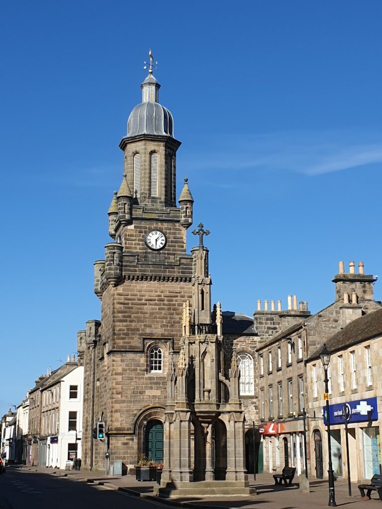
A few miles later I passed through Nairn, an attractive coastal town of local importance, but rather choked by traffic on the busy A96. I took the signed cycle route out from there to Forres, the next town east, along narrow, straight country lanes that passed through flat country, mostly covered in forest, a lot of it pine. In between were fields of green wheat. It reminded me more of parts of Norfolk, or even Nottinghamshire, than Scotland. It was pleasant and made for enjoyable, quiet cycling, with the distinctive “a bit of bread and no cheese” call of yellowhammers as my constant companion. I followed a short section of unsurfaced cycle path that took me over a wooden bridge across the broad, shallow River Findhorn. The planks moved and made sounds like a xylophone as you crossed it. And then I arrived in Forres, which struck me as a very pleasant small town indeed. It was surrounded on both sides and behind by carefully tended parks and gardens and had a range of impressive old stone buildings with interesting towers and turrets. It also appeared to have a brand new train station and the town centre was thankfully by-passed by the busy main road. It is backed by the attractively wooded Romach Hills and is the home of Benromach distillery. All in all, lots to like about Forres, as far as I could see. Shall we move there?
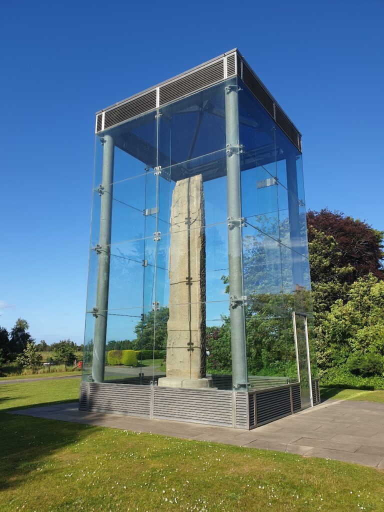
Just on the edge of town I saw a brown information sign pointing to Sueno’s Stone and thought I’d follow it. I’m so glad I did. By the side of the road on a paved area stood a huge glass enclosure, the shape of a telephone box, but many times larger. Inside was an enormous, flat, carved monolith, more than 6m in height. It is the largest of its type ever found in Scotland and on one side is depicted a battle that ends with the decapitation of members of the defeated army. There are competing theories about who is fighting whom, and who is responsible for the carvings. It is believed to date from the 9th century and is the sort of thing you expect to see in the British Museum in London, or maybe its equivalent in Edinburgh, rather than in a quiet roadside location in Moray. Either way, it was a fantastic surprise of epic proportions!
It was getting close to dinner time and I was due to stay in Burghead, a place I knew little about a few miles further up the coast. Before that I had the chance to visit Findhorn, somewhere else I didn’t know; but at least had heard good things about. So I cycled the extra 2 miles through an increasingly strong wind to where the pine trees run out at the end of a spit of land on the east side of Findhorn Bay, a tidal estuary that was full of water glistening in the sun. The village of Findhorn sits at the tip, bounded on both sides by water and protected from the wilder waves of the Moray Firth by sand dunes. It is a quaint, quiet place that gives the appearance of not having changed much at all in many years. There are small boats lying upturned on the shore of the estuary, beach huts on the dunes, and a couple of attractive looking pubs. One of them was offering take away fish and chips, locally caught. Perfect. I sat in the sun (and wind) and enjoyed every mouthful.
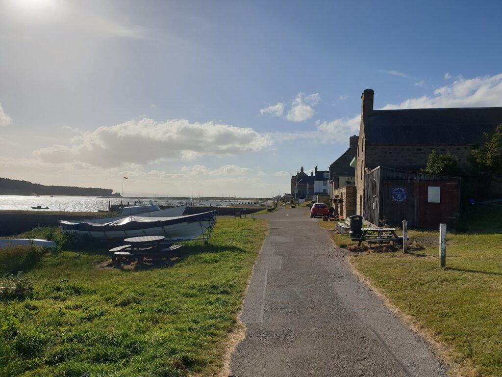
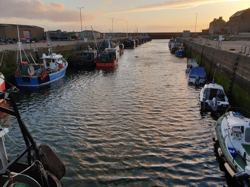
My final stop was Burghead, a planned town and harbour designed by – you guessed it – Thomas Telford. He must have been busy in the mid 19th century. It is a grid of long streets with stone terraces, not unattractive; but unusual in appearance for a British settlement. The streets all run parallel to the harbour and end at the headland which marks the southern gateway to the Moray Firth. The place is full of historical notice boards telling you about its history as far back as the Picts, who had their largest fort here as far back as the 4th century, well before the Vikings arrived. It was a great location for a fort. From the headland you can see for many miles in every direction and command the entrance to the Moray Firth. Looking back towards Inverness, I could clearly see the much narrower entrance to the Cromarty Firth, where I had been a few days ago, some 15 miles to the west. Burghead today seemed a sleepy place, the dominant sound coming from the seagulls and their constant arguments. There was almost no traffic, and very few people in the streets. I saw a couple of shops, a bistro, a Chinese takeaway and a pub that looked open and two that didn’t this Friday evening. For a place with a considerable number of houses, it seemed to have very few local services. It was as if everyone had gone somewhere else.
And in the morning I must go somewhere else myself. I have bike spaces booked on trains between Elgin and Inverness, and then Inverness and Kyle of Lochalsh, which gets me about 15 miles and a ferry ride away from my car in Mallaig, all being well. The weather crossing on to Skye is forecast to be really strong winds once again. Will it ever end? I just need to get safely over the bridge and then I will be able to leave it behind. For a week at least.
2 replies on “Maps 26 & 27”
Yay! Pictures. 😊
Great stuff!! Really good to have the photos inserted too. Good with Mr W. 👍😊