
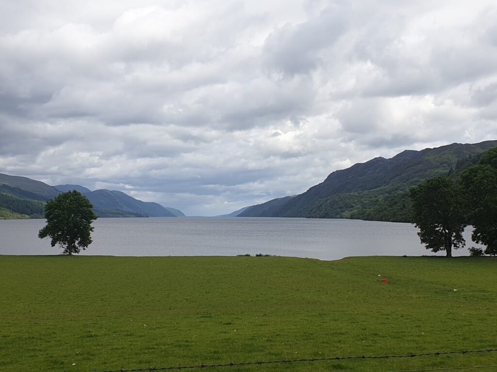
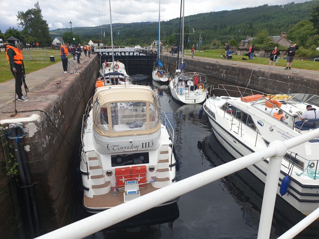
Fort Augustus sits at the bottom of Loch Ness and is where the Caledonian Canal climbs a flight of locks on its way towards Fort William. The locks form a centre piece to the main activity of the village, each one large enough to contain at least six sizeable vessels together as they journey up or down the nautical staircase. It all takes time and provides plenty of entertainment for the visitors on the lockside, where cafes have tables set out. I had my breakfast here, watching the colourful boats and their crews come and go, in no hurry to move myself. I had already dragged my feet leaving my cosy caravan, followed by a lengthy chat to the owner, Keith, about the delights of exchanging the crowds of the south of England for the deer, badgers and even wild boar of the north of Scotland.
My inertia was caused in part by the knowledge that as soon as my ride began, I would be climbing a long, steep hill on the east side of the loch. This was the first part of my route, giving access to open hill country, stretching away for miles without any obvious next refreshment stop. But it was a nice enough morning and the breeze was blowing in the direction of Boat of Garten, 56 miles away, where I would be gratefully staying at the home of a former work colleague, Kate. I had an evening meal time I didn’t want to miss, so it wouldn’t do to wait any longer. Time to ride, hill or no hill.
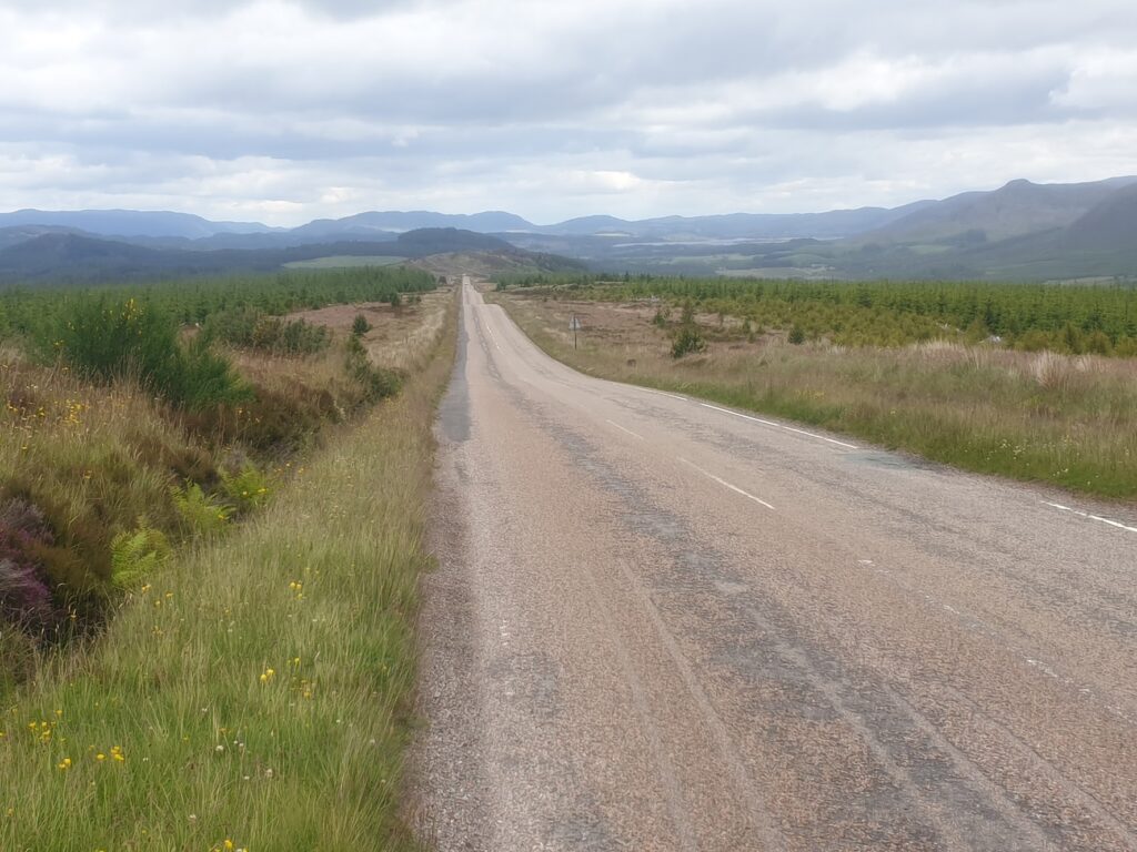
It was a proper climb, but it gave way to miles of open road across, well, just empty space, really. There were small lochs, low rocky hills and areas of forest; but very few buildings. And so it continued for much of the day. There were two pubs in the first 50 miles, and one was closed on Sunday. The other came too soon to be of use. I saw a closed shop in a small village, too. That was it.
Eventually I crossed under the busy A9 and discovered that I was actually not far at all to the south of Inverness. You couldn’t tell. I followed the signs for National Cycle Route 7 along more empty roads and saw a red squirrel cross in front of me, just as the many warning signs said. Finally, when I reached the village of Tomatin, known for its distillery, I came upon the excellent, modern 3 Bridges cafe and shop, where I gratefully stopped and made up for lost time. There was a splendid view of the road and railway crossing the valley on high viaducts. The third bridge was harder to spot. I think it was perhaps a small low affair at water level. Or maybe they just couldn’t count.
Suitably refreshed, I pressed on over Slochd Summit (401m), where the single track train line to Inverness tops out. My route then descended to the village of Carrbridge, notable for its old stone bridge of 1717, partially lost in floods more than 100 years later. Its other claim to fame is the annual World Porridge Making Championship. As daft as it may sound, it’s actually a serious event, with the winner taking away the coveted Golden Spurtle. Look it up. Or even better, why not enter?
Emerging from woodland I had my first view south east to the impressively large Cairngorm mountains. I will be much more closely acquainted with these tomorrow, since they stand more or less directly between Boat of Garten and Aberdeen, the end point of this latest cost to coast. So I know there is plenty more climbing to come. And, ideally, a measurable improvement in the number and distribution of cafés compared to today!
One reply on “Maps 34, 35, 36”
Looks like some more super-deserted roads!