
Today I crossed the Cairngorms. Big mountains. Few roads. It was a memorable 80 mile day of wind assisted cycling across some wild and challenging terrain. There were serious ups – and scary downs – before dropping to the upper reaches of the Don valley and a gentler, sunnier ride east across quiet, green pastures to the coast at Aberdeen. From there I took the evening train to Glasgow – again -repeating exactly the tracks that I first laid on Wednesday. So I covered a lot of ground on Monday!
Knowing what lay ahead, I had meant to get off to an early-ish start. I failed miserably. Inertia set in again and it was close to 10am before I got moving away from Boat of Garten. It was grey and distinctly cool. 4th July it may be; but while the newspaper headlines screamed “Scorch of July”, warning of 36 degrees celcius, we had barely registered double figures in northern Scotland. Summer? What summer?
The first 10 miles or so were through mostly wooded country. It was close to here in the 1980s that Britain’s only pair of nesting Ospreys had their closely guarded nest at Loch Garten. I remember watching it on Blue Peter. They were persecuted to extinction in the early 20th century; but returned to Scotland in the 1950s. Since then, they have recovered well. The nesting site has been protected continuously since 1958. Ospreys are a breeding success story in Britain. There are now about 400 nesting pairs. You can see them today in watery parts of England and Wales, too. Boat of Garten calls itself “The Osprey Village” and you can still see them here, live or via the webcam.
After an hour, the first rain arrived as I reached the mountains. Luckily I had the wind at my back. I negotiated the first of several steep, hair-pinned descents to cross the River Avon (not that one) at Bridge of Brown and hauled myself and my bags in my lowest gear up the 1 in 5 climb on the other side. A couple of miles later I arrived in the remote village of Tomintoul (“Tom-in-towel” – and I could have done with a towel at that point!) where I found welcome relief in a cafe-cum-whisky shop. One bowl of soup and 2 free samples later and I was ready to cross the divide! I tried the local dram, Tomintoul, first. It describes itself as “The Gentle Dram” and that is accurate. Not at all unwelcome, easily sipped, even before noon. Malt of the Month, however, was an Islay blend that I didn’t know: Mac-Talla. Wow! If you want something that explodes with intense smoky peat on your tongue, this is for you. It was certainly up my street. Well matured rocket fuel! Lucky I tried the Tomintoul first!
The next section of riding took me up “The Lecht” which is a ski area in the winter. At the highest point on the road, 2090 feet above sea level, were a series of chair lifts heading up the mountain. This road is one of the highest in Britain but it somehow didn’t feel terribly extreme. However, on the other side it does a series of steep plunges that required some serious concentration to negotiate safely. The wind was a factor on the long straight downhills, where I reached a buffeted high speed of 42mph. However, it is one thing going down a 1 in 5 descent in a long straight line, and another entirely when there are tight hairpins to get around while remaining on your own side of the road. Certainly tests your brakes!
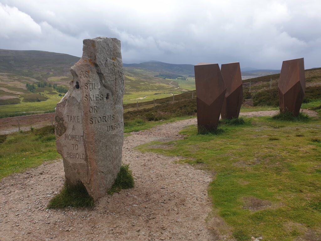
Before one of the last big plunges down, there is a place that everyone seems to stop and admire the view, so I joined in. Here stood a group of tall, man-sized sculptures. They are called ”The Watchers” and they look out across a wide, green open valley in which the white-walled Corgarff Castle can be seen in the distance. One of the sculptures is a standing stone with narrow holes drilled through it. If you put your eye to the opening, you can look down, telescope-like, on the castle far below. The other Watchers are rust coloured metal and turned out to be hollow, with a one person sized bench inside each. It was like sitting in a coffin turned on its end. Each one looked out in a slightly different direction. Cool.
In the lay-by were a group of ten or so motorcyclists. A couple of them seemed to have licence plates from different US states, which struck me as odd. As they all left, a man came up to me and said ”Do you know where they were from?”. The answer, unexpectedly, was Argentina! Every year, for a month, they visit a different country. They leave their bikes behind each time, go back home, and collect them a year later for the next trip. Amazing!
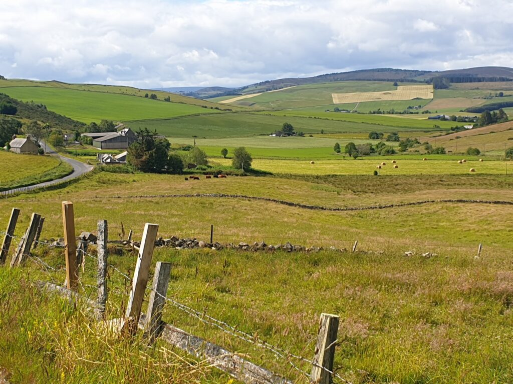
And then, suddenly, I was out of the mountains and turning left into the lovely upper Don valley, or “Strathdon”, a greener, quieter world that I seemed to have all to myself. Everyone else had gone right towards Ballater, in Royal Deeside, which I plan to see later in July, on my next pass through. But I am glad I didn’t miss this!
So began a sublime period of cycling through nowhere of any note, pushed ahead by the wind, slowly and imperceptibly following the river downwards towards the sea. The sun came out, the sky began to look blue in places, and I couldn’t have been happier. Would the next 50 miles all be like this? No. Ten miles on, the rain returned.
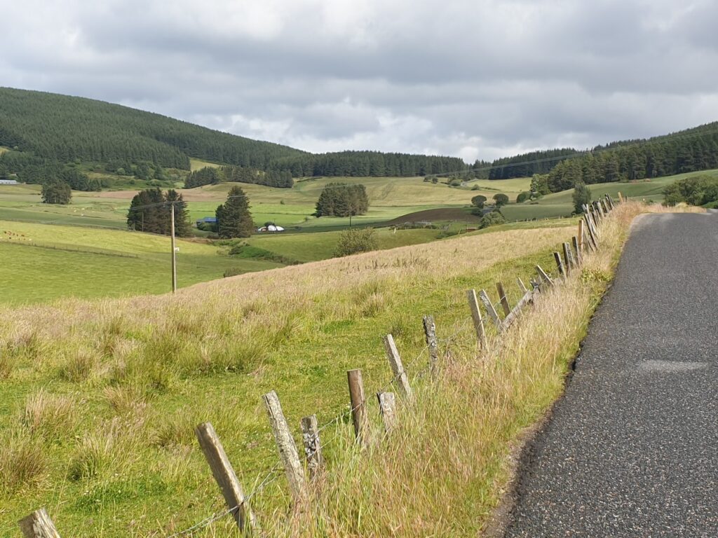
I found a dry area to shelter under trees by a lodge house for the Glenkindie country estate. There was no traffic at all on the A97. Not here, anyway. I talked to some horses and ate my sandwiches (thank you Kate!) until there was a break in the weather. Then I went about another mile before I reached a small petrol station and shop with a sign saying ”Hot pies”. Inside the shop, I chatted to the lady who served me with coffee, Tunnocks Caramel Logs, and a deliciously Scottish Mince, Tattie and Baked Bean pie, warmed in her microwave. It was raining again, so I ate them indoors while we talked over the shop counter. The trouble, she said, was that when the rain comes ”it sometimes forgets to leave”. I had clearly had the better of the weather over the last few days in Barra and the west coast. She (and Kate) described Saturday as a deluge. But now it was dry again, so after discussing directions, I pushed on. I knew from the map that I had a shorter option available to Aberdeen, now 30 miles away, if I went cross-country along smaller lanes. The lady agreed, but implored me to be careful. This road, she said, was very narrow (it wasn’t) and full of pot holes (it wasn’t). In fact, it turned out to be delightful. The sun came out and forgot to leave, the sky turned blue, I was in shirt sleeves for almost the first time in my whole trip, and the birds were singing. The landscape was pleasing to the eye, an undulating world of fields of cows and sheep, trees and more rugged hills in the distance. It was made for cycling.
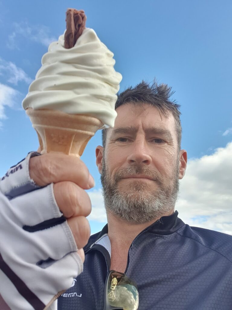
Things got slowly busier as I got closer to Aberdeen. At about 8 miles out you reach the newly built outer bypass, a fast dual carriageway. From here on there were new housing developments and a general feeling of expansion. I found a quiet route that allowed me to sneak up on Aberdeen without it noticing. Suddenly I was riding along smart streets of double bay fronted granite town houses, punctuated by delicatessens and restaurants on street corners. This part of town felt affluent. Spires and towers rose above the rooftops and you had a sense of being somewhere that believed in itself. And then, quite suddenly, I turned through 45 degrees and found myself at one end of the hugely impressive Union Street, Aberdeen’s stately main thoroughfare. Half way along, all traffic except buses and cycles is banished, giving me a sense of superiority as I processed between the grandest buildings, enjoying the empty space around me. I thought I should keep going until the road ran out, and that happened about a mile behind the centre of town when I reached the seaside. There is a beach and a promenade and a run of cafes and other entertainment. The sun was still shining but I was surprised to see people swimming in the sea. I made do with an ice cream, before heading back into town for dinner and the train to Glasgow, where I had a cheap hotel booked.
I am now updating this post the morning after on the 5 hour train journey from Glasgow to Mallaig (another Calmac ferry port that I am getting to know well!). It is a truly spectacular journey, as was the train from Aberdeen last night. So I don’t mind that I am seeing it for the third time in a month! I will be in and around Mallaig for a couple of days as I start my next (6th) crossing of the country by visiting the Small Isles on OS map 39. Rum, Eigg, Muck and Canna get their own map, and I have never been. So there is good reason to feel a sense of anticipation. It also offers a chance to cycle a few less miles before we crank things up again later in the week. And, most important of all, a chance to wash some socks!
2 replies on “Maps 36, 37, 38 – east to Aberdeen”
More great stuff! Glad the Tunnocks worked its magic…
Nice to hear you finally got some sunshine, albeit preceded by more rain. Gardens down here could do with it!