
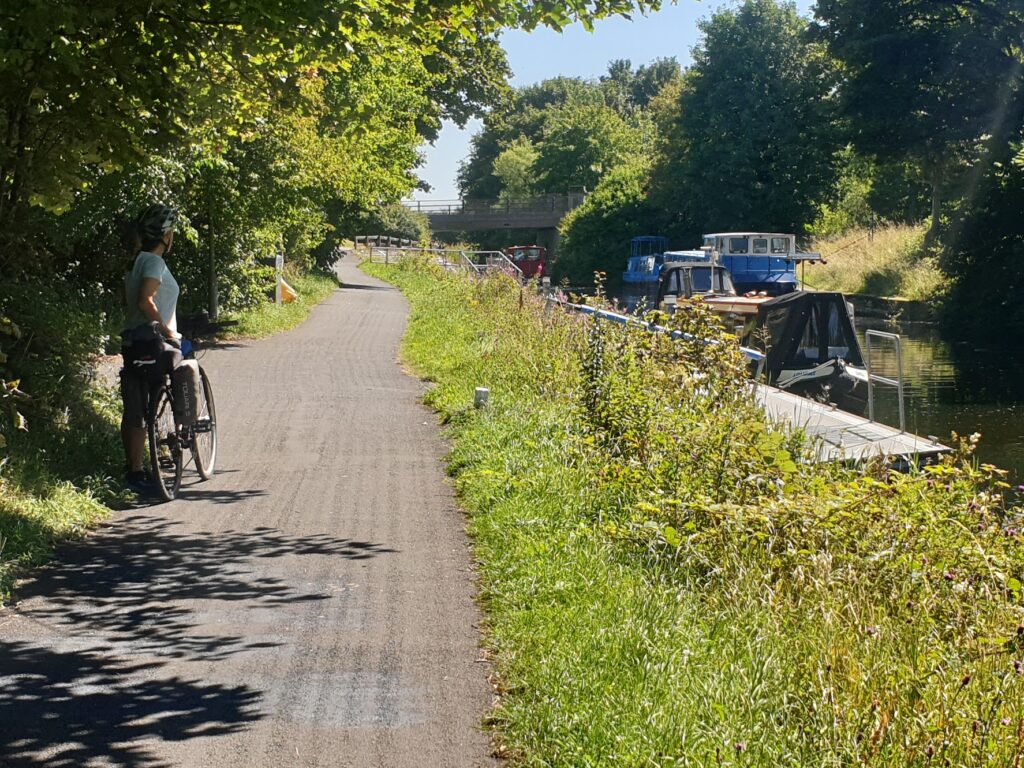
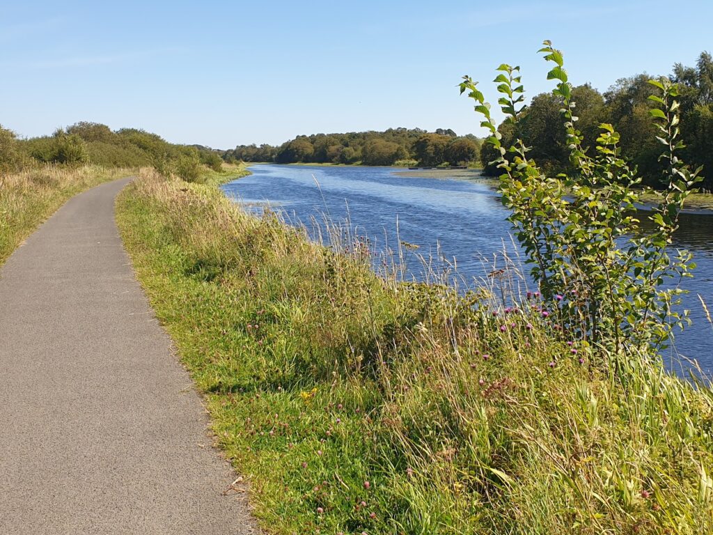
I was a bit worried about this section of my journey. It is a busy part of the country, with two very large cities lying at either side of a heavily populated strip, and a good deal of industry, past and present, thrown in for good measure. Not, on the face of it, a particularly favourable situation for a day of cycling. But I was proven wrong thanks to the excellent Sustrans cycle route along the towpaths of the Forth and Clyde Canal and then the Union Canal, linking Glasgow city centre to Edinburgh city centre along a green and pleasant corridor. The surface is good all the way and it was pretty quiet for long stretches. Some parts were much wider than others, and towards Edinburgh some parts were really quite narrow, with thick vegetation either side and barely room for 2 cycles to pass; but in the main it was a rural delight and an entirely traffic free 6 hours of cycling, plus stops. The only parts you really couldn’t cycle were 3 high aqueducts, spanning deep valleys, where the towpath became rough cobbles. You simply had to walk these features and hope you met no one coming the other way!
These are quite broad canals and there are very few locks. We saw a number of canal boats out for a leisurely ride in the warm sun, as well as canoes, paddle boards and the odd dinghy. But it wasn’t at all busy and for long sections it was just us and the ducks and swans. All very peaceful, even if after a while it lacked a little in the way of variety.
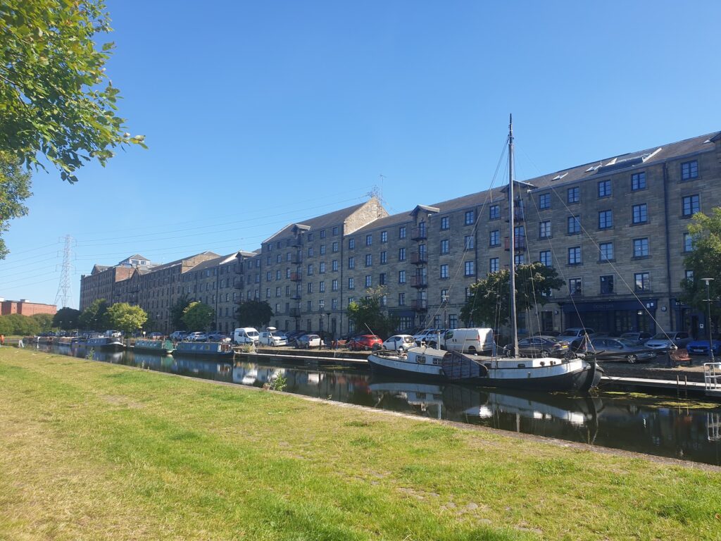
There were a few highlights. The cycle path started just a few streets north of our central Glasgow hotel, at a place called Port Dundas (also the location for a grain distillery until 2010, among other things). I had no idea this existed, despite many previous work trips to Glasgow, when I often went out running. There are now fancy residences in converted warehouse buildings and a posh restaurant. It is named after a major canal backer of the day and was created in the late eighteenth century. Until 1928 it was the site of the world’s tallest chimney! It sits at the bottom of a spur off the main Forth and Clyde Canal, which – as the name suggests – provides a navigable coast to coast link between the Firth of Clyde to the west of Glasgow, and the Firth of Forth at Grangemouth, well to the west of Edinburgh and the Forth Bridges. In the brief but golden age of the canals, before the coming of the railways, this must all have been of great importance.
Now, a couple of centuries on, the canals are used purely for leisure; but they also offer the cyclist an escape from busy roads, not to mention a hill-free riding experience. This is one part of the Sustrans national cycle network I was glad to incorporate into my journey and would happily recommend. And so I told the local man in a day glow waistcoat, who interviewed me on the towpath close to the junction with the main canal. He was a Sustrans volunteer and had 4 pages of questions for me. Linguistically, we struggled to understand each other, such was the strength of his Glaswegian. But together we agreed that it was all rather splendid.
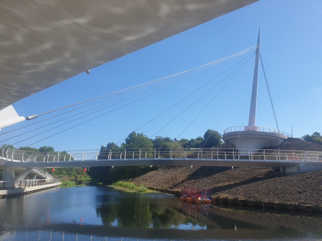
Surprisingly, he could tell me nothing about the huge and impressive piece of modern engineering just around the corner from his interview position. A new space-age system of curved ramps and suspended bridges, linking together the towpaths of the joining canals, is in the final stages of landscaping before it opens next month. It is an architectural wonder and a multi-million pound investment in the region’s green transport infrastructure. We saw workmen wiring up lighting and planting embankments. I don’t quite know how my interviewer had managed to miss it all!
After that, progress was trouble free for a good couple of hours. The towpath was mostly broad enough to ride two abreast and we soon left Glasgow’s sprawl behind and had the low Ochil hills as a companion, running in parallel with the canal to the north of us. We had planned to cover the first 22 mile section, about two fifths of the total journey, before lunch, and were just getting quite hungry when things suddenly got busy. Really busy. We had arrived at the Falkirk Wheel.
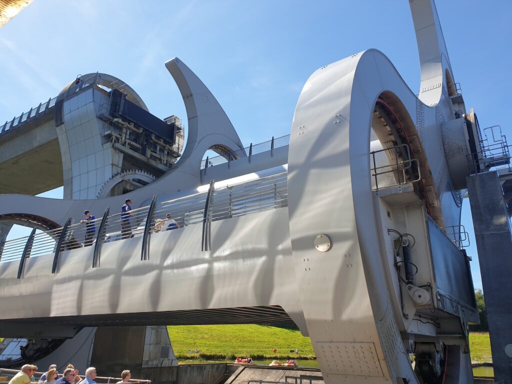
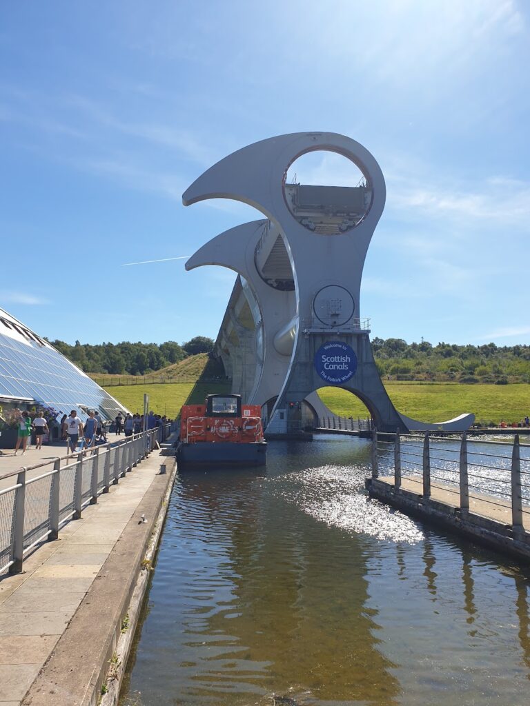
The Union Canal, which terminates in the centre of Edinburgh, meets the Forth and Clyde Canal just outside the town of Falkirk. Both canals have a pretty level, almost lock free course; but when they meet they are at completely different heights. There was once a staircase of 11 locks here; but the navigable link between Scotland’s two main cities was broken from the 1930s until a major Millennium project restored the link in 2002 with opening of the magnificent and unique Falkirk Wheel. This remarkable feat of engineering lifts boats up and down 24 metres between the two canals using a rotating pair of curved steel arms, inspired by the backbone of a whale, taking advantage of the balanced weight between the two moving bathtubs of water. It is a beautiful thing. It is also huge; but despite its size it is powered by the equivalent of just eight electric kettles. It was built, assembled and then disassembled in Derbyshire, before being transported here and built again. The Queen officially opened it in May 2002. It has become, as intended, a landmark in its own right and was buzzing with visitors when we stopped for lunch in the cafe. From our table, we could watch it turn and lift the tourist boats to and from the basin below. A rotation through 180 degrees takes 5 minutes. Great fun.
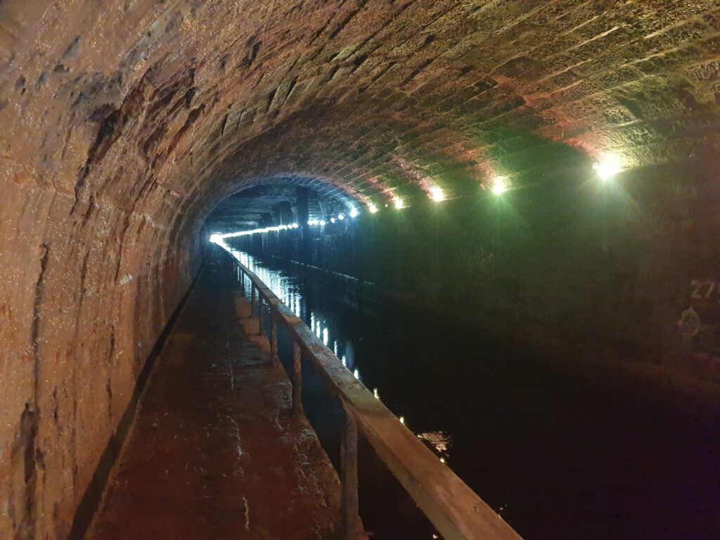
Moving on, we soon found ourselves passing through two tunnels. The first, part of the wheel project, was quite short and well lit. The second, a few miles on, was long and dark and wet. Not at all an easy place to ride your bike, or even see people coming towards you. About half of it was dimly lit. The lights were out in the other half and it was pretty disconcerting, despite the ever present wooden fence between you and the water.
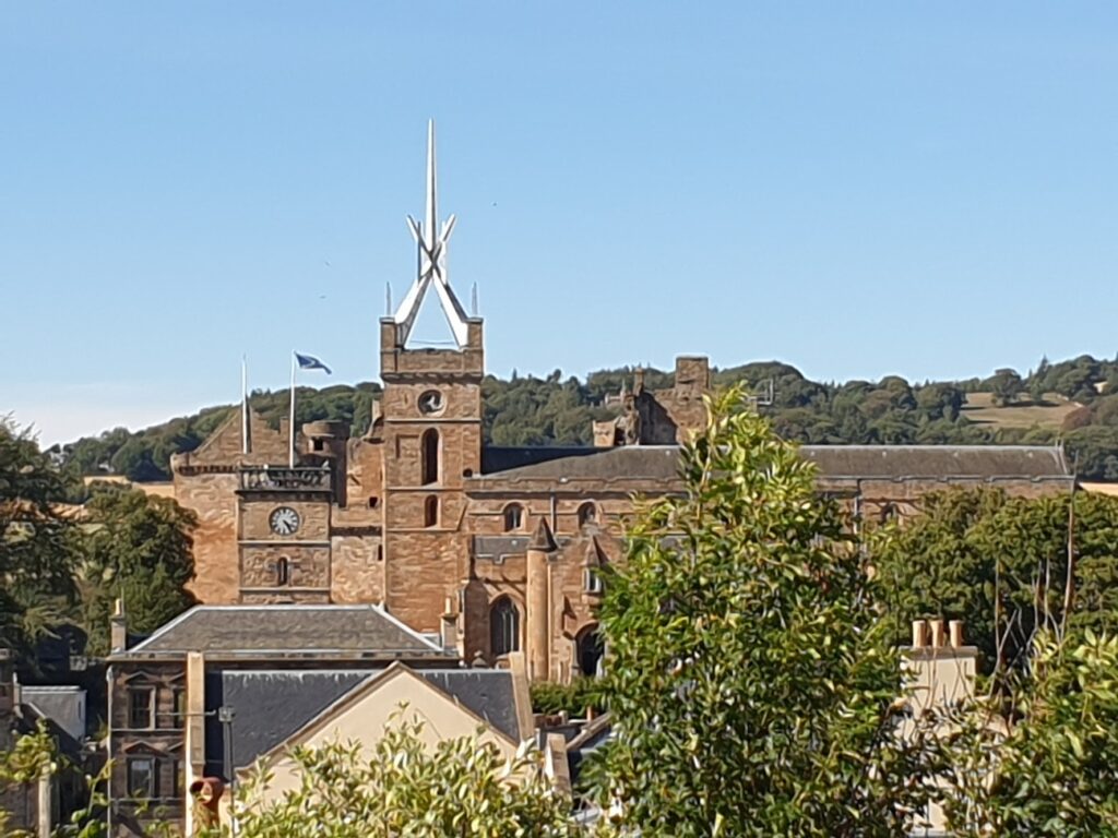
After that, it was still another 3 or more hours of canal path cycling to Edinburgh. We made one further stop in Linlithgow, a Royal Burgh and place of great historic significance. Looking down over the town from the canal you could see in one glance a proud church with a metal crown on the top of the prominent tower, and behind it the ruins of the a royal palace, set by the side of a sparkling blue loch, surrounded by green parkland. It was enticing; but we didn’t need to leave the canal. There is a pretty basin with old canal buildings, one of which is now a tea room. Ideal for a welcome tea, ice cream and cake stop.
The rest of Linlithgow deserves a return visit, and I will do that one day soon. Luckily I have two brothers who both reside in the south of Edinburgh, and it was to there that we now focussed our attention, arriving in time to order take away curry at a civilised 6.30pm. It had really been a most pleasant day of riding through gentle, quiet green countryside – or so it felt. Somehow we had transported ourselves 60 miles between the throbbing heart of one big city to the well heeled suburbs of another, passing all manner of human habitation on the way, and not climbed a hill. Result!
One reply on “Maps 64 to 66 – Glasgow to Edinburgh”
Great pics, looks like a really interesting hill free route.