
Tonight I am staying in the lovely artists’ town of Kirkcudbright, in the region of Galloway, and it will be my very last night in Scotland before leaving it behind for the remainder of this cycling adventure. I feel mixed emotions about that. Sad, because I have got very used to Scotland since early May, and it has been mostly very good to me. Happy, because it represents a whole new phase of the journey, during which – for a short time at least – I will be dealing exclusively with England. Moreover, it is a major milestone, and one that represents tangible progress, which is something I really need to feel as we get deeper into the month of August.
It should also represent a change to slightly simpler coast to coast journeys from here onwards, without the need to ride ferries backwards and forwards every time. There will be a few more; but very much now the exception, rather than the rule. I will reflect, no doubt, in days to come about what I have taken away from my journeys across this large, mostly mountainous and sparsely populated land. But I can already say that I will miss it. I have seen and cycled many parts of Scotland, and it has shown me that there is a lot to like, and much more to see. So I know I will be back again soon.
I am leaving on something of a high, because I really could not have wished for two more beautiful days than yesterday and today to explore this south-west corner of Scotland. It has been ideal weather for cycling. It was raining when I left Edinburgh yesterday morning; but by the time I reached Stranraer, a couple of hours by train south west from Glasgow, the sun was out and the sky was blue. And so it has largely remained.
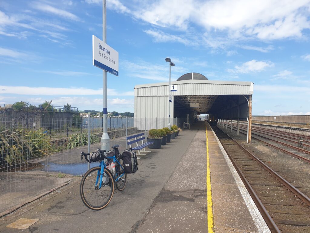
Stranraer is a ferry port without a ferry. For many years, it was the terminus for the Northern Ireland service to Belfast and Larne. But these now both depart from a few miles further up the side of beautiful Loch Ryan, at the ferry port of Cairnryan, and Stranraer now has a big gaping empty space between the main road and the water where the terminal used to stand. The train station still does stand out there, all alone now at the end of a road to nowhere. In the past you could hop off a train and straight on to a ferry. Now you have to walk or ride your way between fences with nothing behind them, for quarter of a mile or so, to reach the town centre. It is all a bit odd.
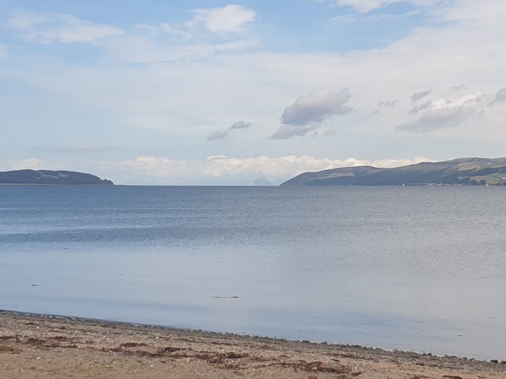
The western part of Galloway looks like a hammer head sticking into the Irish Sea. Between the top of the hammer and the rest of the land mass is the large expanse of Loch Ryan, a broad, sheltered bay that Stranraer sits at the southern end of. It is an exceptional location. You can look north from Stranraer across Loch Ryan and see straight through the neck of the loch where it narrows and lets out into the sea. Filling the opening is Ailsa Craig, seen here from the south. Its location apart, Stranraer is a fairly forgettable place. It is the main town for the whole of the region, and it has a lovely waterfront park with a miniature train and a very impressive cafe, called Driftwood, which I very much recommend (closed Wednesdays). Those are probably the highlights.
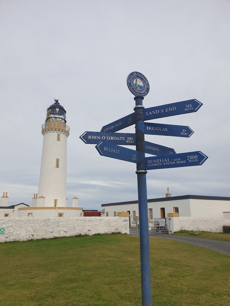
My main quest, before heading east, was to visit the lighthouses that stand at either extreme of the Rhins of Galloway, as the hammer head part is known. I hadn’t quite realised how many miles that would be. I started riding about 2pm yesterday and had to finish off the job this morning. From Stranraer to the most southerly point in Scotland, the Mull of Galloway, and back via Portpatrick to Kirkcolm, just above Stranraer on Loch Ryan, was about 60 miles. It didn’t look that far. But the journey south to the tip was into the wind and took a couple of hours. It was well worth the effort, however. The land narrows to a sharp point, surrounded on 3 sides by the sea and low, jagged cliffs. You could see for miles in every direction, and in every direction there was land across the sea. The most prominent and spectacular was the Isle of Man, whose entire mountainous western side was on display. That took me by surprise. I had only ever seen the opposite side from the mainland before. You could also see, much further away, the coast of Northern Ireland, and especially the distinctive outline of the Mourne Mountains. To the north and east you looked across at the rest of Galloway, snaking around from Luce Sands all the way south to the Isle of Whithorn, with the hills of Glentrool in the distance. It seemed an emphatic and suitable place for a country to end. Or start. Depending on your perspective.
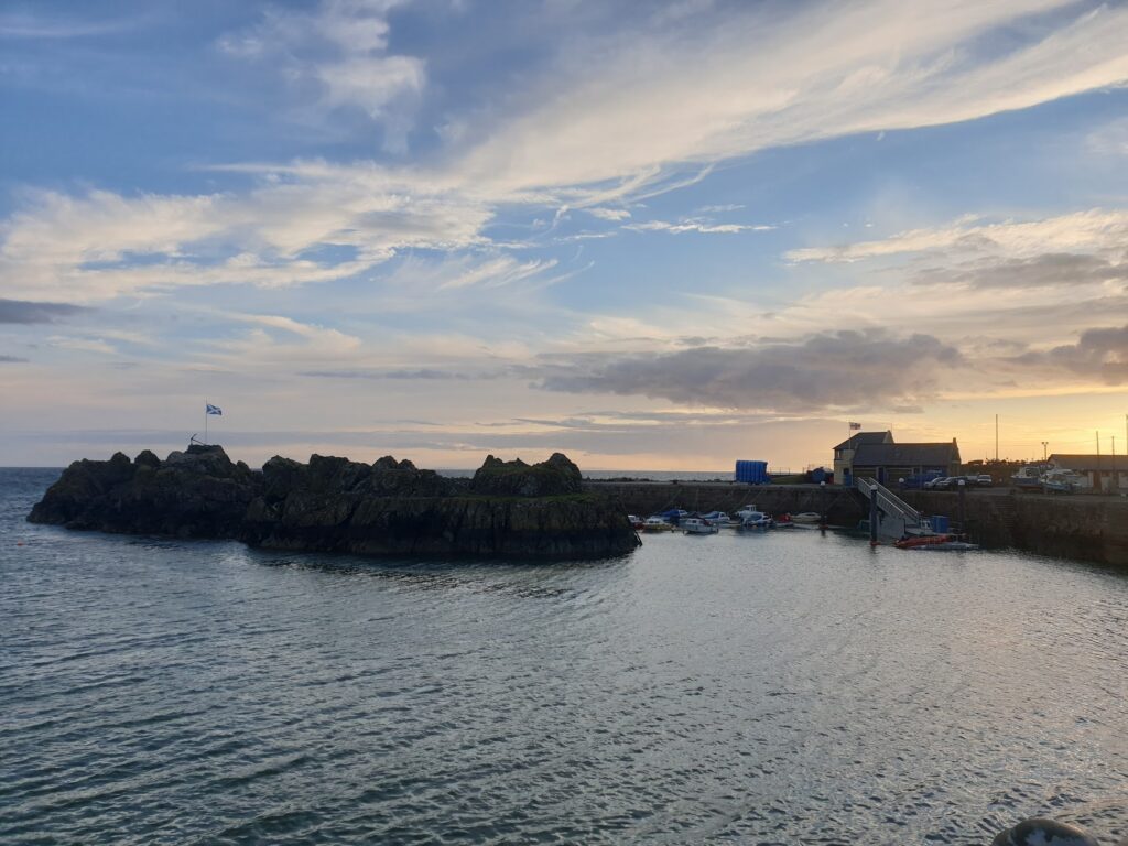
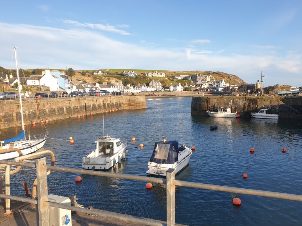
I turned around and enjoyed some wind assisted riding, first to the delightful port of Portpatrick, which is a real picture postcard village around a west facing harbour whose dramatic entrance is framed by jagged rocks. I correctly guessed that this was my best chance of finding dinner and a pint, which I enjoyed outside facing the sea in the evening sun. Then I pretty much flew along straight, empty roads to the village of Kirkcolm and my delightful bnb. It was, to say the least, a quiet location, overlooking Loch Ryan at the spot that saw a great deal of flying boat activity in the second world war.
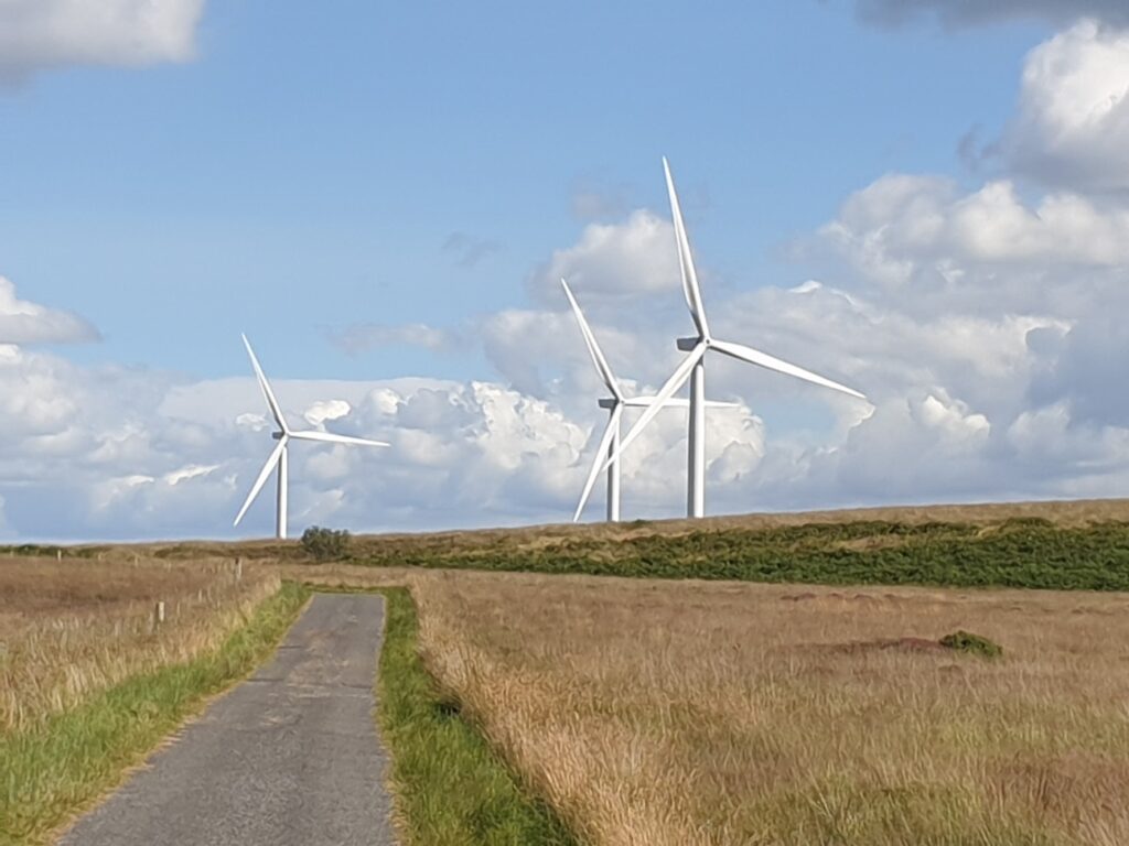
This morning I made the much shorter trip north to see the other lighthouse, and then back to Stranraer for lunch. In the early afternoon I continued across long, quiet, empty moorland roads, passing through large numbers of huge wind turbines, all rotating in the breeze, and seeing almost no one, until I arrived in the busy little riverside town of Newton Stewart for tea and cake. After that, I followed national cycle route seven on a section of old railway to avoid the main A75. Apart from one rather hairy section of 1 in 3 single-track descent that ended in a sharp bend and a cattle grid, it was good. After Creetown, I followed a wonderful back road 12 miles up a deserted valley and back down another, through the best countryside of the day, past much larger hills, and into the small town of Gatehouse of Fleet. The rows of white buildings and the clock tower shone in the evening sun. The long, quiet high street, now bypassed, was a pretty place to be. I had stayed here as quite a young boy on one of my first ever camping holidays. The story goes that we arrived to a pretty full site; but my little brother Dan, who was a baby at the time, screamed the place down. By morning we were alone.
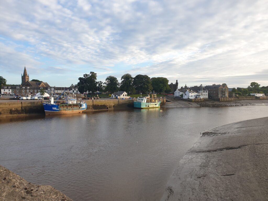
I had a pint in a beer garden by the river and it was all rather lovely. Then I found the final eight miles very easy to Kirkcudbright, which is a pretty little town on the tidal reaches of the River Dee. I entered over a bridge and was afforded great views. It all seemed vaguely familiar, which made sense because I was last here on a family camping holiday about 40 years ago. It didn’t seem to have changed a great deal. Maybe that is a good thing.
One reply on “Maps 82 & 83 – Galloway”
Very sorry about the 1in3 with the hairpin. That was not mentioned on sustrans!