
The trouble with living in such a wonderfully green country is that, inevitably, it rains sometimes. Especially on the western side of Britain where the Atlantic Ocean meets land, often in the shape of mountains. Here, it rains quite a lot. All year round. Places like the Isle of Skye are known for it. So it should be no surprise that I got a little damp cycling around the Trotternish Peninsula on my birthday, 14th June. It is simply an occupational hazard for the adventure cyclist.
The day started early. Really early. I had to be in Lochmaddy, North Uist, to get the 7.15am ferry to Uig, Skye. But the closest accommodation I could find was in Benbecula, 20 miles away. So I was up at 4.30am and riding by 5am. It was light and the road was empty. It was grey but the breeze was in my favour. I was making good progress.
In these unlikely circumstances, I had an encounter with a red deer stag. The two of us met where the road went through a rock cutting. I was going quite fast, perhaps 20mph; but the stag merely had to canter to outpace me until he reached open ground. Worth getting up for.
I caught up on sleep on the ferry and then had a huge amount of smoked salmon and scrambled eggs for breakfast at the aptly named “Smoke on the Water” cafe and smokehouse in Uig. You just don’t get salmon in these quantities usually. I guess I was eating local! Then it was time to cycle. I only put my waterproof jacket on as an afterthought. I didn’t really need it. But better safe then sorry.
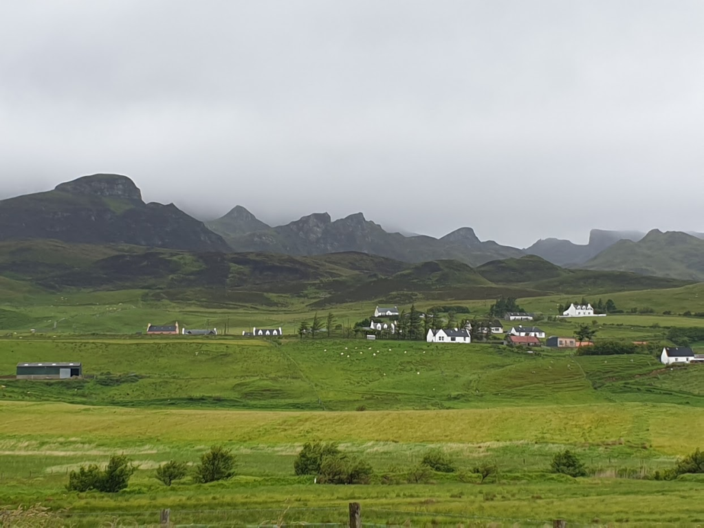
Since Uig sits half way up the west side of the Trotternish peninsula, northern Skye’s main landmass, it seemed like a very good opportunity to cycle a different way to Portree. Regular readers will know that I have been across Skye a few times already on this trip and it was appealing to do something a little different. It started well. The narrow road, an A road in name only, wound its way 10 miles or so to the tip of the peninsula, with attention grabbing views out to sea and up to the cloud capped mountains at every turn. You couldn’t see every part of the Quiraing range, but those parts that were exposed were unusual shapes, with sharp edges and sheer cliffs, evidence of significant landslips and geological activity. It looked quite different from the rest of Skye.
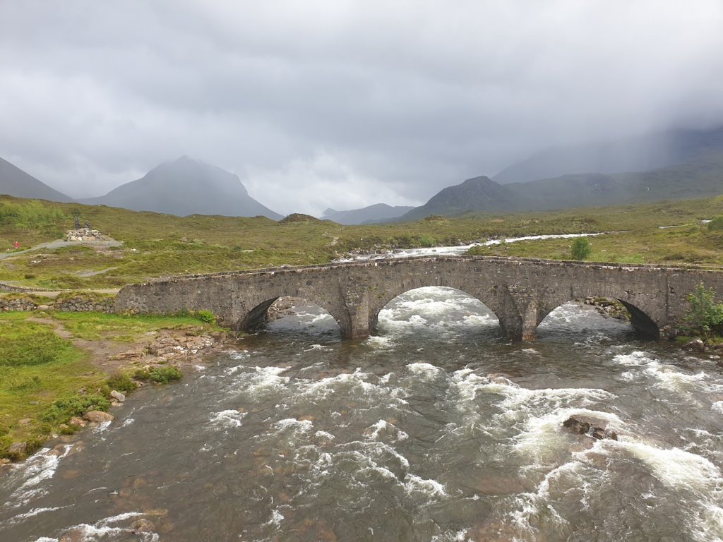
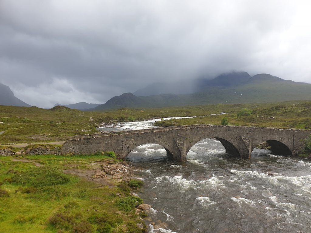
As I rounded the end of the peninsula, everything changed. I reached the main village of Staffin expecting to see a café or two. None materialised, so I pushed on. And then the rain started. I was heading south again now and the wind was in my face. The rain was light; but the combination was nasty. For the next couple of hours I didn’t really enjoy myself. This part of the road, closer to Portree, was bigger and busier with tourists in their camper vans. There was no shelter and no respite. I stopped twice to recover: once, behind the walls of a rare farm building; and once to buy coffee and cake in the shelter of a new looking coffee takeaway stand by the Old Man of Storr, today a busy car park offering views of nothing more than clouds. Otherwise I was fully exposed to the elements. Despite my glasses the rain made my eyes sting. It wan’t nice. And then, when I thought it would never end, I was suddenly in Portree, which was over run with tourists. I got lucky finding a cafe that had a table and I made the most of it. Through the windows I could see the rain continuing to fall. I stayed as long as I felt I reasonably could and then took a deep breath and got ready to cycle on. I had 25 miles still to go to Broadford; but planned to stop at the Sligachan Hotel for a birthday whisky or two.
And then, remarkably, the rain stopped. My timing, once again, was lucky. Very briefly I even found I had a shadow keeping me company. The miles slipped by. I reached Sligachan and found to my disappointment that the famous whisky bar was closed due to staff shortages, a constant theme of this trip. Moving round to the proper hotel entrance, a sign said they would open at 5pm. It was ten minutes to five. Perfect. Somehow this fact was missed by the many tourists outside and I was ushered to a lovely table in a convivial, quiet hotel bar and treated to a couple of absolutely cracking local single malts. The first was from Raasay, the island I would not see today except from over the narrow strait that separates it from Skye; and the next (appropriately) was Talisker Storm. Happy Birthday me! While I was there England pulled off the most unlikely and thrilling win in the cricket test at Trent Bridge against world test champions New Zealand, and everything seemed well with the world.
Reluctantly I left and cycled the final 16 miles under dark, brooding clouds; but it stayed dry. I feel like I know this road pretty well now. And one of the benefits of spending a couple of hours drinking whisky is that the busy daytime traffic on Skye dies away and you get the road and the accompanying mountains to yourself.
At Broadford Youth Hostel I changed into dry clothes and accepted the offer of a beer from a fellow cyclist Peter, from Chesterfield. He told me how he had fallen foul of a ferry cancellation. He arrived in the Outer Hebrides on a Sunday, with all his prior bookings no longer valid, and almost found himself without both food and accommodation! He was close to sleeping in a bus shelter. It sounded pretty dire and underlined, if were needed, just how easy it is to find yourself unable to access the most basic local services in these far flung parts of the country, post pandemic and post Brexit, if you haven’t got bookings. There is no shortage of visitors; but a serious shortage of local labour! Book, book, book!
One reply on “Map 23 – North Skye”
A good birthday choice, Talisker storm and a remarkable cricket match. Good combination