
Today was the kind of day I imagine I will have quite a few more of before this trip is done. I covered something like 96 miles and 3 whole maps and followed a more or less straight line from west to east. I started out in Ardrossan, on the Ayrshire coast, and reached Cardrona, a village in map 73, just east of Peebles on the River Tweed in the lovely Scottish Borders.
It was a mixture of cycle paths for the first 20 miles to Kilmarnock, followed by long stretches of very quiet roads, interspersed with the odd few miles of main road, which were almost unavoidable. Much of the country I crossed was pleasant but unremarkable. Some of the settlements were pretty down at heel. Things improved on both fronts towards the end of the day and I am looking forward to the rest of the Tweed Valley and more Scottish Borders towns and countryside tomorrow. Perhaps I will take more photos. I wasn’t inspired to do much of that today.
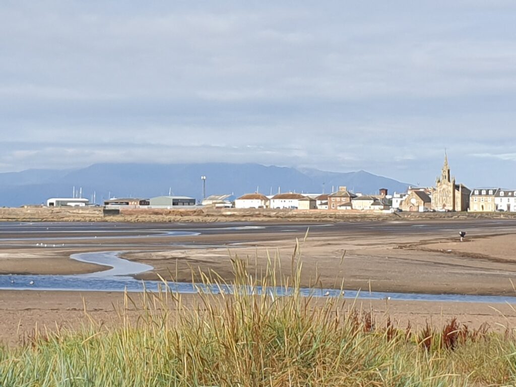
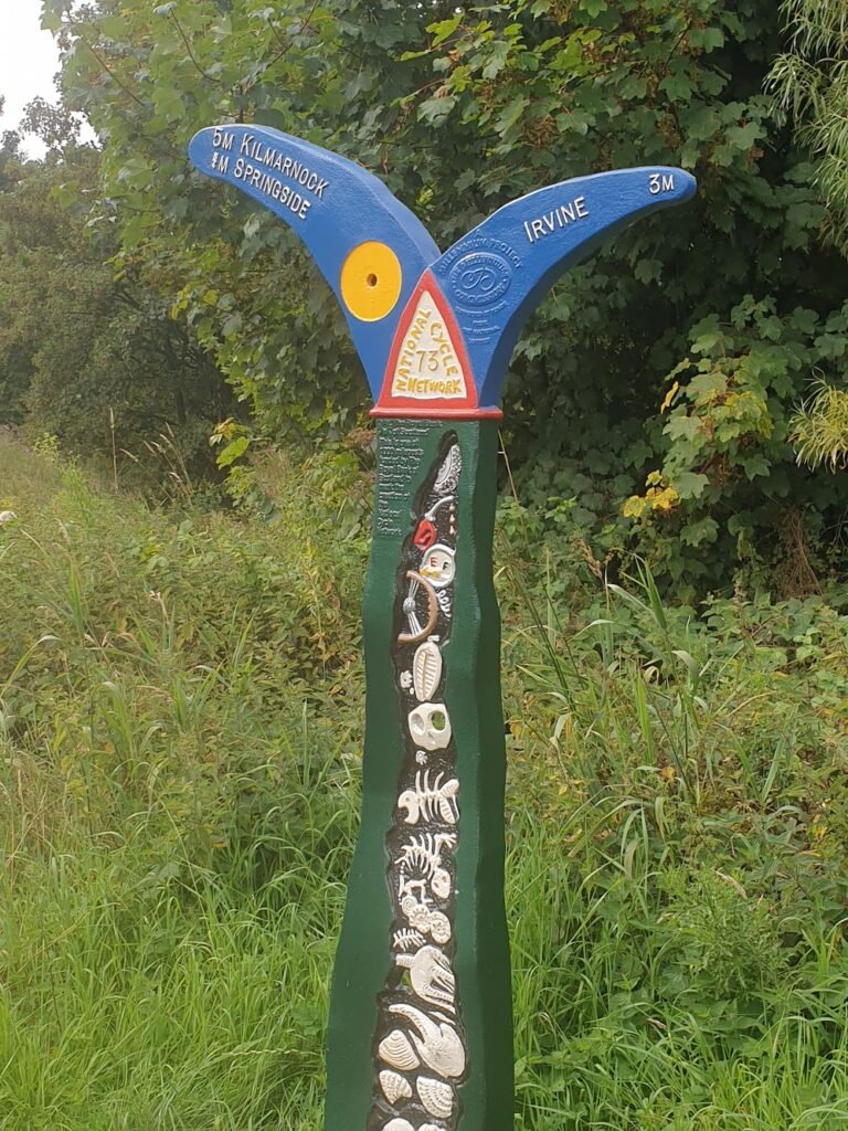
The first few miles, until I turned inland, were nice by virtue of the fact that the sun was shining and I was by the sea. Arran was still visible and the beach at Ardrossan is probably its best feature. People were out taking exercise and enjoying the weather. At Irvine, a few miles south along the bike path (which was well signed and surfaced), I was directed inland and along the River Irvine, in the town of the same name. As the Proclaimers’ song suggests, it was soon ”Irvine no more” for me, as I followed the river past 4 tall residential tower blocks in the middle of town that were all standing empty, their lower windows boarded up, the whole area fenced off. I assume this means that soon they will be demolished. That will make Irvine a more visually appealing place at least. Like many of the towns on my route today, it is no oil painting.
Which brings me to Kilmarnock, 20 miles in to the ride. I have never been there before in my life and I know it only for its Scottish Premier League football team. That in itself was not the best omen. The cycle path dumped me on an urban dual carriageway from which I followed my instincts half a mile or so to a large Morrisons supermarket. I was hungry and they had a cafe, so I played it safe. It did the job nicely and gave me a chance to look at the map. Today was not the usually simple job of following the only obvious road, like most of the trip so far. Joining the dots today would be a very different experience, full of decisions about places and roads I didn’t know at all.
I looked first to see where the centre of Kilmarnock might be. It turned out I was in it. Across the road was a rather attractively refurbished old factory with the original owner’s name spelt out in wrought iron along the roofline. This was once a locomotive works, and trains are still made in Kilmarnock to this day, just across the road. So that was one good thing. I struggled to find many more. There was a big park with a lake and a fountain, containing Scotland’s largest monument to the poet Robert Burns. So that was another. And I later realised I should perhaps have made straight for the Dick Institute, which, before you snigger, is the local museum and art gallery. Entry is free and it has a cafe, all housed in the nicest building I saw in town. Next time. Not that I am planning to return. But you never know.
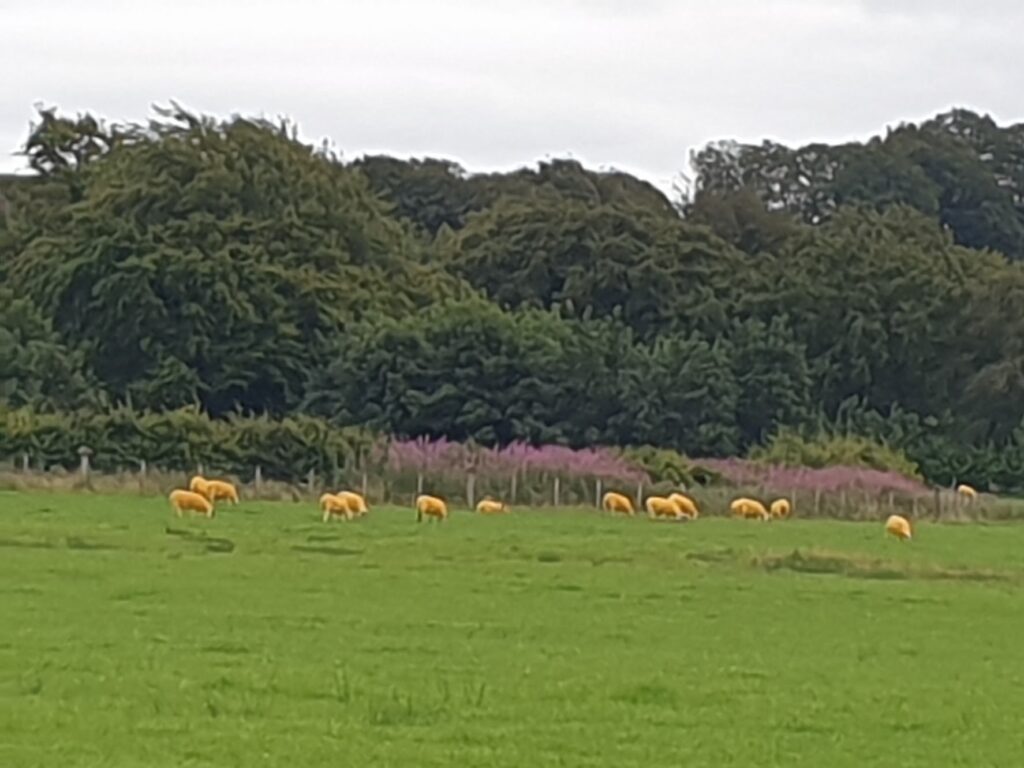
For the next few miles, the A71 took me through places I had never heard of, like Newmilns and Darvel. Let’s be clear: I won’t be spending my holidays here. These small towns have seen much better days. It was quite sad to see how many of the shops were boarded up. They were trying, with floral displays and street furniture; but it was a forlorn task. There was an air of resignation about what was still there. Signs spoke of volunteer awards for civic regeneration, while other signs spoke of closure of businesses. I was glad to get through all of this. It is surely representative of many similar communities around the country; but somehow I had mostly managed to avoid anything quite like this in my first 69 maps. What I needed was some nice countryside to cheer me up. What I got was a featureless, open area of low hills covered with countless wind farms. If they have to go somewhere, this is a good place for them. But it didn’t help my mood. I at least managed to escape the A71 and rode completely alone for perhaps an hour on tiny country lanes. But I didn’t see anything worthy of a photo. Or at least not until I saw a field of orange sheep. Honestly. At Boghead, I turned for Lesmahagow, known best for its silly name and its truck stop on the M74 motorway, which runs from Carlisle and the south up to Glasgow. Apparently their breakfast is the stuff of legend. But it was neither breakfast time, nor was I in a truck. I needed a cafe.
Lesmahagow came to my rescue in an unexpected way. The town follows the course of a deep valley and, while better than what came before it, seemed to be half closed and hidden behind metal shutters, which never makes a place look better. At the far end of town I at last found a nice looking cafe with a person in a seat in the window, so I stopped. The opening hours sign on the door suggested it was open. The door was not locked. The lights were on. But the person was a small boy playing a game and eating a big tub of chocolates, and a female voice from the back said ”sorry, we’re closed”. A rather glamorous looking lady followed the voice as she emerged from the back of the room. But she must have taken pity because she said she could make me ”a wee coffee”, and I ended up with a latte and a piece of millionaire shortbread. When I tried to pay, she waived me away, saying the tills were all switched off and telling me with a smile that I had ”a wee freebie”! She returned to her chat with the friend I could now see sitting at the back of the shop, and I stayed to consume my food and drink, amazed at my good fortune. The small boy appeared utterly oblivious to my presence and the ladies clearly had better things to discuss. So I charged my phone. Feeling guilty, I found and left behind a five pound note. Only a funny Scottish one, not real money; but hopefully she will appreciate my gesture as I did hers.
A stiff climb later and I crossed the M74, which felt like a line in the sand. Pretty soon after that the cycling and the countryside got more interesting, as well as more hilly. I was heading for historic Lanark, where I had never been. I knew it was on the upper reaches of the River Clyde. Only it isn’t. After you cross the bridge you are confronted with a climb of a mile or so up a 1 in 7 hill! It’s pretty brutal; but it’s worth the effort for the sense of arrival you get from the showpiece town centre. If ever there was an example of how to successfully use street lights and banners to improve a town, this was it. Have a look at the pictures.
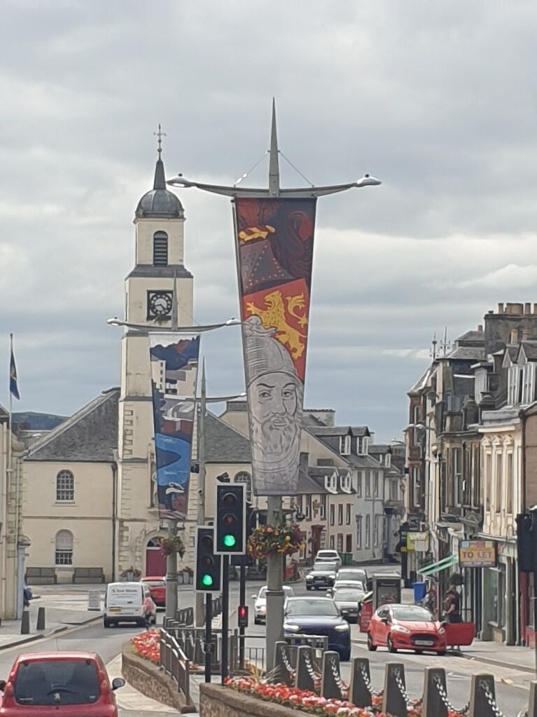
Lanark felt like it was doing OK. Most of the shops were occupied and, but for the queues of traffic, you would say the place was nice to be in. There were bright flowers in the middle of the road and it all felt much more optimistic.
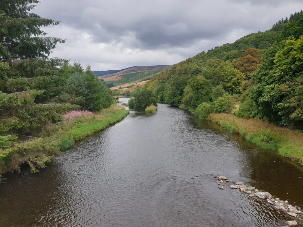
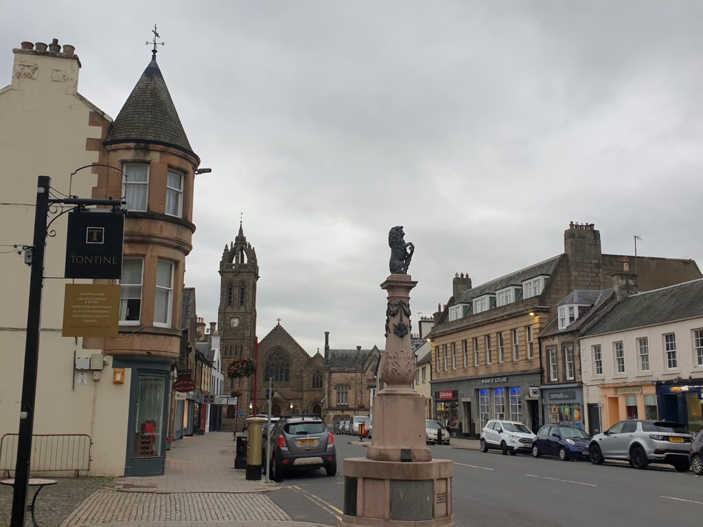
It was another hour to attractive Biggar, where I found food, and then 90 minutes of glorious cycling to Peebles, an inland spa town with a riverside setting, my faith restored. Each town seemed more prosperous than the last. I was now well into the Scottish Borders region and the countryside was delightful. Proper heather clad, purple and green, bare, rolling hills, with lots of mature trees below in the valleys, and handsome stone walls. It was lovely.
2 replies on “Maps 70, 71 & 72”
Do the orange sheep only eat carrots? How strange!
I suspect it’s all down to a secret passion for Scotland’s national drink!
(by which I mean Irn Bru, not whisky!)