
I have always thought it would be fun to cycle the length of the River Tweed. It flows roughly west to east for 97 miles, rising in Scotland, then forming the border with England, and finally emptying into the North Sea at Berwick, a fully English river. I have long had in mind a ride from the most southerly point in Scotland, on the Mull of Galloway (where I hope to be later this month) to the most northerly point in England, just north of Berwick. That ride would would pick up the Tweed about halfway, at its source in the hills above Moffat, in the southern uplands, and follow it all the way to the end. Today was the closest I have come to riding the second half of that journey. I did something quite close to the first half about 7 years ago, which included staying in a bothy, wild camping, and getting a bit carried away on beer. The less said about that the better.
I actually picked up the Tweed yesterday evening between Biggar and Peebles, and since then have followed it for about 64 very enjoyable miles of cycling. I will deviate from it slightly tomorrow morning as I head east and a little south to hit the coast at Holy Island. I would have gone this evening; but the tidal causeway is impassable until 11.30am. So instead I am staying in a very nice pub in a quiet village about half a mile into England. It is the first time since Shetland that I have ended a full day of cycling and not stayed in Scotland. Another milestone.
I started the day in Cardrona, a ”new village” created from green fields about 20 years ago, next to a large golf course and hotel, alongside the Tweed just east of Peebles. All of the upmarket homes are the same age and style and size, pretty much. But it isn’t a bad place. It just feels a bit odd. National cycle route 1 runs right through Cardrona, following the route of the old railway from Innerleithen to Peebles, and it is a pleasant and scenic place to ride. The weather was decent and the world felt like a good place this morning.
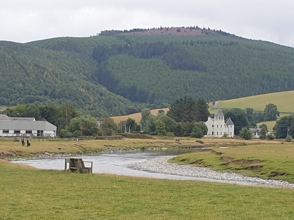
It turns out they do cycle routes rather well in the Scottish Borders, and I was able to follow well signed routes, either off road or on quiet lanes, all day long. This really is an unsung part of the country. It has a gentle beauty, lots of open space, some lovely small towns, and it just doesn’t seem to do crowds. Most people, it seems, miss out on this region altogether as they rush between Edinburgh and the Highlands to the north, and the Lake District and Newcastle to the south. Very few people bother to find out what lies in between. That may be an issue for the local tourist industry; but it is just fine with me. Apart from a few mountain bikers around Peebles and Innerleithen, only a discerning few make the extra effort to explore the delights of the Scottish Borders. And based on what I saw today, there is plenty to explore.
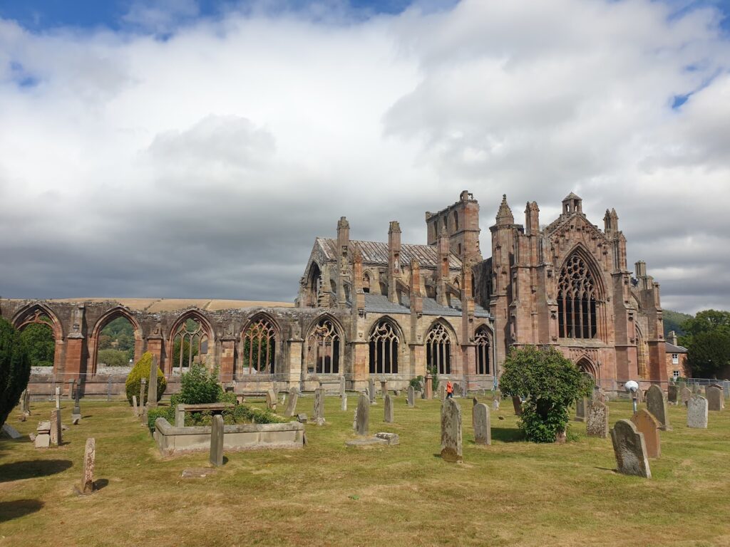
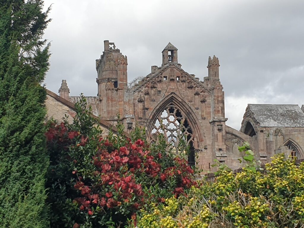
I lunched in Melrose, which is the most delightful little town. It is known for its picturesque ruined abbey; but there are also gardens to see and a lovely collection of shops, cafes and hotels. I could happily return. I stayed quite a while as it was. But I had a way to go, so I cycled on, briefly poking my nose into Dryburgh Abbey, before riding out across a rather less hilly landscape, past golden fields of hay bales and large country estates, until I reached my third ruined abbey of the day, right in the centre of the large and well-heeled town of Kelso.
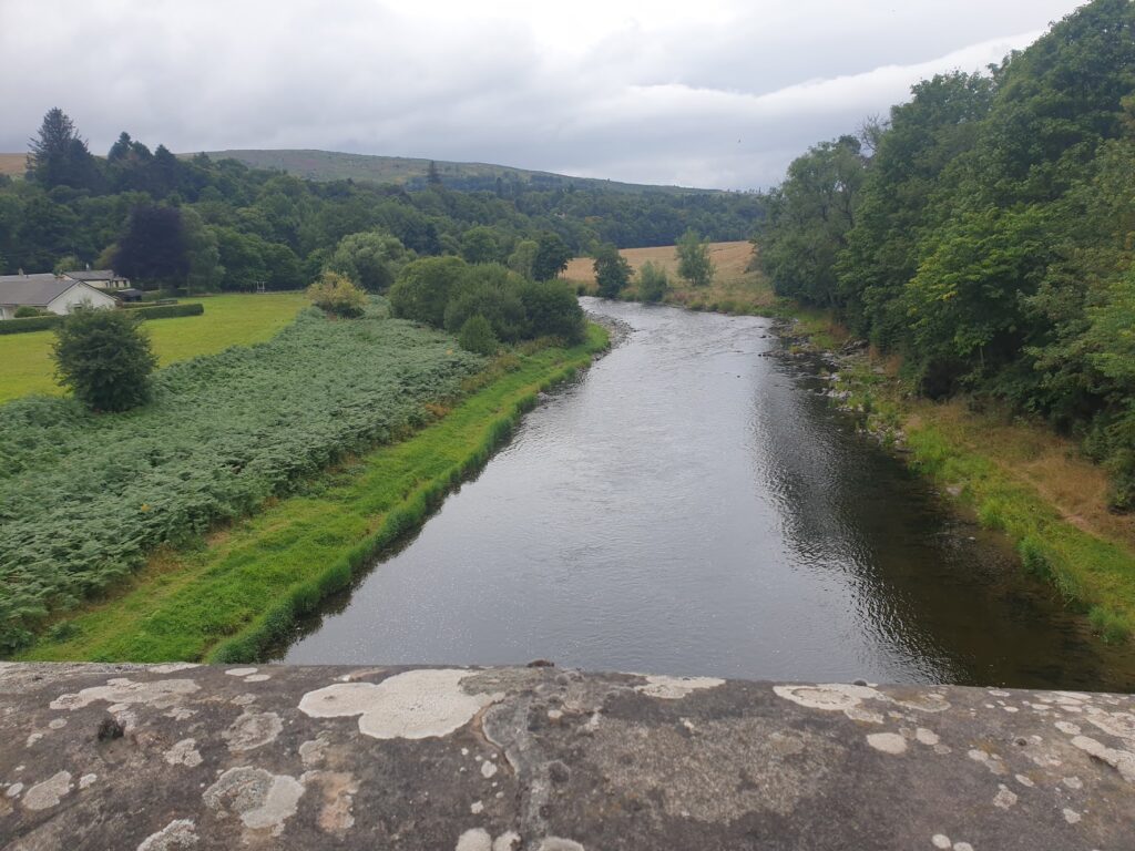
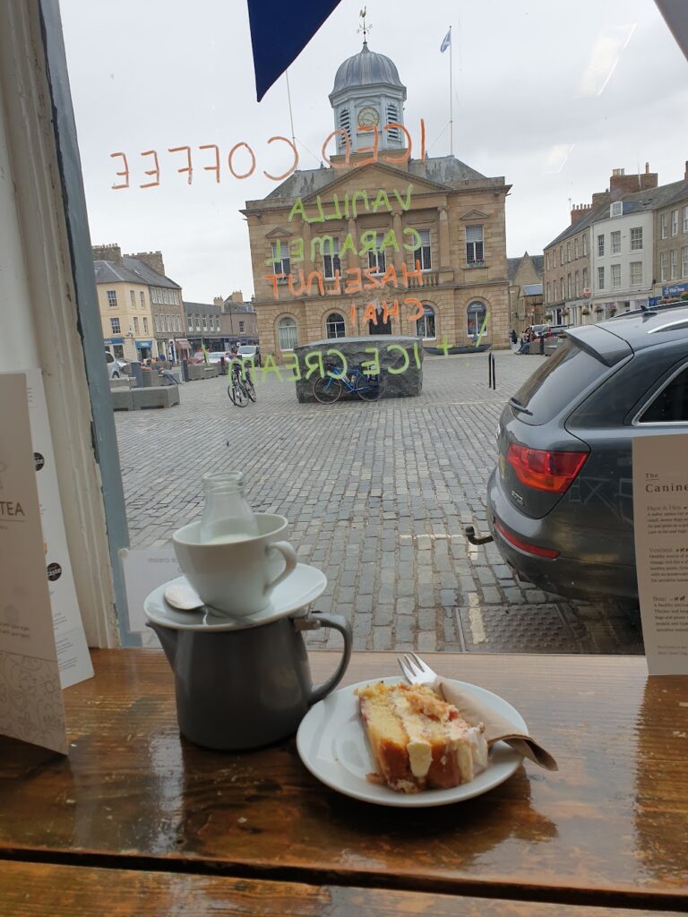
Kelso is the sort of country town you imagine more places should be like. It has a large and handsome market place, completely cobbled for the annoyance of passing cyclists, with a grand town house at its centre, complete with cupola and flags. All around the square were interesting looking shops, cafes and hotels, including the grand looking Cross Keys, which occupied one whole side of the square and had more colourful window boxes than I could count. It was a most pleasing place. The square led out onto a many arched bridge over the now broad River Tweed. And in between the two was the ruined abbey, right up against the street. On the other side of town is the grand entrance to Floors Castle, a stately home and estate whose high stone walls I had followed for some miles in my approach to the town. Everything spoke of a comfortable level of country living. It was a million miles from the struggling towns of East Ayrshire. I stopped right in the centre of town for my customary tea and cake and was given a leaving gift of a cheese scone that apparently no one wanted. It’s not in my nature to refuse.
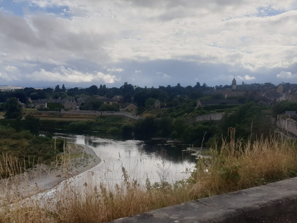
In the late afternoon it threatened to rain; but then lost interest and didn’t bother after all. I crossed into England a few miles beyond Kelso, and then back into Scotland at Coldstream as I recrossed the river. From there, I left the busy main road through the town centre and had the lanes completely to myself to my destination, back over the river one more time to England and the attractive village of Norham. It being Thursday, the fish and chip van was in the village, and many people brought their meals into the pub, and then stayed on for bingo. It was quite a night, which brought to an end a lovely day for me here in border country.
One reply on “Maps 73 & 74 – the River Tweed”
Looks like a lovely area to cycle, another one to put on my wish list