
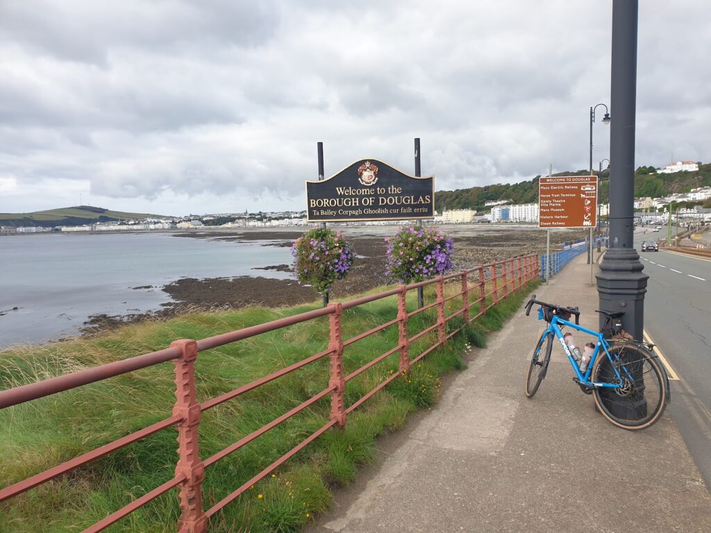
My task today was straightforward: get up, have breakfast, ride roughly 85 miles around the full perimeter of the Isle of Man, collect my bags from the hotel, and all in time to catch the 7.45pm ferry back to Heysham. I am happy to report that I achieved all of it. I was a little unsure of making the ferry in the last hour of cycling, which seemed endless, and I was giving it everything. However, I in fact reached Douglas in plenty of time, and I was able to relax and enjoy its showpiece waterfront one last time before checking in.
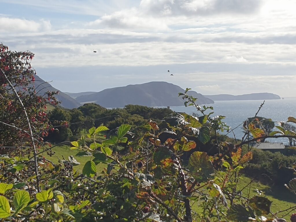
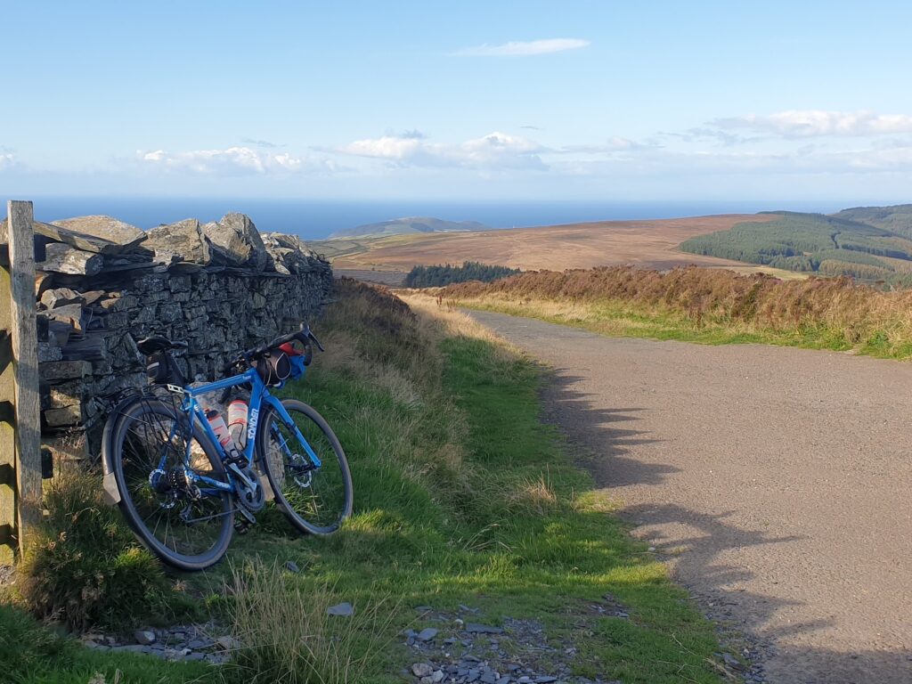
I was blessed with a beautiful late summer day, with the breeze still coming across the island from the north west. The sun shone and the skies were mostly bright blue. The mountains, in cloud when I arrived yesterday, were in full view. Snaefell just scrapes over 2,000 feet, so it is no monster; but a large part of the central and southern portion of the island is made of high, rolling moorland, making my ride far from level. According to the tourist literature it is upwards of 6,000 feet of climbing to make a full circuit of the island, and I can believe it. The far north of the island is much flatter, and there is also a low coastal plain to the south east, where the airport is found, and where there are more towns, villages and traffic. This was the final part of my circuit, and I was glad, because until then my whole day had been pretty close to traffic free. A delight, in fact.
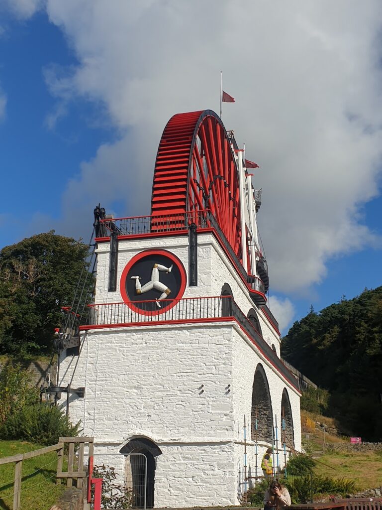
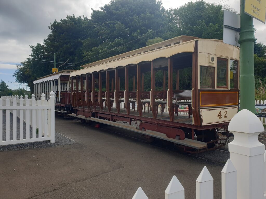
I started out from Douglas, which is at roughly 4 o’clock on the island’s slightly Dali-esque clock face, and headed uphill in an anti-clockwise direction. I found that for the first hour or more I was following alongside the tracks of the Manx Electric Tramway, that makes the hilly journey along the north east coast from Douglas to Ramsay, the northern most town on the island. After perhaps ten undulating miles, the tram tracks and I came to the pretty village of Laxey, a place I had seen many times in pictures due to it having the largest working water wheel in the world, the Laxey Wheel. Painted in the national Manx colours of red, white and black, this is a marvel of Victorian engineering that was used to drain water from the mines in Laxey Glen. It is undergoing careful restoration and looked resplendent in today’s bright sun; but it was not turning. Oh well. I’ll be back.
Another 40 minutes or so further on I descended steeply to the small resort and port of Ramsay. This is a place of substance, made up mostly of buildings that would not look out of place in Douglas, and it has a main shopping street with interesting shops worthy of more time. But it also has a working harbour that runs inland into a tidal river. It is crossed by an impressive iron swing bridge, which seems to be something of a symbol of the town, and judging by the height of some of the boats upriver from it, it is still operational. I cycled across it a couple of times. It is narrow and traffic is restricted to one way only, heading away from the shops. At the beach end is a cafe and that was my early lunch stop.
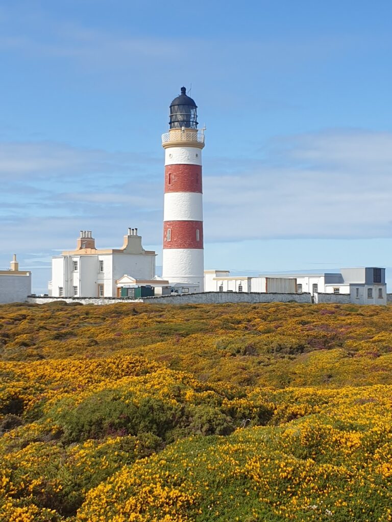
Hereafter, the land became much gentler until, at the very top of the island, Point of Ayre, it was pretty flat and carpeted by a deep intertwined pile of yellow gorse and purple heather. At this northern outpost stands a red and white striped lighthouse which looks out across the sea to the mountains of Cumbria, in England, to the east and the mountains of Galloway, in Scotland, to the north. It was very quiet up here. In fact the whole of the north part of the island after leaving Ramsay until at least Kirk Michael, half way down the west side, was very peaceful indeed. I was riding along lanes fringed by hedges full of red fuscias. The sea to the west was a deep blue, with white horses made by the strong breeze, now broadly in my favour. Ahead of me, the hills spread themselves across the central part of the island. It all made for excellent cycling.
Soon after that, I joined the TT motorcycle racing course for a couple of miles. I knew I had because the kerbs were painted alternating black and white flashes, and the bus stops doubled up as marshall’s shelters. The TT brings thousands of motorcyclists and fans to the Isle of Man every year. Sadly, every year there are injuries and deaths, too. I guess they are an occupational hazard. But I was here for another kind of cycling, and it just kept getting better. Turning off the TT route I dropped a few miles back to the coast and reached the main town on the west coast, Peel.
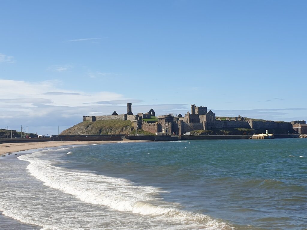
This is a very pleasant place with a sandy beach, quaint centre and long breakwater that forms a safe harbour for several large fishing vessels. Dominating the whole scene, and facing back over the harbour to the town, is St Patrick’s Isle, site of a large ruined castle within whose walls are the remains of St German’s Cathedral, the seat of the Diocese of Sodor and Man. No-one knows exactly where Sodor is; but Thomas the Tank Engine lives and works there. Also in the same complex is a mediaeval round tower, which completed my set of all 3 that survive outside Ireland (the others, you will recall, being in Brechin and Abernethy in Scotland). The small island is now connected permanently to the mainland, so you can walk around the ruins. It is impressive today and must have been even more so in its heyday. This a place of great history: the Vikings built the original castle. I had wanted to visit for many years and was not disappointed.
But all too soon it was time to move on, such was my ambition to see the whole island in a day. The next section was the toughest climb of the day as the hills to the south crashed headlong into the sea, making further passage along the coast impossible. On a high ridge in the mountains, I reached a point where you could look left and right and see the sea on either side. And then, just as I was getting used to being up, the road swooped back downhill again in spectacular and slightly scary fashion, which was not made any easier to navigate by the gusting wind that changed with every bend in the road. I was down quickly and minutes later found myself in the impressive semi-circular bay that cradles the small and rather swish town of Port Erin, with smart residential apartment buildings up on the cliffs overlooking the beach. It had an end of season feel about it. There were signs of recent summer activity: a temporary stage on the beach, volleyball nets, surfing shops with signs saying “see you next year”. It was only 15th September and the weather was good. But the only people around this Thursday afternoon were dog walkers and the cafes were all closed. Like the rest of the island, I had the place mostly to myself. I found an open pub and drank a pint of local bitter to give me a boost. It’s a funny thing, but I find I always cycle really well after one pint of ale. Sometimes I start to crave it. Other times, it is pretty much the only thing on offer. Two pints would be counter productive, I reckon; but one is just the thing for the long distance adventure cyclist!
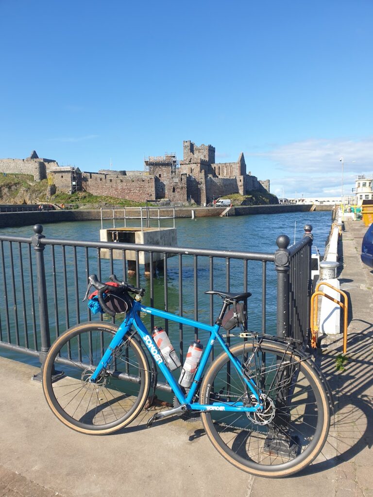
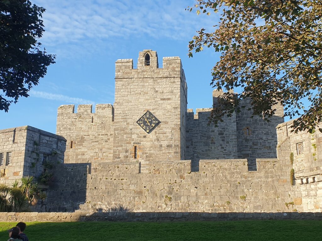
The afternoon was running out on me, so I hit the road and in ten minutes had crossed the narrow bottom of the island to the equally pretty and slightly more lively Port St Mary. In the evening sunshine, it looked a picture. But I had to press on. I just had time to detour through the centre of Castletown, the old capital, and was glad I did. It was perhaps the most attractive of all the island’s small towns, with its pretty town square and river harbour overlooked by the ancient and vey well preserved Castle Rushen. Not for the first time today, I wished I had more time. I was seeing a lot in a single ride, but any of these places was deserving of a visit in its own right. One for the future.
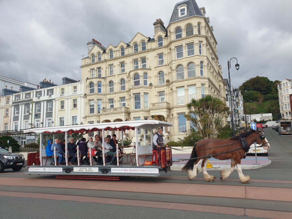
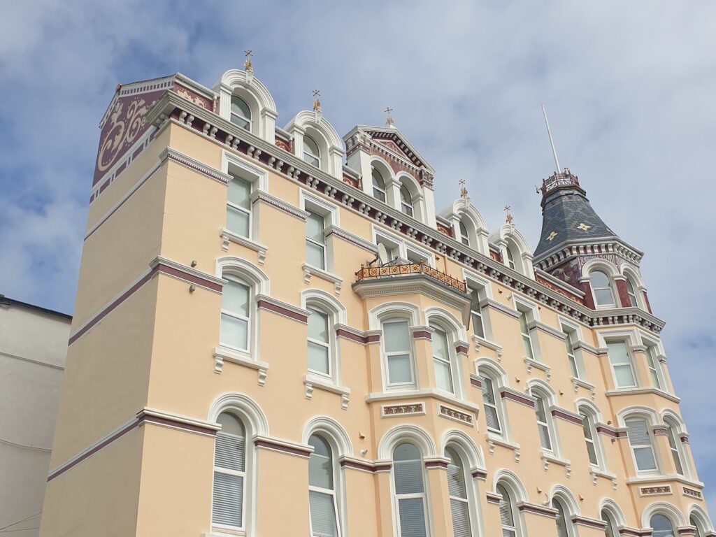
I covered the last part of the journey to Douglas in about 45 minutes, which was going some. Must be the beer. Or possibly the need not to miss the ferry. Or both. It turned out that this was where all the people were. I even saw a long traffic queue coming in the opposite direction: Douglas commuters, I guessed. I knew everyone must have been somewhere. The population of the island is 89,000. That is many, many times more than the similarly map-sized Islay, or Arran, summer visitors notwithstanding. Jura, also about the same size, could easily fit its entire population into Douglas’ Gaiety Theatre (currently showing a production of Grease). But that seems an unlikely turn of events. At any rate, I was not surprised that the roads had finally turned busy on me. It was what I had expected most of the day. But, once again, I instead enjoyed the natural beauty of another jewel in these lovely islands that are our home, in peace and tranquility. Mostly.
So if you are looking for a place that provides excellent cycling without traffic, lots of route options, history around every turn, its own post office vans, Thomas the Tank style railways and a cool flag with 3 legs on it, this is the place to come. You won’t regret it.
One reply on “Map 95 – Ellan Vallin”
Sad I missed this one. Definitely coming with you next time.