
When you open out OS map 42, you see a very obvious way to cycle quietly across it, all the way from left to right in a horizontal line. It even deviates upwards to connect nicely with the slightly more northerly map 43, just where you need it near the right edge of the map. Route planning is rarely this straightforward in mountainous Scotland.
There is only one problem: this road goes no further west than Rannoch Station, high up and alone in bleak Rannoch Moor. Coming as I was from Roybridge, to the north, where the only available road turns north-east towards Newtonmore in map 35, this required some out-of-the-box thinking. The solution came in the form of a southbound train, which I got on at Tulloch, 6 miles along the valley from Roybridge. Here the railway turns south and goes it alone across the blanket bog. This scenic 50 minute train journey, passing the highest mainline station in Britain at Corrour (1340 feet above sea level and not accessible by public road at all), allowed me to magically teleport myself and my bike further south without noticeably moving any further east. No road? No problem. Seamless.
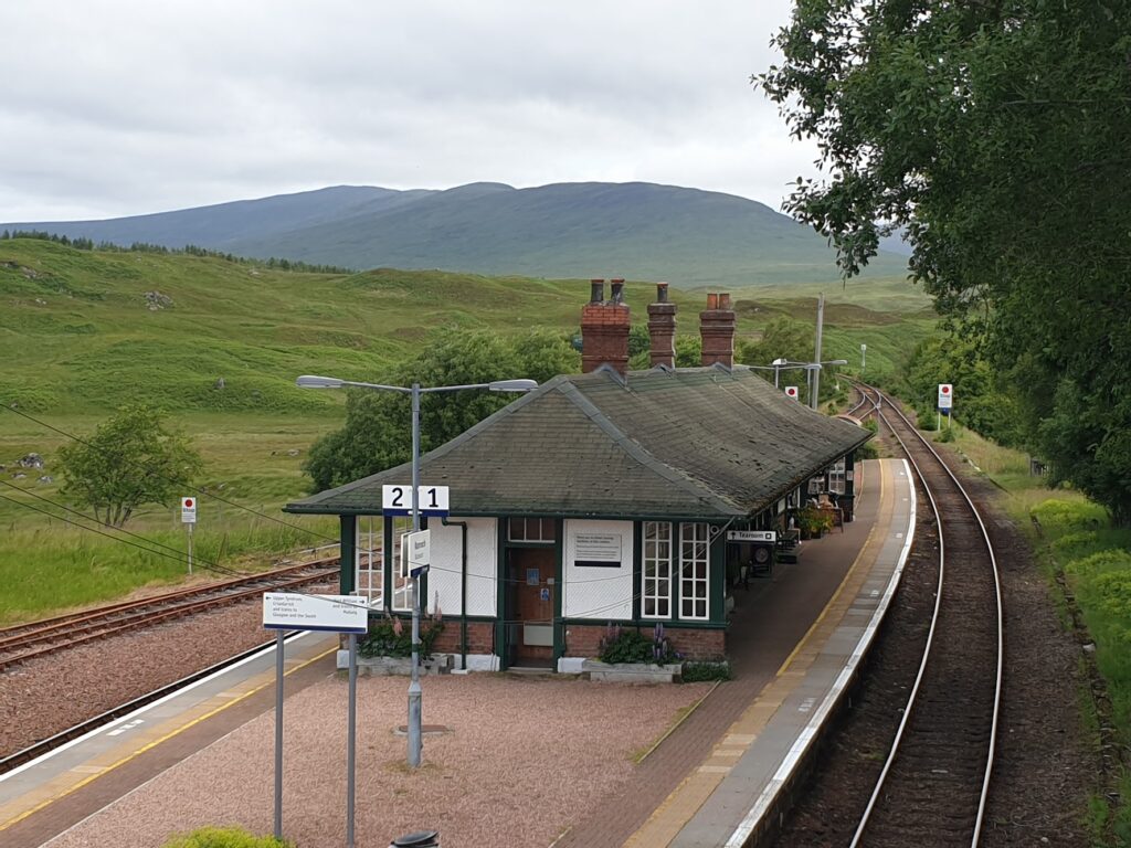
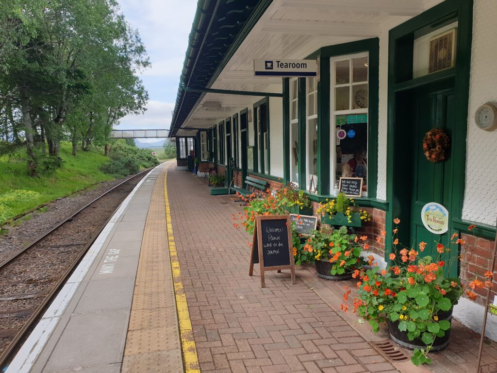
To do this required an early start, which meant sacrificing my cooked breakfast. I did still manage a large bowl of Frosties, which still seem special to me because we were not allowed them at home when I was growing up! So I was thrilled to discover that the tearoom at remote Rannoch station was already open when my train arrived at 9am. I was the only customer and was treated to a warm scone straight from the oven and lashings of breakfast tea.
The day was already looking very promising; but the air up here was cool. The cafe was short staffed (3 of the usual 5 were sick) and had a busy Saturday of bookings ahead of them; but they were cheerful and chatty. I learned that life up here may be remote, but you can still get Asda online groceries delivered and Amazon is reliable, too.
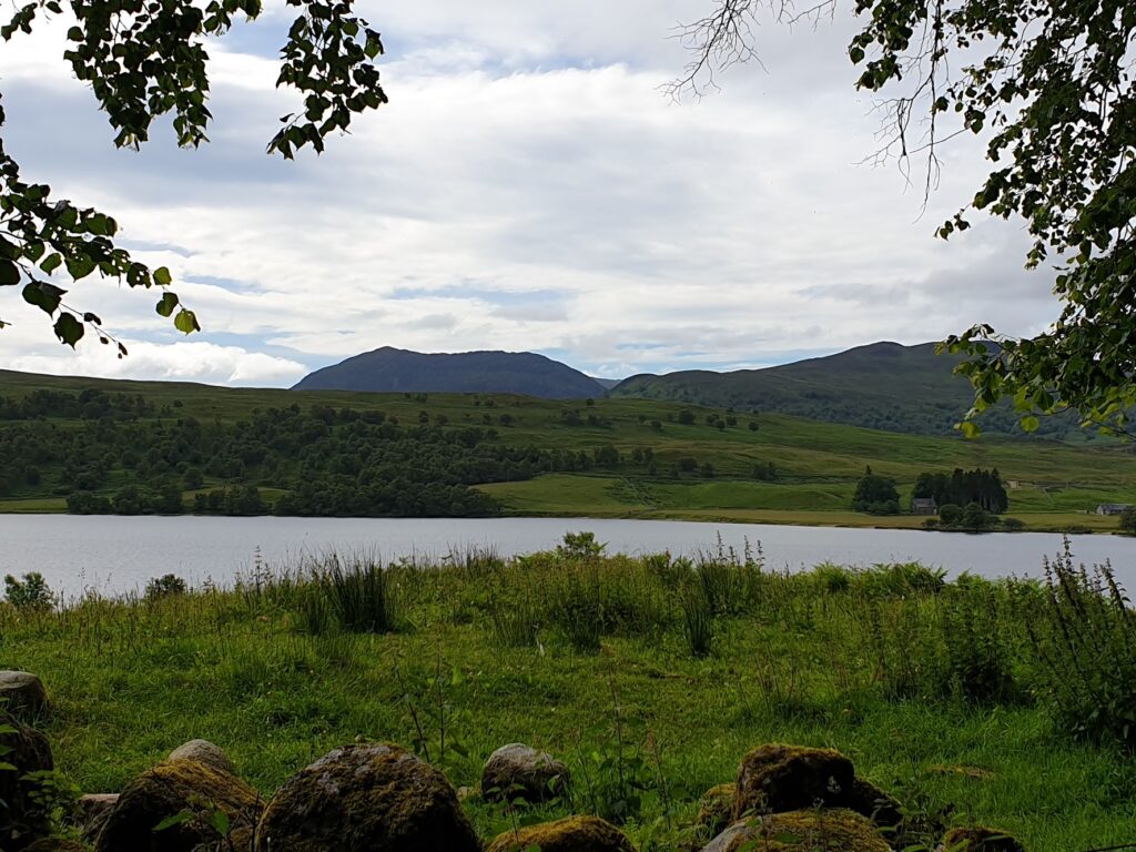
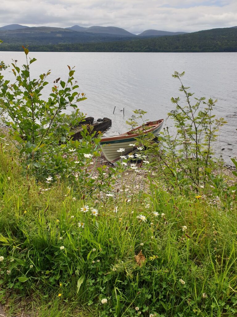
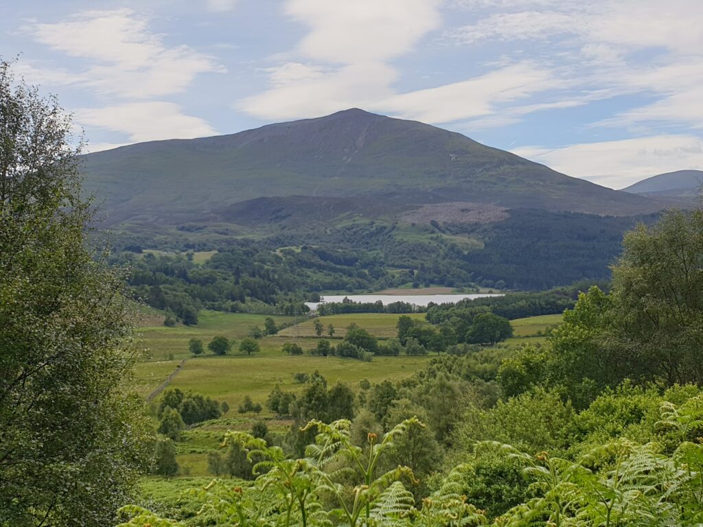
But at this hour it was very quiet. After a quick look around the heritage centre, I began my ride down to and then alongside the beautiful Loch Rannoch. In the morning sunlight, the water glistened and the surrounding hills glowed for its entire 10 mile length. Along the north shore at regular intervals, people had pitched tents under the trees by the small sandy beaches. Many were enjoying their breakfast. At the eastern end is the village of Kinloch Rannoch, a small, pretty place with a big hotel and a cafe. Standing sentinel to the south – and drawing the eye – is the prominent mountain of Schiehallion, 1,083m tall, an almost perfectly symmetrical shape rising to a pointed summit like a child’s drawing. Its sides were green from top to bottom.
Schiehallion has a unique place in scientific history. It was selected due to its symmetrical shape and relative isolation for an 18th century experiment to calculate the weight (or to be accurate “mean density”) of the earth, funded by the Royal Society. The experiment sought to measure the tiny deflection caused by the gravitational attraction of the mountain, relative to that of the earth. Given their relative densities and volumes, it should then be possible to calculate the weight of the earth, and from that the sun, moon and other known planets. It took place in 1774 under the direction of the Astronomer Royal, Nevil Maskelyne. For the record, after complex calculations, they computed the Earth’s density in 1778 to be 4,500 kg per metre cubed. The modern accepted value is 5,515. So they did quite well, all things considered.
After a stop at the cafe for a breakfast roll (it was open, after all) I continued along quiet green valleys to Blair Atholl and map 43. It was now a warm, one layer day and the valley was wide enough to accommodate a few arable fields. The local farmers were literally making hay while the sun shone. I found a rooftop outdoor bistro for lunch and had to put up the parasol for some shade. Where had this weather been for the past two months?
After Blair Atholl the road and railway squeeze through the narrow, wooded gorge that is the Pass of Killicrankie. This was the site of a famous and gory battle during the first Jacobite uprising in 1689. Here is Soldier’s Leap, where it is said that a Redcoat soldier leapt 18 feet across the raging River Garry below, fleeing the Jacobites.
A couple of miles later and I was in that most unusual of things in my recent travels: a town. I don’t know Pitlochry very well; but it perhaps should not be underestimated for the role it has played in my life, for it was here that my Dad proposed to my Mum. His precise words, the story goes, were “Will you, then?”, to which I believe she replied ”Will I what?”. This event occurred in 1965 during a holiday they spent together in Scotland in times when that kind of thing raised eyebrows. I believe my Grandad refused to lend his daughter his tent, such was his disapproval. How times have changed.
Pitlochry reminded me of Ambleside or Windermere. It was full of hotels, cafes, outdoor shops and large numbers of people, many enjoying ice cream in the sunshine. I located a bike shop and bought some new tyre levers. I also took the opportunity to borrow their track pump and inflate my tyres for the first time in a several days, as one should. These events are significant and I will return to them later. For now, I took the road heading uphill and east out of Pitlochry and immediately left all of this hubbub behind.
To be continued….
2 replies on “Maps 42 & 43 – Rannoch Moor and more”
Pitlochry? Isn’t that on map 52 (and 53)?
I hope no ‘rules’ have been broken with a wee wander out of numerical sequence!
It is where the turning is to get back into map 43. Mountains in the way.