
I am staying the night in the cottage where Robert Burns’ mother, Agnes Broun, was born in 1732. It has been somewhat modernised inside and makes a lovely little self-contained unit that I have all to myself. My bike is outside my door, sheltered under a parasol. I have a fridge full of goodies and, not for the first time on this trip, I wish I was staying longer. But I have a new coast to coast to start in the morning, and another 80 miles of cycling to do, so I will enjoy it while I can.
Part of the problem is I never get anywhere very early in the day. Today I got here later than normal; but I did a lot, and the sun shone brightly on me, so I can’t complain. It all began way back in the Mason’s Arms in Norham, where I stayed last night. I was up late in the evening, talking to the young man, Dec, who ran the place with great efficiency. He grew up in the Wirral and sounded nothing like the locals around these parts, who are somewhere between Geordie and Scottish. It emerged that he had also spent three years living in the middle of China, teaching English and learning Mandarin. The pub, and the village of Norham, are a delight and you should go there. But you won’t see Dec. He is joining the air force. I feel reassured that a member of our armed forces will have such a valuable perspective of the world. You can’t beat travel for that.
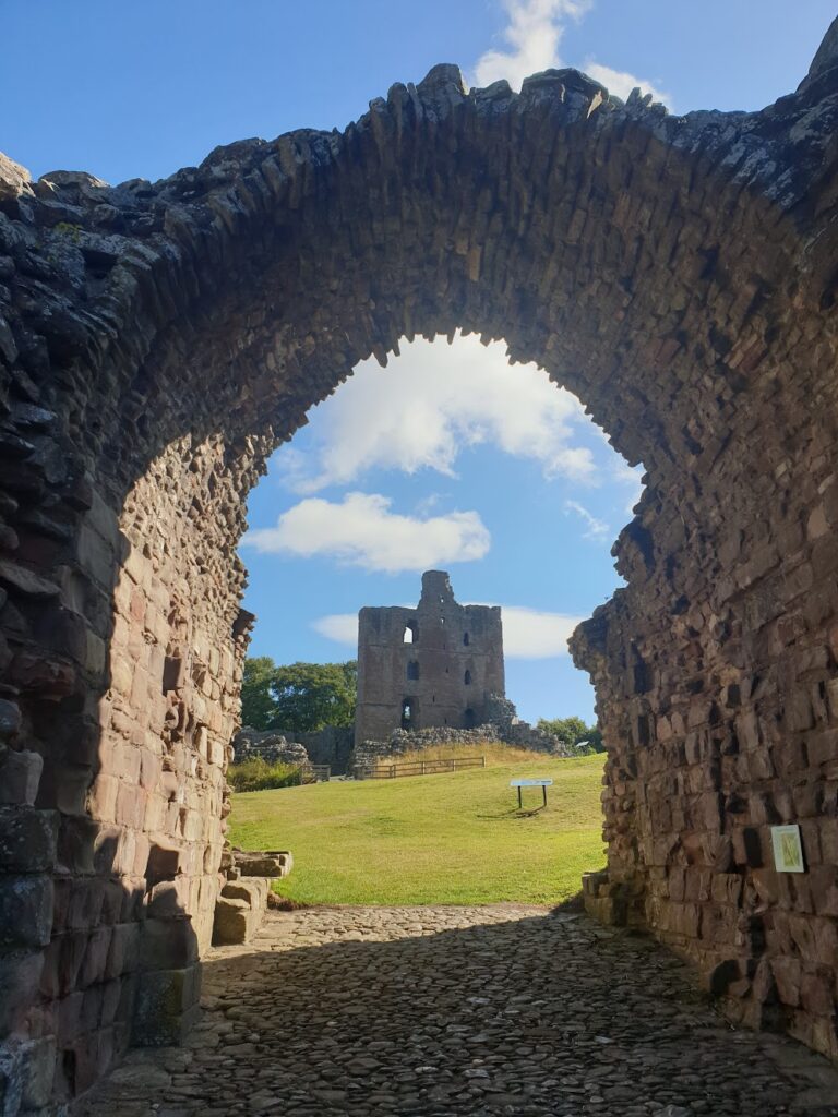
My first stop after a fine pub breakfast was Norham Castle, which presides over the pretty high street from its hilltop location, guarding a crossing point of the Tweed. These were dangerous parts and successive Bishops of Durham were given almost king like powers to protect the border region from marauding Scots. The castle was besieged nine times and sacked on four occasions, each time being rebuilt larger and stronger. But when Elizabeth 1 refused to invest in Norham, it fell into decline. Today you are free to browse the ruins. In the morning sunshine, it was great fun.
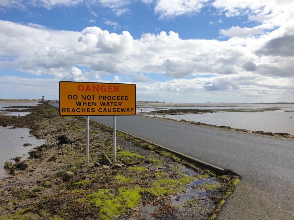
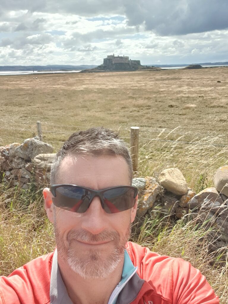
Then I cycled an hour along very quiet lanes in a straightish line to the tidal causeway that links the mainland to the Holy Island of Lindisfarne. The low lying island is visible from several miles away, an expanse of grassy sand-dunes a few miles wide, with the prominent castle rock sticking up at the right hand end behind the small village, the only buildings on the island. I carefully crossed the busy A1 and descended the last couple of miles to cross the causeway. Big warning signs speak of the folly of attempting to cross when the tide is not out; but I was a good 30 minutes on the right side of the tide tables and a steady stream of visitors were already making their way across in vehicles. It is a bit surreal cycling across a road that is only there half of the time and I enjoyed the sense of being somewhere a bit special. The sand and salt marsh stretched out for miles in each direction until reaching shallow water the same blue colour as the vast sunny skies above.
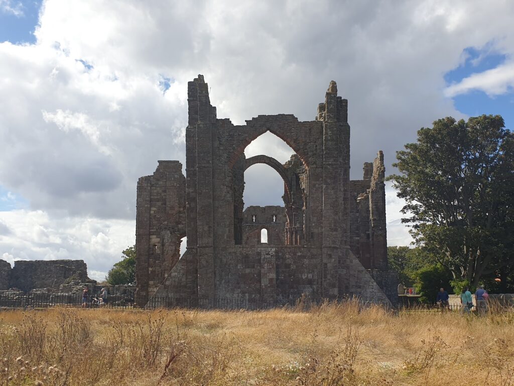
The story of Lindisfarne began in 684. Saint Aidan was an Irish monk from Iona, the small island off the Isle of Mull, that I visited a few maps ago. He founded a Priory on Holy Island and began converting the locals. A few years after Aidan’s death, a monk named Cuthbert arrived, by way of Melrose, where I was yesterday. After living as a hermit on a small nearby island for 10 years, Cuthbert reluctantly became bishop, aged 50. When he died he was buried in Lindisfarne and it became a place of pilgrimage. This was the golden age of Lindisfarne, when the beautiful Lindisfarne Gospels, illustrated manuscripts of great significance, were made.
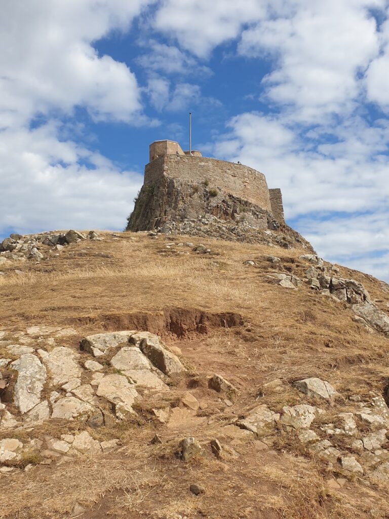
Then the vikings invaded in 794 and it all came to a shuddering halt. Some years later, the monks left, taking Cuthbert’s perfectly preserved body with them. That found its way to Durham Cathedral, where you can see his tomb today. It was only after the Norman conquest in 1066 that the second priory was founded and the name Holy Island was first used. Its red sandstone ruins are a relic of the reformation. The stones from the priory were used to build the castle in 1550. In 1902, Edwin Lutyens designed the Edwardian building that sits atop the prominent plug of rock today.
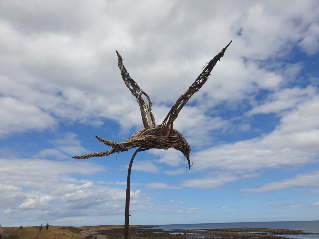
It was busy today with tourists, all making the mile walk from the car park to the castle and queuing up the path to get inside. I walked out to the shore and considered my latest coast to coast officially complete. You could see for miles. To the south, the magnificent Bamburgh Castle. To the east, the tiny Farne Islands, home once to St Cuthbert and now to many sea birds. To the west, the Cheviot hills. And everywhere sea and sky.
One day I will stay on the island and enjoy the sense of isolation that must still exist when the tide comes in and the visitors disappear. But today I settled for a bowl of loaded fries in someone’s garden!
3 replies on “Map 75 – Lindisfarne”
With a son called Aidan and a daughter called Iona, Lindisfarne was an obvious destination for a weekend trip a few years ago. It is indeed awesome to be there when the tide comes in and most of the other tourists have gone out. Definitely worth a revisit, with or without Aidans and Ionas:)
This had me double-taking Mark…. I hadn’t realised (until I looked at the Map of all Maps’) that you will have 2 or 3 traverses that start in Scotland and end in England. The things you learn….
Indeed. One more cross border c2c still to come this week. That border is far from horizontal.