
Where I grew up in South Yorkshire, we got Look North on BBC and Calendar on ITV for our local TV news bulletins. When they showed the weather map for our area, it covered all of Yorkshire and Humberside as well as Lincolnshire, and for some reason there was always an extra finger of shaded in map around The Wash to include Kings Lynn. I always found that strange. I couldn’t imagine that anyone sitting in their living room in Kings Lynn, Norfolk, would be watching Yorkshire television, and even less that they might have any interest at all in what was happening in Wakefield or Halifax. It seemed to me to be wishful thinking at best, and television colonialism if it were actually true. And so it became the norm in our house, whenever the map appeared on the screen, for someone to say ”Kings Lynn?” in an incredulous voice. I can’t easily say the name any more without doing it like this. Sorry Kings Lynn.
It happened quite a few times today as I cycled through the town. Indeed it was one of the last places I saw in full sunshine before the day gave way to a stunning sunset and became evening. To be fair, I was asking a lot of myself, because I had to get all the way from Nottingham to East Dereham in Norfolk, not far short of Norwich. And that, it turns out, is 120 miles. And the days are getting shorter. I was always going to be spending a night in Nottingham because I had more than one offer of accommodation. After all, I used to live there. I wasn’t always going to cycle 120 miles though. My plans changed when the next round of train strikes was announced. I realised that if I could get to the east coast by lunchtime on 4th October, I could possibly make it by train across to Aberystwyth in mid Wales before the end of the evening, and save myself a couple of valuable days. This in turn keeps alive my hopes of completing this challenge this year. So there was sound joined up thinking behind it, and I was blessed with great weather again.
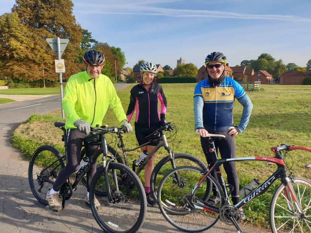
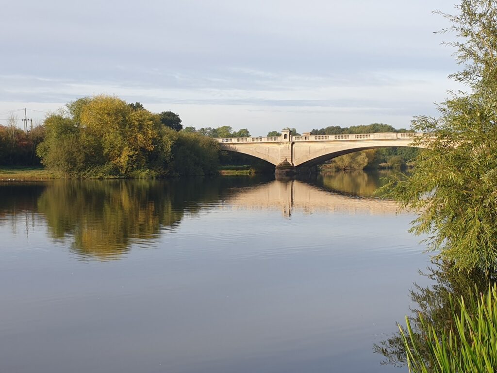
But to begin at the beginning, it was an early and rather brisk start to the day, accompanied by my wonderful hosts Ann and Steve on their bikes for the first hour to Gunthorpe Bridge over the River Trent east of Nottingham. We were only a few miles here from the first house Jenni and I bought, where we lived for eight years on the fringes of West Bridgford, walking distance from Trent Bridge cricket ground. So I was in familiar cycling territory. It was busy this Monday morning getting to the bridge, where another old friend, Andy, was waiting to accompany me. We all rode together into the Vale of Belvoir and the noise and traffic disappeared, to be replaced by pretty villages and quiet back lanes. In Car Colston, a village with a huge open green of common land for grazing your livestock (should you have any), Andy and I peeled off and headed south east for another couple of hours through gentle country with pretty villages that would not look out of place in the Cotswolds. There is a similar honey coloured stone here, and also a few characteristic ups and downs to keep us working.
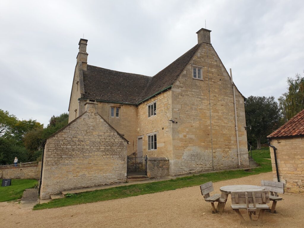
Our first destination was Woolsthorpe by Colsterworth, a small village that gave the world a big name and some revolutionary ideas. It was here, on a farm, that Isaac Newton grew up, and (allegedly) where the apple fell on his head. I can confirm that there is still an apple orchard. The property is now owned by the National Trust and they have a pleasant tea room, where we sat outside near the barns and caught up on over a year’s worth of conversation. They make a big thing of one tree in particular; but at best it must be a descendent. Anyway, it is well worth a look if you are in the area. He was a genius who was far ahead of his time.
Andy set off for home and I carried on into Lincolnshire. After another hour, I was through the small town of Bourne and into the fens, which I was crossing all the way to Kings Lynn (Kings Lynn?), half a day later. It isn’t pretty. There are other words more suitable. Flat would be one of the more polite. But this is some of the most important farming land in Britain, so we should be glad it exists. I just won’t be going there on holiday.
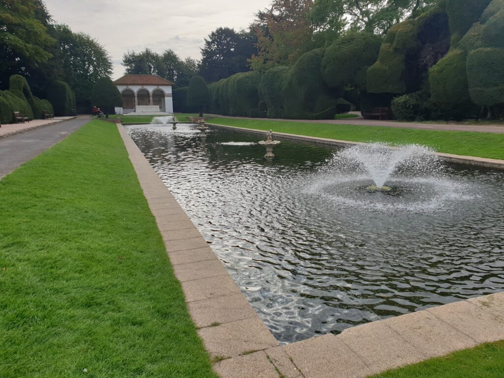
The main places of interest (to me at least) in the fens are its churches, which are rightly celebrated. You can see their towers and spires rising from the flat landscape. These tend to be in the villages and towns, obviously. However, my route across the flat fens took me through very few settlements, sticking as I did to the lesser used routes. I did make a refreshment stop in the town of Spalding, which is famous for its tulip festival every May. In the middle of town is an old red brick gabled house, Ayscoughee Hall, which is now a museum. Behind it, to my surprise, is a beautiful park with an Italian sunken garden with fountains playing in a long pool, and amazing topiary all around. It also had a cafe, and I might struggle to find a nicer place to sit outside and enjoy home made mushroom soup. Especially in the Fens.
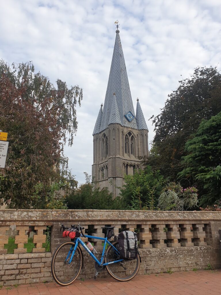
After Spalding came more monotonous flat fields and drainage ditches. This whole area is at or below sea level and it was only drained by the Dutch in the eighteenth century. Before that, it was a world of swamps and low islands, confusing and difficult to traverse. People feared catching Fen fever. King John famously lost his Crown Jewels in these marshes, which must have been quite upsetting. He died not many days later in Newark Castle. A particularly bad trip with hindsight. Today, though, the landscape here is just boring. I emerged from the fields into the small town of Long Sutton, which was nice enough and has an impressive church with a lead spire that stands slightly apart from the rest of the building.
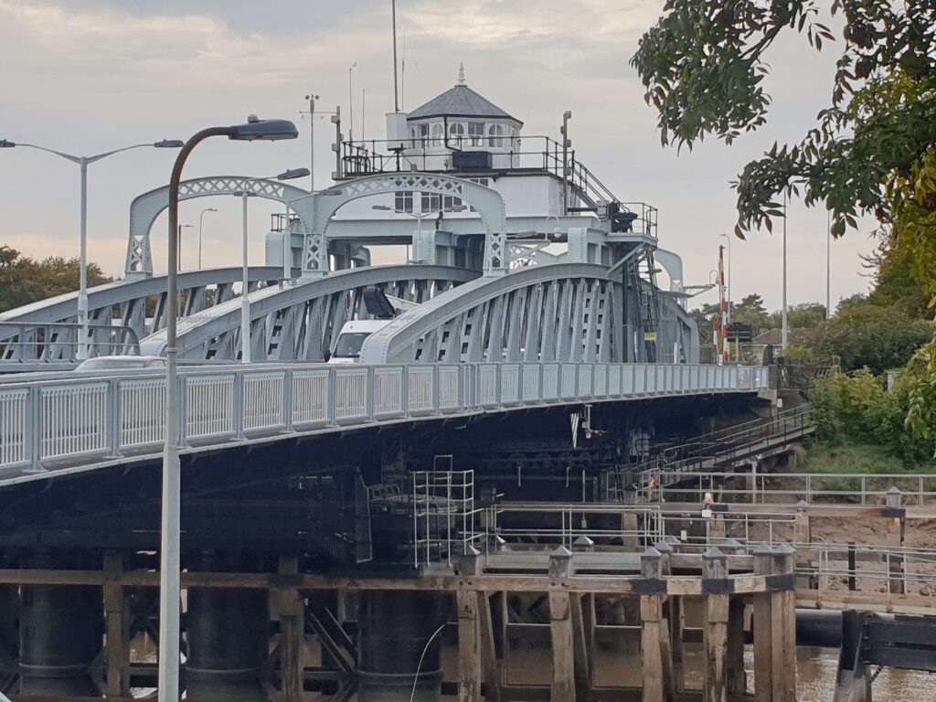
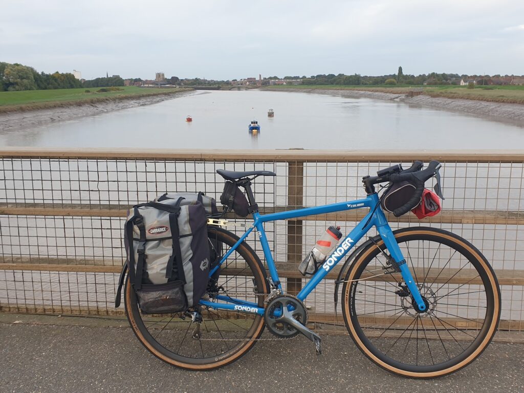
A few miles further on at Sutton Bridge you reach the River Nene, close to where it gives out into The Wash, the rectangular bite taken out of the east coast between Skegness and Hunstanton in Norfolk. The river here is pretty large and also tidal. It was once crossed by a ferry, but now there is a sturdy swing bridge that carries large amounts of traffic on the A17. Any boats making their way to or from the small port of Wisbech, several miles inland, would need to pass along this stretch of river, but today there was nothing so exciting to see.
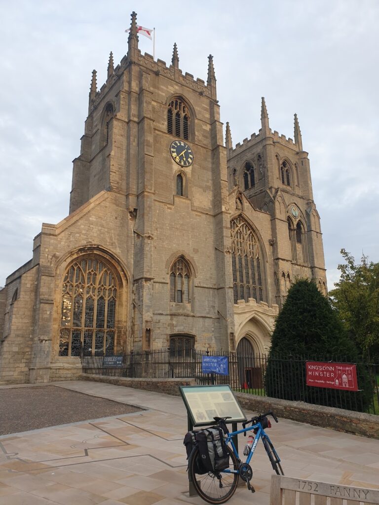
Over the bridge – but curiously not straight away as you cross the obvious natural boundary – you quickly pass into Norfolk. I took the old main road that is today very quiet as it snakes through a couple of large villages, with names like Clenchwarton, before reaching an even bigger river, the Great Ouse, just upstream from its mouth at Kings Lynn. This is a major port and also the main town for this part of Norfolk. I rode in to town from the bridge on a cycle path along the top of the flood embankment, which is perhaps the best way to view the town. The main building you see from afar is the twin towered minster church, whose towers curiously do not match. Non-identical twins, you might say. Close up it is a fine sight, and one of the towers bears an unusual tide clock. Around it and close to the river are a series of streets of quite ancient brick buildings that are well worth a look around. It also has a rather fine old customs house on the cobbled quayside and you get a general sense of how the place may have been in the days, before 1537, when it was known as Bishops Lynn.
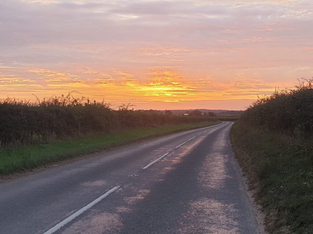
But time and tide waits for no man, and I couldn’t linger here long. I still had a couple of hours of cycling, and perhaps 90 minutes of daylight. I rode due east as fast as I could, as the sun and the sky did marvellous things behind me. Slowly, as I made haste, the colours drained out of the no-longer-quite-flat, heathy landscape of fields and trees around me and in time I was seeing only in monochrome. Eventually I had to admit that I needed my bike lights not just to be seen by the very occasional passing car, but also to see the road ahead myself! But these days bike lights really are excellent, and I found the experience, while it lasted, rather exhilarating. I was basically alone, in the dark, on a calm, mild evening in the middle of nowhere. My senses were heightened and I became aware of every movement and sound. I arrived in East Dereham at about 7.45pm, which is not at all an unusual or surprising finish time over the months of this trip; but tonight it felt awfully late!
3 replies on “Maps 130, 131, 132 – Kings Lynn?”
A total honour to cycle with you Mark.. enjoy the rest of your challenge!
Sutton Bridge. I remember it well. The ethereal mystery and all that.
Good work Mark – great progress